Size of this preview:
800 × 459 pixels. Other resolutions:
320 × 183 pixels |
640 × 367 pixels |
1,024 × 587 pixels.
Original file (1,024 × 587 pixels, file size: 82 KB, MIME type: image/jpeg)
| This is a file from the
Wikimedia Commons. Information from its
description page there is shown below. Commons is a freely licensed media file repository. You can help. |
Summary
| Description |
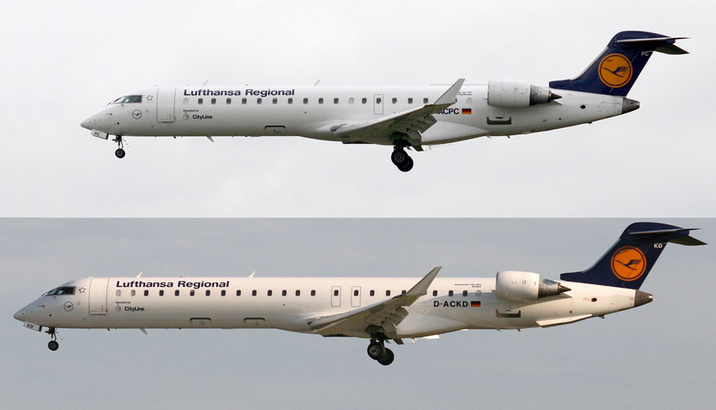
Nederlands: Vergelijking tussen Bombardier CRJ700 "Espelkamp" (boven) en CRJ900 "Wittlich". |
| Date | |
| Source | own work (both pictures by me) |
| Author | Klever |
Espelkamp:
| Object location |
| View this and other nearby images on: OpenStreetMap |
|
|---|
Licensing
| I, the copyright holder of this work, release this work into the
public domain. This applies worldwide. In some countries this may not be legally possible; if so: I grant anyone the right to use this work for any purpose, without any conditions, unless such conditions are required by law. |
File history
Click on a date/time to view the file as it appeared at that time.
| Date/Time | Thumbnail | Dimensions | User | Comment | |
|---|---|---|---|---|---|
| current | 12:37, 13 September 2007 |
| 1,024 × 587 (82 KB) | Klever | {{Information |Description=Vergelijking tussen Bombardier CRJ700 (boven) en CRJ900 |Source=eigen werk |Date=2007.09.12 |Author= Klever }} |
File usage
The following pages on the English Wikipedia use this file (pages on other projects are not listed):
Global file usage
The following other wikis use this file:
- Usage on ar.wikipedia.org
- Usage on ca.wikipedia.org
- Usage on cs.wikipedia.org
- Usage on et.wikipedia.org
- Usage on fa.wikipedia.org
- Usage on ja.wikipedia.org
- Usage on nl.wikipedia.org
- Usage on zh.wikipedia.org