Size of this preview:
800 × 600 pixels. Other resolutions:
320 × 240 pixels |
640 × 480 pixels |
1,024 × 768 pixels |
1,280 × 960 pixels |
2,048 × 1,536 pixels.
Original file (2,048 × 1,536 pixels, file size: 1.16 MB, MIME type: image/jpeg)
| This is a file from the
Wikimedia Commons. Information from its
description page there is shown below. Commons is a freely licensed media file repository. You can help. |
.jpg)
Summary
| Description |
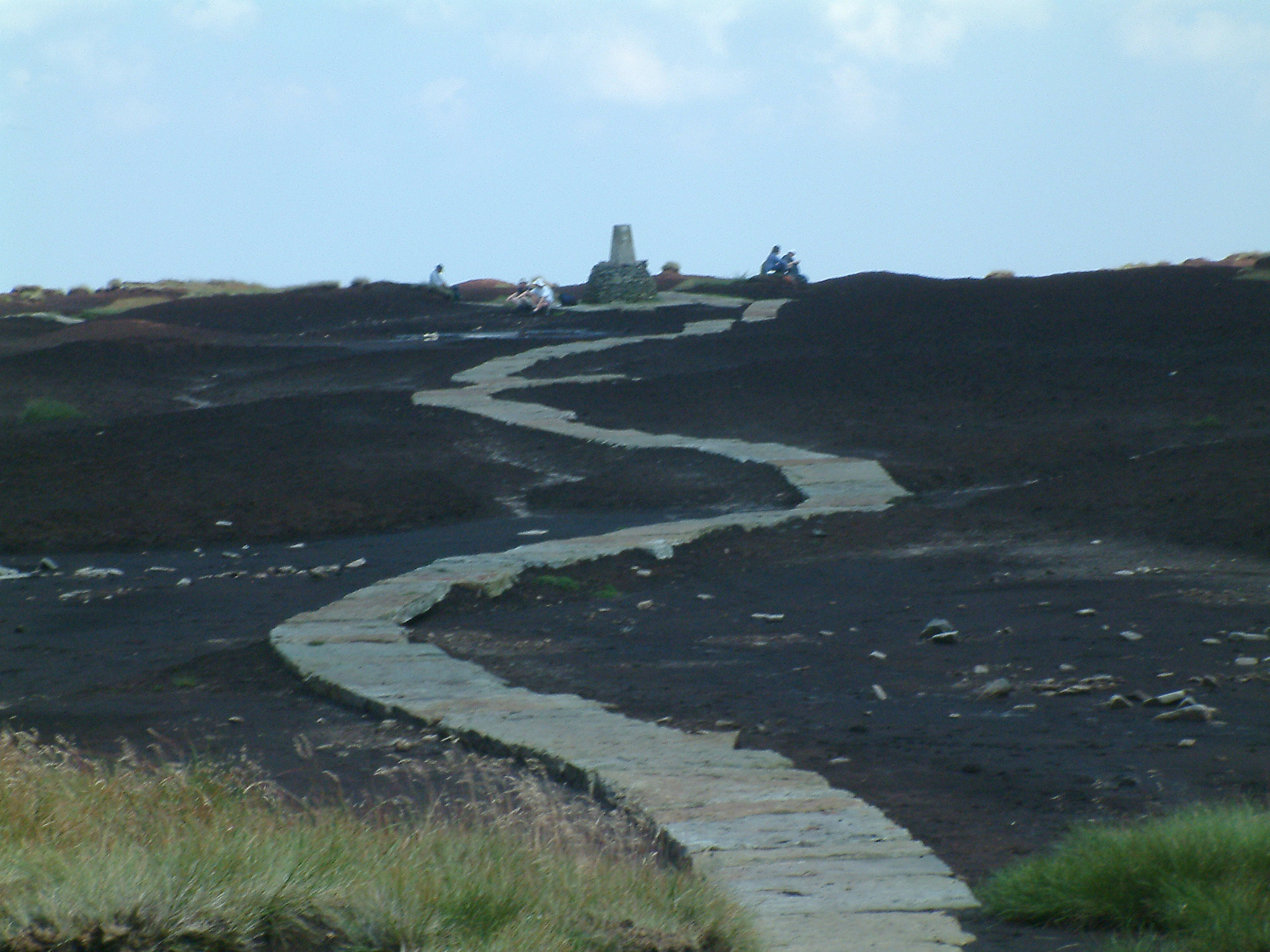
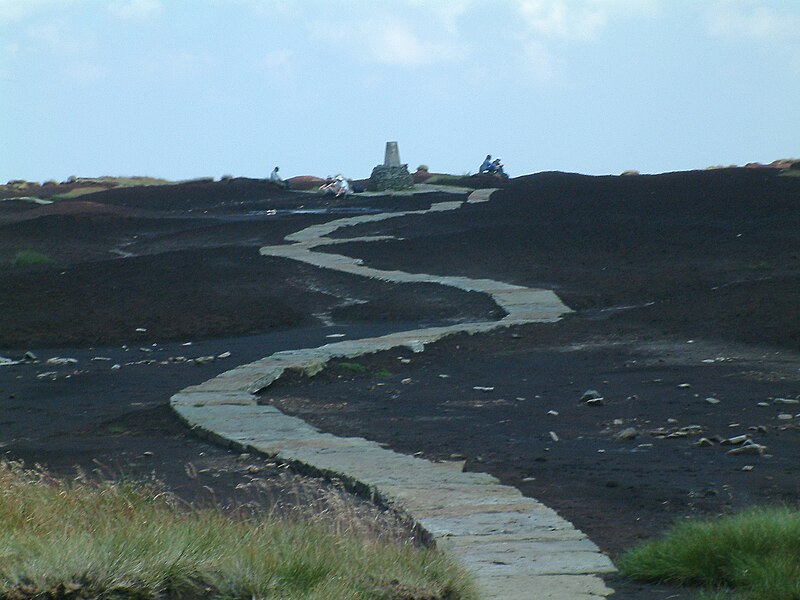
The Pennine Way on the summit of Black Hill (Peak District). The triangulation column and highest point on Black Hill is on a small elevated mound, called Soldiers' Lump. According to Alfred Wainwright's Pennine Way Companion the support timbers for the Ramsden theodolite, used by the Royal Engineers in the original Ordnance Survey, were still to be found here many years later. Photograph by Stephen Dawson 7 August en:2004. |
| Date | 6 February 2005 (original upload date) |
| Source | Transferred from en.wikipedia to Commons. |
| Author | The original uploader was StephenDawson at English Wikipedia. |
| Permission ( Reusing this file) |
This file is licensed under the
Creative Commons
Attribution-Share Alike 2.0 Generic license.
|
| Other versions |
| Object location |
| View this and other nearby images on: OpenStreetMap |
|
|---|
.jpg¶ms=053.537000_N_-001.890000_E_globe:Earth_class:object_type:object_source:geograph-osgb36(SE0704)_region:GB-ENG_&language=en)
Original upload log
The original description page was
here. All following user names refer to en.wikipedia.
- 2005-02-06 21:06 StephenDawson 2048×1536×8 (1218950 bytes) Pennine Way on the summit of Black Hill (Peak District)
File history
Click on a date/time to view the file as it appeared at that time.
| Date/Time | Thumbnail | Dimensions | User | Comment | |
|---|---|---|---|---|---|
| current | 23:31, 1 September 2007 |
| 2,048 × 1,536 (1.16 MB) | Responsible? | {{Information |Description=The Pennine Way on the summit of Black Hill (Peak District). The triangulation column and highest point on Black Hill is on a small elevated mound, called Soldiers' Lump. According to Alfred Wainwright's ''Pennine Way Companion' |
File usage
The following pages on the English Wikipedia use this file (pages on other projects are not listed):
Global file usage
The following other wikis use this file:
- Usage on arz.wikipedia.org
- Usage on ceb.wikipedia.org
- Usage on da.wikipedia.org
- Usage on de.wiktionary.org
- Usage on en.wikivoyage.org
- Usage on fr.wikipedia.org
- Usage on nn.wikipedia.org
- Usage on sv.wikipedia.org
- Usage on www.wikidata.org
.jpg)