
Original file (3,648 × 2,352 pixels, file size: 7.18 MB, MIME type: image/jpeg)
| This is a file from the
Wikimedia Commons. Information from its
description page there is shown below. Commons is a freely licensed media file repository. You can help. |
.jpg)
Summary
| Description |
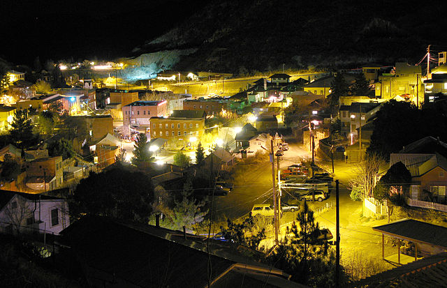
This is the first in a series of shots I will be posting from our trip to Bisbee, Arizona. It was a Christmas gift from our kids--a weekend trip away, by ourselves. It was their first time alone that long but they did great, and so did we! Bisbee is an old Arizona mountain town built into the hills. It has your requisite art and antique shops, but it's definitely different from your (e.g.) Colorado ski town, or even Arizona's Jerome. In Jerome, the hippies listen to Phillip Glass. In Bisbee, they listen to Bob Marley and I imagine have read "On the Road" within the last 3 years. This is actually an overview of what is called "Old Bisbee", and you can see pretty much all of it from the "Sleepy Dog House"--a wonderful B&B that I would highly recommend, which has the most wonderful kitsch decorating we have ever seen. I'll be showing some of it in later shots. I imagine we're 80 or 100 feet over the town center. In the very background you can barely make out a mountain, which is right where the Queen Mine is and the highway. If you look closely--I uploaded the big size so you can view large--you can see a lot of interesting detail. (Explore 2.2.2008--Thanks friends!) |
| Date | |
| Source |
|
| Author | Kevin Dooley from Chander, AZ, USA |
| Camera location |
| View this and other nearby images on: OpenStreetMap |
|
|---|
.jpg¶ms=031.447053_N_-109.914060_E_globe:Earth_type:camera_source:Flickr_&language=en)
Licensing
- You are free:
- to share – to copy, distribute and transmit the work
- to remix – to adapt the work
- Under the following conditions:
- attribution – You must give appropriate credit, provide a link to the license, and indicate if changes were made. You may do so in any reasonable manner, but not in any way that suggests the licensor endorses you or your use.
| This image, originally posted to Flickr, was reviewed on 14 September 2013 by the administrator or reviewer File Upload Bot (Magnus Manske), who confirmed that it was available on Flickr under the stated license on that date. |
File history
Click on a date/time to view the file as it appeared at that time.
| Date/Time | Thumbnail | Dimensions | User | Comment | |
|---|---|---|---|---|---|
| current | 05:37, 14 September 2013 |
| 3,648 × 2,352 (7.18 MB) | File Upload Bot (Magnus Manske) | Transferred from Flickr by User:PDTillman |
File usage
Global file usage
The following other wikis use this file:
- Usage on tr.wikipedia.org
.jpg)