
Size of this preview:
800 × 600 pixels. Other resolutions:
320 × 240 pixels |
640 × 480 pixels |
1,024 × 768 pixels |
1,280 × 960 pixels |
2,560 × 1,920 pixels |
2,816 × 2,112 pixels.
Original file (2,816 × 2,112 pixels, file size: 2.02 MB, MIME type: image/jpeg)
| This is a file from the
Wikimedia Commons. Information from its
description page there is shown below. Commons is a freely licensed media file repository. You can help. |
|
This is an image of a place or building that is listed on the
National Register of Historic Places in the
United States of America. Its reference number is
80003543. |
| Camera location |
| View this and other nearby images on: OpenStreetMap |
|
|---|
| Description |
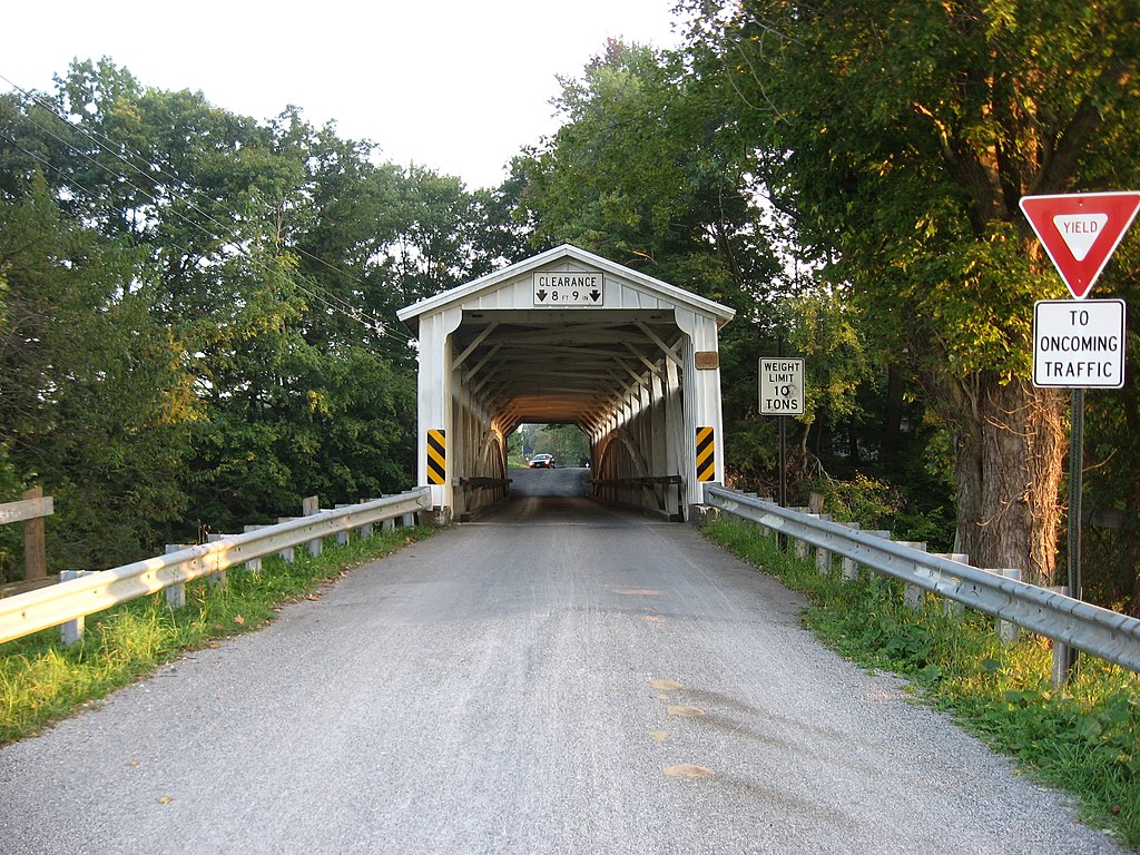
English: Northern portal of the
Banks Covered Bridge, which carries Covered Bridge Road over the Neshannock Creek east of
New Wilmington in
Wilmington Township,
Lawrence County,
Pennsylvania,
United States. Built in 1889, the bridge is listed on the
National Register of Historic Places. |
||
| Date | Taken on 17 September 2009 | ||
| Source | Own work | ||
| Author | Nyttend | ||
| Permission ( Reusing this file) |
|
File history
Click on a date/time to view the file as it appeared at that time.
| Date/Time | Thumbnail | Dimensions | User | Comment | |
|---|---|---|---|---|---|
| current | 17:44, 22 September 2009 |
| 2,816 × 2,112 (2.02 MB) | Nyttend | {{Location|41|5|26|N|80|17|10|W}} {{Information |Description={{en|Northern portal of the {{w|Banks Covered Bridge}}, which carries Covered Bridge Road over the Neshannock Creek east of {{w|New Wilmington, Pennsylvania|New Wilmington}} in {{w|Wilmington To |
File usage
The following pages on the English Wikipedia use this file (pages on other projects are not listed):
Global file usage
The following other wikis use this file:
- Usage on cy.wikipedia.org
- Usage on es.wikipedia.org
- Usage on tl.wikipedia.org
- Usage on uk.wikipedia.org
- Usage on ur.wikipedia.org
- Usage on vi.wikipedia.org
- Usage on www.wikidata.org