
Original file (720 × 720 pixels, file size: 338 KB, MIME type: image/jpeg)
| This is a file from the
Wikimedia Commons. Information from its
description page there is shown below. Commons is a freely licensed media file repository. You can help. |
| Description |
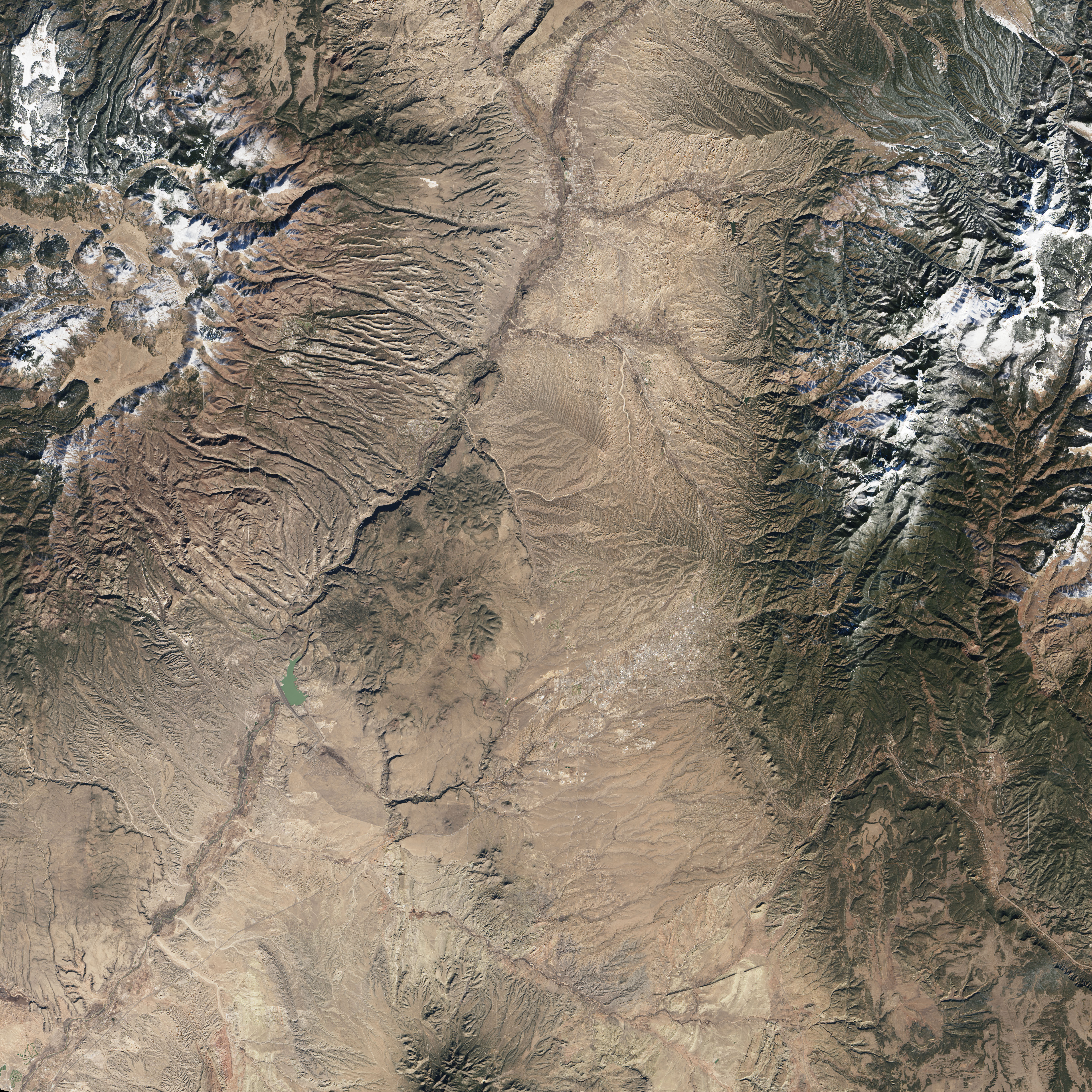
English: On December 5, 2015, the Operational Land Imager (OLI) on Landsat 8 captured a natural-color image of Bandelier (top). The monument area encompasses about 130 square kilometers (50 square miles) of land west of Santa Fe and adjacent to Los Alamos National Laboratory.
The second image was acquired by National Park Service photographer Sally King. It shows the tall walls of Frijoles Canyon and some dwellings along its base—a site called Long House. These remnants of earlier human presence are too small to be spotted from space, but you can get a sense of the landscape that made it a favorable place to build. The cliffs are soft volcanic tuff, composed of consolidated ash from the eruption of the Jemez Volcano more than 1 million years ago. The volcano’s summit collapsed and formed the Valles Caldera, visible in the top left corner of the Landsat image. Rising from the rim of the caldera, and marking Bandelier’s northwestern boundary, is the snow-capped summit of Cerro Grande—the monument’s highest elevation at 3109 meters (10,199 feet). From that mountaintop down to Bandelier’s southeastern boundary on the banks of the Rio Grande, the land loses almost a vertical mile of elevation. Most of the landscape is designated as wilderness area, and it is lined with deep canyons sharply eroded from the plateaus. The landscape appears more stark and brown in the satellite image than it might at other times of the year. “The winter scene really lets you see the landscape without much vegetation softening it,” said Kay Beeley, an NPS cartographic technician for Bandelier National Monument. “This image catches Bandelier at one of the least active times of the year for vegetation growth,” said Craig Allen, a U.S. Geological Survey ecologist at Bandelier. “The vegetation is quite dormant at all elevations in December due to relatively cold winter temperatures.” |
|||||
| Date | acquired December 5, 2015 | |||||
| Source | http://earthobservatory.nasa.gov/IOTD/view.php?id=87460&src=eoa-iotd | |||||
| Author | NASA Earth Observatory image by Jesse Allen, using Landsat data | |||||
| Permission ( Reusing this file) |
|
|||||
| Other versions | Larger version (9MB) |

File history
Click on a date/time to view the file as it appeared at that time.
| Date/Time | Thumbnail | Dimensions | User | Comment | |
|---|---|---|---|---|---|
| current | 06:01, 10 February 2016 |
| 720 × 720 (338 KB) | Tillman | {{Information |Description ={{en|1=On December 5, 2015, the Operational Land Imager (OLI) on Landsat 8 captured a natural-color image of Bandelier (top). The monument area encompasses about 130 square kilometers (50 square miles) of land west of San... |