No higher resolution available.
Bancroft_engine_house_and_chimney_-_geograph.org.uk_-_1343955.jpg (640 × 427 pixels, file size: 62 KB, MIME type: image/jpeg)
| This is a file from the
Wikimedia Commons. Information from its
description page there is shown below. Commons is a freely licensed media file repository. You can help. |
Summary
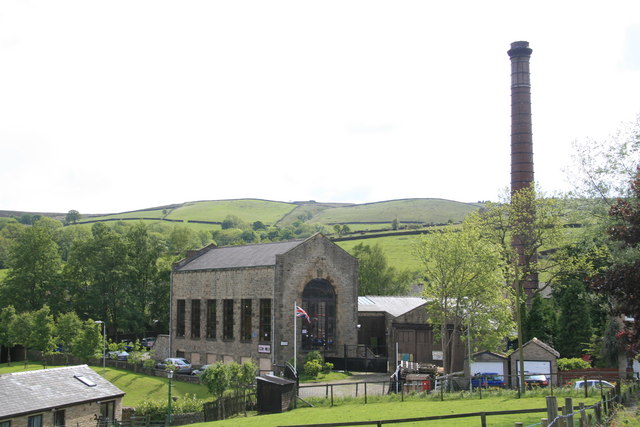
| Description |
English: Bancroft engine house and chimney This complex is all that remains of the last weaving shed built in Barnoldswick. The shed was closed in 1978 and the preserved engine house opened in 1982. The 600 horsepower cross compound engine is run at full speed and you get a real feel of what an operating mill engine was like. This is possibly the best view but the light was not with me. |
| Date | |
| Source | From geograph.org.uk |
| Author | Chris Allen |
| Attribution ( required by the license) | Chris Allen / Bancroft engine house and chimney / |
| Camera location | | View this and other nearby images on: OpenStreetMap |
|
|---|
_heading:225.00&language=en)
| Object location | | View this and other nearby images on: OpenStreetMap |
|
|---|
_heading:225.00&language=en)
Licensing

|
This image was taken from the
Geograph project collection. See
this photograph's page on the Geograph website for the photographer's contact details. The copyright on this image is owned by Chris Allen and is licensed for reuse under the
Creative Commons Attribution-ShareAlike 2.0 license.
|
This file is licensed under the
Creative Commons
Attribution-Share Alike 2.0 Generic license.
Attribution: Chris Allen
- You are free:
- to share – to copy, distribute and transmit the work
- to remix – to adapt the work
- Under the following conditions:
- attribution – You must give appropriate credit, provide a link to the license, and indicate if changes were made. You may do so in any reasonable manner, but not in any way that suggests the licensor endorses you or your use.
- share alike – If you remix, transform, or build upon the material, you must distribute your contributions under the same or compatible license as the original.
File history
Click on a date/time to view the file as it appeared at that time.
| Date/Time | Thumbnail | Dimensions | User | Comment | |
|---|---|---|---|---|---|
| current | 03:53, 28 February 2011 |
| 640 × 427 (62 KB) | GeographBot | == {{int:filedesc}} == {{Information |description={{en|1=Bancroft engine house and chimney This complex is all that remains of the last weaving shed built in Barnoldswick. The shed was closed in 1978 and the preserved engine house opened in 1982. The 600 |
File usage
The following pages on the English Wikipedia use this file (pages on other projects are not listed):
Global file usage
The following other wikis use this file:
- Usage on www.wikidata.org