
Size of this preview:
415 × 599 pixels. Other resolutions:
166 × 240 pixels |
333 × 480 pixels |
532 × 768 pixels |
710 × 1,024 pixels |
1,416 × 2,043 pixels.
Original file (1,416 × 2,043 pixels, file size: 1.1 MB, MIME type: image/png)
| This is a file from the
Wikimedia Commons. Information from its
description page there is shown below. Commons is a freely licensed media file repository. You can help. |
Summary
| Description |
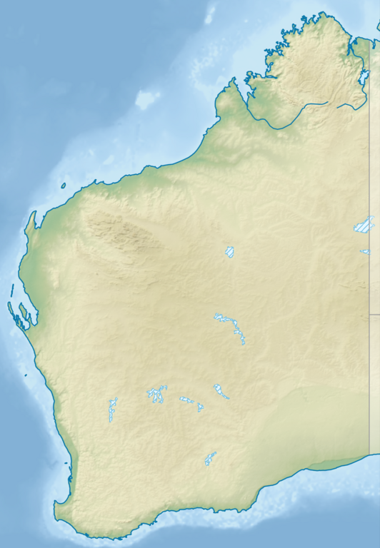
English: Relief location map of
Western Australia,
Australia
Equidistant cylindrical projection, latitude of true scale 24.62° S (equivalent to equirectangular projection with N/S stretching 110 %). Geographic limits of the map:
|
| Date | |
| Source |
|
| Author | Tentotwo |
Licensing
I, the copyright holder of this work, hereby publish it under the following license:
This file is licensed under the
Creative Commons
Attribution-Share Alike 3.0 Unported license.
- You are free:
- to share – to copy, distribute and transmit the work
- to remix – to adapt the work
- Under the following conditions:
- attribution – You must give appropriate credit, provide a link to the license, and indicate if changes were made. You may do so in any reasonable manner, but not in any way that suggests the licensor endorses you or your use.
- share alike – If you remix, transform, or build upon the material, you must distribute your contributions under the same or compatible license as the original.

|
This map has been made or improved in the German
Kartenwerkstatt (Map Lab). You can
propose maps to improve as well.
|
File history
Click on a date/time to view the file as it appeared at that time.
| Date/Time | Thumbnail | Dimensions | User | Comment | |
|---|---|---|---|---|---|
| current | 21:25, 9 August 2023 |
| 1,416 × 2,043 (1.1 MB) | Lojwe | Cropped < 1 % horizontally, < 1 % vertically using CropTool with precise mode. |
| 18:27, 2 February 2013 |
 | 1,423 × 2,052 (1.12 MB) | Tentotwo | User created page with UploadWizard |
File usage
More than 100 pages use this file. The following list shows the first 100 pages that use this file only. A full list is available.
- Alexander Morrison National Park
- Avon Valley National Park
- Badgingarra National Park
- Balgo, Western Australia
- Beagle Bay Community, Western Australia
- Bluff Knoll
- Boorabbin National Park
- Brockman National Park
- Cape Arid National Park
- Cape Le Grand National Park
- Collier Range National Park
- D'Entrecasteaux National Park
- Danggu Gorge National Park
- Drovers Cave National Park
- Drysdale River National Park
- Dumbleyung Lake
- Eucla National Park
- Fitzgerald River National Park
- Francois Peron National Park
- Frank Hann National Park
- Gloucester National Park
- Goongarrie National Park
- Gooseberry Hill National Park
- Greater Beedelup National Park
- Greenmount National Park
- Hamelin Pool Marine Nature Reserve
- Hamersley Range
- Hassell National Park
- Horizontal Falls
- John Forrest National Park
- Johnnie Walker Classic
- Joseph Bonaparte Gulf
- Kalamunda National Park
- Kalbarri National Park
- Karijini National Park
- Kennedy Range National Park
- King George Sound (Western Australia)
- King Sound
- Kumpupintil Lake
- Lake Argyle
- Lake Banksiadale
- Lake Barlee
- Lake Bryde-East Lake Bryde
- Lake Carey
- Lake Carnegie (Western Australia)
- Lake Dora (Western Australia)
- Lake Grace North
- Lake Grace South
- Lake Gregory (Western Australia)
- Lake Leschenaultia
- Lake Macleod
- Lake Muir
- Lake Nabberu
- Leeuwin-Naturaliste National Park
- Lesueur National Park
- Looma Community, Western Australia
- Marmion Marine Park
- Millstream Chichester National Park
- Mirima National Park
- Moore River National Park
- Mount Augustus National Park
- Mount Cooke
- Mount Frankland National Park
- Mount Meharry
- Mundaring Weir
- Nambung National Park
- Neerabup National Park
- New Norcia, Western Australia
- Ningaloo Coast
- Peak Charles National Park
- Porongurup National Park
- Purnululu National Park
- RAAF Base Curtin
- RAAF Base Learmonth
- RAAF Base Pearce
- RAAF Gingin
- Rossiter Bay
- Scott National Park
- Serpentine National Park
- Shannon National Park
- Shark Bay Marine Park
- Shoalwater Islands Marine Park
- Sir James Mitchell National Park
- Stirling Range
- Stirling Range National Park
- Stokes National Park
- Tathra National Park
- Torndirrup National Park
- Tuart Forest National Park
- Tunnel Creek National Park
- Walpole-Nornalup National Park
- Walyunga National Park
- Warren National Park
- Watheroo National Park
- Waychinicup National Park
- Wellington Dam Hydro Power Station
- West Cape Howe National Park
- William Bay National Park
- Windjana Gorge National Park
- Wolfe Creek Meteorite Crater National Park
View more links to this file.
Global file usage
The following other wikis use this file:
- Usage on als.wikipedia.org
- Usage on ar.wikipedia.org
- Usage on ast.wikipedia.org
- Usage on az.wikipedia.org
- Usage on ban.wikipedia.org
- Usage on bg.wikipedia.org
- Usage on ceb.wikipedia.org
- Usage on ckb.wikipedia.org
- Usage on da.wikipedia.org
- Usage on de.wikipedia.org
- Easter Group
- Lacepedeinseln
- Lake Argyle
- Purnululu-Nationalpark
- Bungle Bungle
- Windjana-Gorge-Nationalpark
- Wolfe-Creek-Krater-Nationalpark
- Shark Bay
- Cape-Arid-Nationalpark
- Nambung-Nationalpark
- Mirima-Nationalpark
- Tunnel-Creek-Nationalpark
- Mount Augustus
- Mount Gabi
- Karijini-Nationalpark
- Kalbarri-Nationalpark
- Marinefunkstelle Harold E. Holt
- Ningaloo Reef
- Cape-Range-Nationalpark
- Dirk Hartog Island
- Dampier-Archipel
- Buccaneer-Archipel
- Barrow Island (Western Australia)
- François-Péron-Nationalpark
- Houtman-Abrolhos-Archipel
- Wallabi-Inseln
- Pelsaert-Inseln
- North Island (Houtman-Abrolhos)
- Montebello-Inseln
- Mount-Augustus-Nationalpark
View more global usage of this file.