Size of this preview:
557 × 599 pixels. Other resolutions:
223 × 240 pixels |
446 × 480 pixels |
714 × 768 pixels |
952 × 1,024 pixels |
2,448 × 2,634 pixels.
Original file (2,448 × 2,634 pixels, file size: 2.99 MB, MIME type: image/jpeg)
File history
Click on a date/time to view the file as it appeared at that time.
| Date/Time | Thumbnail | Dimensions | User | Comment | |
|---|---|---|---|---|---|
| current | 02:11, 30 July 2020 |
 | 2,448 × 2,634 (2.99 MB) | Beyond My Ken | Reverted to version as of 22:27, 31 May 2020 (UTC) |
| 05:30, 12 July 2020 |
 | 2,448 × 3,264 (4.53 MB) | Oknazevad | Reverted to version as of 15:57, 31 May 2020 (UTC) how is reliving important architectural aspects "better visibility". | |
| 22:27, 31 May 2020 |
 | 2,448 × 2,634 (2.99 MB) | Beyond My Ken | Reverted to version as of 22:22, 10 May 2016 (UTC) Better visibility | |
| 15:57, 31 May 2020 |
 | 2,448 × 3,264 (4.53 MB) | Oknazevad | Reverted to version as of 02:49, 22 July 2009 (UTC) I don't thnink the cropping improved anything. It's all still tunnel. In fact, it made the image worse by removing too much of the high vaulted ceiling, which is a significant aspect of the design. | |
| 22:22, 10 May 2016 |
 | 2,448 × 2,634 (2.99 MB) | Beyond My Ken | adjustments for visibility, crop into subject | |
| 02:49, 22 July 2009 |
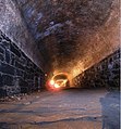
 | 2,448 × 3,264 (4.53 MB) | VladRud | {{Information |Description={{en|1=Atlantic Ave Tunnel in Brooklyn, NY}} |Source=Own work by uploader |Author= Vlad Rud |Date=2009-07-12 |Permission= |other_versions= }} {{location dec|40.68977|-73.992696|region:US_heading:WNW}} [[Category: |
File usage
The following pages on the English Wikipedia use this file (pages on other projects are not listed):
Global file usage
The following other wikis use this file:
- Usage on es.wikipedia.org
- Usage on fr.wikipedia.org
- Usage on it.wikipedia.org
- Usage on www.wikidata.org
