Size of this preview:
800 × 534 pixels. Other resolutions:
320 × 214 pixels |
640 × 427 pixels |
1,024 × 683 pixels |
1,500 × 1,001 pixels.
Original file (1,500 × 1,001 pixels, file size: 479 KB, MIME type: image/jpeg)
| This is a file from the
Wikimedia Commons. Information from its
description page there is shown below. Commons is a freely licensed media file repository. You can help. |
|
| This image appeared on Wikipedia's Main Page in the Did you know? column on 28 May 2013 (see archives). |
| Description |
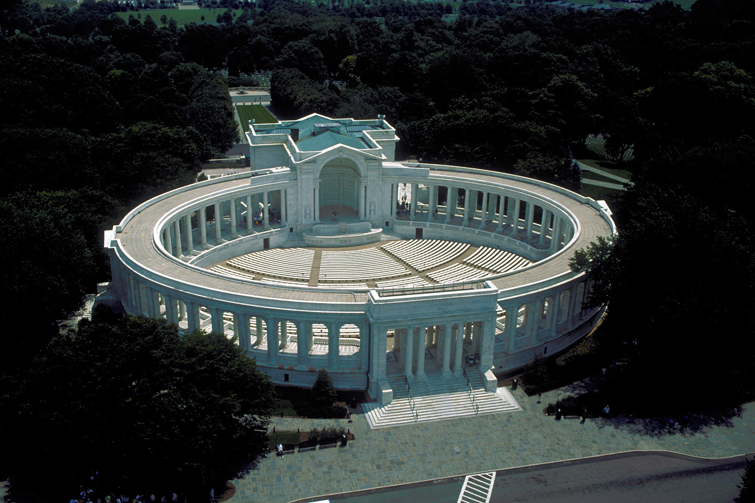
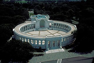
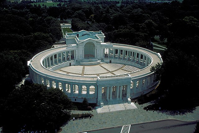
English: Aerial view of the amphitheater at Arlington National Cemetery in Arlington, Virginia, USA. |
|||
| Date | ||||
| Source |
U.S. Army Corps of Engineers Digital Visual Library Image page Image description page Digital Visual Library home page |
|||
| Author | Susanne Bledsoe, U.S. Army Corps of Engineers | |||
| Permission ( Reusing this file) |
|
|||
| Location | Arlington, Virginia, USA |
| Camera location |
| View this and other nearby images on: OpenStreetMap |
|
|---|
File history
Click on a date/time to view the file as it appeared at that time.
| Date/Time | Thumbnail | Dimensions | User | Comment | |
|---|---|---|---|---|---|
| current | 23:58, 7 April 2007 |
| 1,500 × 1,001 (479 KB) | DanMS | {{Information | Description = {{en|Aerial view of the amphitheater at Arlington National Cemetery in Arlington, Virginia, USA.}} | Source = U.S. Army Corps of Engineers Digital Visual Library<br />[http://images.usace.army.mil/images/Hires/0454 |
File usage
The following pages on the English Wikipedia use this file (pages on other projects are not listed):
Global file usage
The following other wikis use this file:
- Usage on de.wikipedia.org
- Usage on fa.wikipedia.org
- Usage on fr.wikipedia.org
- Usage on he.wikipedia.org
- Usage on simple.wikipedia.org
- Usage on www.wikidata.org