No higher resolution available.
Arizona_Locator_Map_with_Lower-Left_Inset.png (351 × 407 pixels, file size: 22 KB, MIME type: image/png)
| This is a file from the
Wikimedia Commons. Information from its
description page there is shown below. Commons is a freely licensed media file repository. You can help. |
| Description |
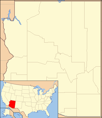
English: Composite map showing the U.S. state of Arizona and its location within the United States |
|||||
| Date | ||||||
| Source | File:Arizona Locator Map.PNG and File:Map of USA AZ.svg. Base maps from U.S. Census site here | |||||
| Author | U.S. Census and User:Ruhrfisch for Arizona locator; User:Huebi for U.S. map highlighting Arizona. Composite by User:Finetooth. | |||||
| Permission ( Reusing this file) |
I, the copyright holder of this work, hereby publish it under the following licenses:
This file is licensed under the
Creative Commons
Attribution-Share Alike 4.0 International license.
You may select the license of your choice.
|


File history
Click on a date/time to view the file as it appeared at that time.
| Date/Time | Thumbnail | Dimensions | User | Comment | |
|---|---|---|---|---|---|
| current | 02:12, 13 June 2017 |
| 351 × 407 (22 KB) | Finetooth | {{Information |Description ={{en|1= Composite map showing the U.S. state of Arizona and its location within the United States}} |Source = File:Arizona Locator Map.PNG and File:Map of USA AZ.svg. Base maps from U.S. Census site [http... |
File usage
The following pages on the English Wikipedia use this file (pages on other projects are not listed):
Global file usage
The following other wikis use this file:
- Usage on ban.wikipedia.org
- Usage on ml.wikipedia.org
- Usage on si.wikipedia.org
- Usage on uz.wikipedia.org
- Usage on zh.wikipedia.org