Size of this preview:
800 × 600 pixels. Other resolutions:
320 × 240 pixels |
640 × 480 pixels |
1,024 × 768 pixels |
1,280 × 960 pixels |
2,272 × 1,704 pixels.
Original file (2,272 × 1,704 pixels, file size: 1.62 MB, MIME type: image/jpeg)
| This is a file from the
Wikimedia Commons. Information from its
description page there is shown below. Commons is a freely licensed media file repository. You can help. |
Summary
| Description |
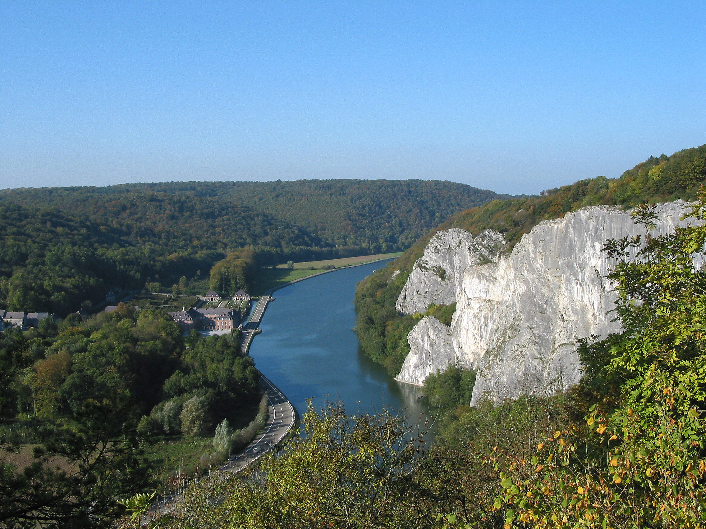
Français : La
Meuse entre
Dinant et
Hastière (Belgique).
English: The
Meuse river between
Dinant and
Hastière (Belgium).
Walon : Li Moûse inte Dinant èt Astîre (Bèljike).
|
||||||
| Date | |||||||
| Source | Own work | ||||||
| Author | Jean-Pol GRANDMONT | ||||||
| Permission ( Reusing this file) |
|
||||||
| Other versions |
|

.jpg)
.jpg)
.jpg¶ms=050.222281_N_0004.894775_E_globe:Earth_type:camera_region:BE_heading:337.50&language=en)
Licensing
I, the copyright holder of this work, hereby publish it under the following licenses:

|
Permission is granted to copy, distribute and/or modify this document under the terms of the GNU Free Documentation License, Version 1.2 or any later version published by the Free Software Foundation; with no Invariant Sections, no Front-Cover Texts, and no Back-Cover Texts. A copy of the license is included in the section entitled GNU Free Documentation License. |
This file is licensed under the
Creative Commons
Attribution 3.0 Unported license.
- You are free:
- to share – to copy, distribute and transmit the work
- to remix – to adapt the work
- Under the following conditions:
- attribution – You must give appropriate credit, provide a link to the license, and indicate if changes were made. You may do so in any reasonable manner, but not in any way that suggests the licensor endorses you or your use.
You may select the license of your choice.
File history
Click on a date/time to view the file as it appeared at that time.
| Date/Time | Thumbnail | Dimensions | User | Comment | |
|---|---|---|---|---|---|
| current | 00:56, 16 March 2010 |
| 2,272 × 1,704 (1.62 MB) | Jean-Pol GRANDMONT | {{Information |Description={{fr|1=La Meuse entre Dinant et Hastière (Belgique) * Rive droite: les rochers de Freÿr ( Anseremme). * Rive gauche: le [[:fr:château de Freÿr|château de Freÿ |
File usage
The following pages on the English Wikipedia use this file (pages on other projects are not listed):
Global file usage
The following other wikis use this file:
- Usage on af.wikipedia.org
- Usage on fr.wikipedia.org
- Usage on fr.wikivoyage.org
- Usage on mad.wikipedia.org
- Usage on nl.wikipedia.org
- Usage on te.wikipedia.org
.jpg)