Size of this preview:
800 × 450 pixels. Other resolutions:
320 × 180 pixels |
640 × 360 pixels |
1,024 × 576 pixels |
1,280 × 720 pixels |
2,560 × 1,440 pixels |
5,120 × 2,880 pixels.
Original file (5,120 × 2,880 pixels, file size: 22.5 MB, MIME type: image/png)
| This is a file from the
Wikimedia Commons. Information from its
description page there is shown below. Commons is a freely licensed media file repository. You can help. |
Summary
| Description |
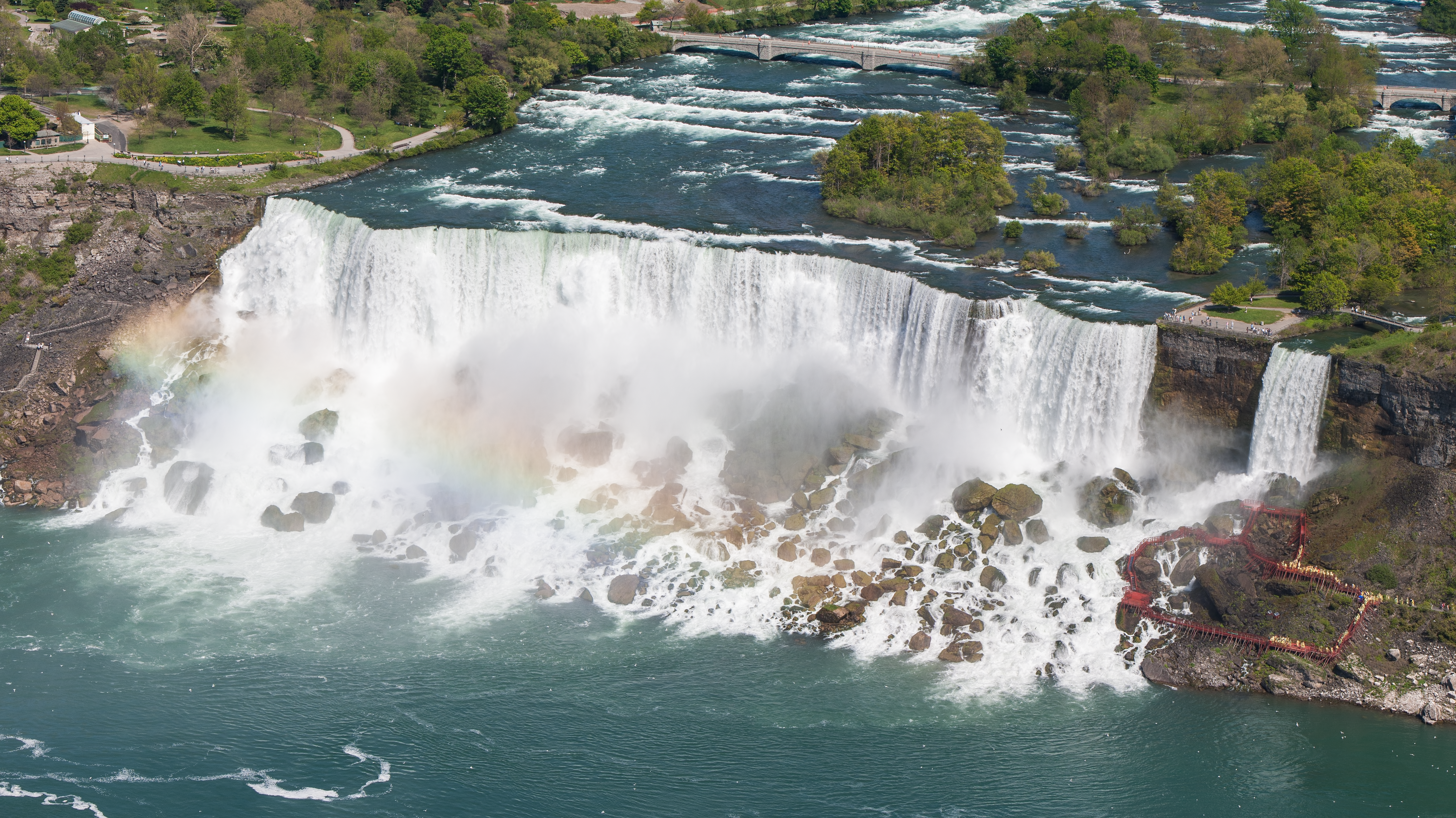
English: The American Falls and the Bridal Veil Falls of the Niagara Falls in the USA from Skylon Tower on May 28, 2002.
Deutsch: Die American Falls und die Bridal Veil Falls der Niagarafälle in den USA vom Skylon Tower aus am 28. Mai 2002.
|
||||
| Date | |||||
| Source | Own work | ||||
| Author | Robert F. Tobler | ||||
| Permission ( Reusing this file) |
English: This photograph was taken by
Robert F. Tobler and released under the license(s) stated below. You are free to use it for any purpose as long as you credit the author, the Source (Wikimedia Commons) and the license (CC-BY-SA 4.0) in close relation to the image.
Deutsch: Dieses Foto wurde von
Robert F. Tobler erstellt und unter nachfolgend aufgeführter Lizenz veröffentlicht. Das Bild kann frei verwendet werden solange der Urheber, die Quelle (Wikimedia Commons) und die Lizenz (CC-BY-SA 4.0) in erkennbarem Zusammenhang mit dem Bild genannt wird.
|
||||
| Other versions |


| Camera location | | View this and other nearby images on: OpenStreetMap |
|
|---|
Licensing
I, the copyright holder of this work, hereby publish it under the following license:
This file is licensed under the
Creative Commons
Attribution-Share Alike 4.0 International license.
- You are free:
- to share – to copy, distribute and transmit the work
- to remix – to adapt the work
- Under the following conditions:
- attribution – You must give appropriate credit, provide a link to the license, and indicate if changes were made. You may do so in any reasonable manner, but not in any way that suggests the licensor endorses you or your use.
- share alike – If you remix, transform, or build upon the material, you must distribute your contributions under the same or compatible license as the original.
| Annotations | This image is annotated: View the annotations at Commons |
This image has been assessed using the
Quality image guidelines and is considered a
Quality image.
|
File history
Click on a date/time to view the file as it appeared at that time.
| Date/Time | Thumbnail | Dimensions | User | Comment | |
|---|---|---|---|---|---|
| current | 05:48, 13 March 2016 |
| 5,120 × 2,880 (22.5 MB) | Rftblr | correct 16:9 size |
| 05:41, 13 March 2016 |
 | 5,121 × 2,880 (22.51 MB) | Rftblr | slightly better color | |
| 03:18, 13 March 2016 |
 | 5,120 × 2,880 (22.46 MB) | Rftblr | tighter crop (mainly on the right) | |
| 15:54, 12 March 2016 |
 | 5,760 × 2,880 (26.02 MB) | Rftblr | slightly brighter | |
| 15:42, 12 March 2016 |
 | 5,760 × 2,880 (25.43 MB) | Rftblr | User created page with UploadWizard |
File usage
The following pages on the English Wikipedia use this file (pages on other projects are not listed):
Global file usage
The following other wikis use this file:
- Usage on ar.wikipedia.org
- Usage on bn.wikipedia.org
- Usage on ca.wikipedia.org
- Usage on de.wikipedia.org
- Usage on de.wikivoyage.org
- Usage on es.wikipedia.org
- Usage on fa.wikipedia.org
- Usage on fr.wikipedia.org
- Usage on ha.wikipedia.org
- Usage on hyw.wikipedia.org
- Usage on it.wikipedia.org
- Usage on kw.wikipedia.org
- Usage on lb.wikipedia.org
- Usage on mdf.wikipedia.org
- Usage on nl.wikipedia.org
- Usage on si.wikipedia.org
- Usage on sq.wikipedia.org
- Usage on sr.wikipedia.org
- Usage on vi.wikipedia.org