
Size of this JPG preview of this TIF file:
390 × 599 pixels. Other resolutions:
156 × 240 pixels |
620 × 952 pixels.
Original file (620 × 952 pixels, file size: 215 KB, MIME type: image/tiff)
| This is a file from the
Wikimedia Commons. Information from its
description page there is shown below. Commons is a freely licensed media file repository. You can help. |
Summary
| Description |
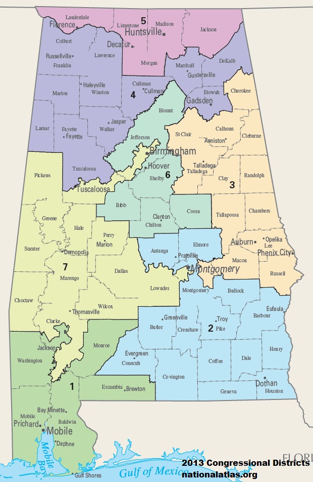
English: Map of Congressional Districts in the state of Alabama, reflecting district boundaries current to the 113th United States Congress. |
| Date | |
| Source | National Atlas of the United States |
| Author | Department of the Interior |
Licensing
This map was obtained from an edition of the
National Atlas of the United States. Like almost all works of the U.S. federal government, works from the National Atlas are in the
public domain in the United States.
Online access: NationalAtlas.gov | 1970 print edition: Library of Congress, Perry-Castañeda Library
|
File history
Click on a date/time to view the file as it appeared at that time.
| Date/Time | Thumbnail | Dimensions | User | Comment | |
|---|---|---|---|---|---|
| current | 18:07, 31 January 2014 |
 | 620 × 952 (215 KB) | 7partparadigm | User created page with UploadWizard |
File usage
No pages on the English Wikipedia use this file (pages on other projects are not listed).
Global file usage
The following other wikis use this file:
- Usage on fa.wikipedia.org
- Usage on fr.wikipedia.org
- Usage on hu.wikipedia.org
- Usage on it.wikipedia.org
- Usage on ru.wikipedia.org
- Usage on simple.wikipedia.org
- Usage on uk.wikipedia.org
- Usage on uz.wikipedia.org
- Usage on zh.wikipedia.org