
Size of this preview:
800 × 600 pixels. Other resolutions:
320 × 240 pixels |
640 × 480 pixels |
1,024 × 768 pixels |
1,280 × 960 pixels |
2,560 × 1,920 pixels |
3,264 × 2,448 pixels.
Original file (3,264 × 2,448 pixels, file size: 6.37 MB, MIME type: image/jpeg)
| This is a file from the
Wikimedia Commons. Information from its
description page there is shown below. Commons is a freely licensed media file repository. You can help. |
Summary
| Description |
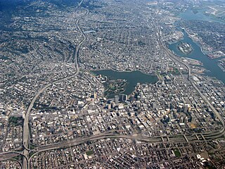
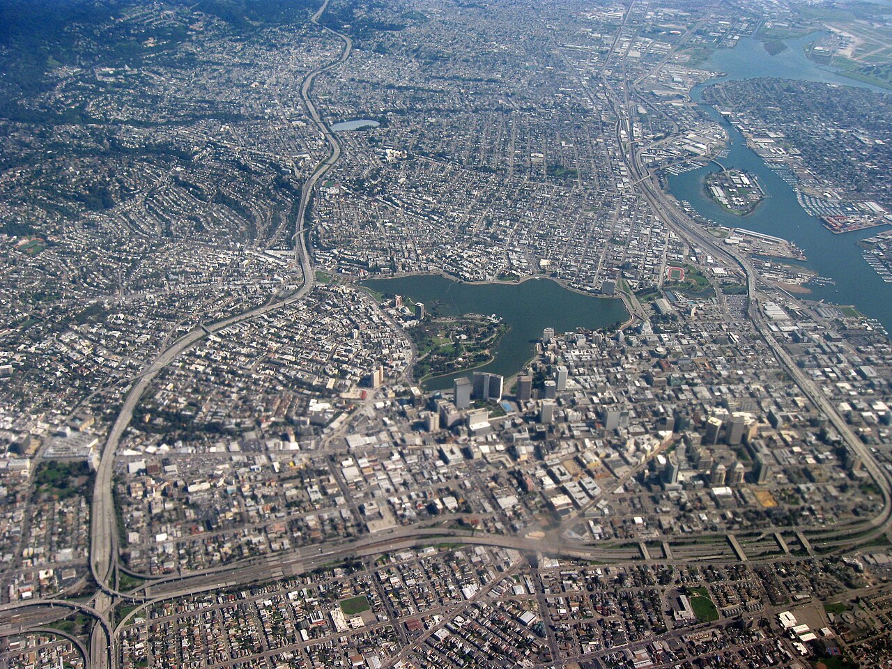
English: Aerial view of city of Oakland, California. Lakeside Park, Lake Merritt in center, Laney College to the right of that, Downtown Oakland right below the lake, Interstate 580 on left, Interstate 980 on bottom, Oakland Inner Harbor Channel and Government Island in upper right. |
| Date | |
| Source | Own work |
| Author | Dcoetzee |
| Camera location |
| View this and other nearby images on: OpenStreetMap |
|
|---|
Licensing
| I, the copyright holder of this work, release this work into the
public domain. This applies worldwide. In some countries this may not be legally possible; if so: I grant anyone the right to use this work for any purpose, without any conditions, unless such conditions are required by law. |
File history
Click on a date/time to view the file as it appeared at that time.
| Date/Time | Thumbnail | Dimensions | User | Comment | |
|---|---|---|---|---|---|
| current | 06:59, 4 June 2009 |
| 3,264 × 2,448 (6.37 MB) | Dcoetzee | {{Information |Description={{en|1=Aerial view of city of Oakland, California. Lakeside Park, Lake Merritt in center, Laney College to the right of that, Downtown Oakland right below the lake, Interstate 580 on left, Interstate 980 on bottom, Oakland Inner |
File usage
The following pages on the English Wikipedia use this file (pages on other projects are not listed):
Global file usage
The following other wikis use this file:
- Usage on bg.wikipedia.org
- Usage on bm.wikipedia.org
- Usage on fr.wikipedia.org
- Usage on ku.wikipedia.org
- Usage on pa.wikipedia.org
- Usage on pl.wikipedia.org
- Usage on pnb.wikipedia.org
- Usage on ro.wikipedia.org
- Usage on so.wikipedia.org
- Usage on zh-yue.wikipedia.org
- Usage on zh.wikipedia.org