
Size of this preview:
800 × 533 pixels. Other resolutions:
320 × 213 pixels |
640 × 427 pixels |
1,024 × 683 pixels |
1,280 × 853 pixels |
2,560 × 1,707 pixels |
5,568 × 3,712 pixels.
Original file (5,568 × 3,712 pixels, file size: 6.61 MB, MIME type: image/jpeg)
| This is a file from the
Wikimedia Commons. Information from its
description page there is shown below. Commons is a freely licensed media file repository. You can help. |
Summary
| Description |
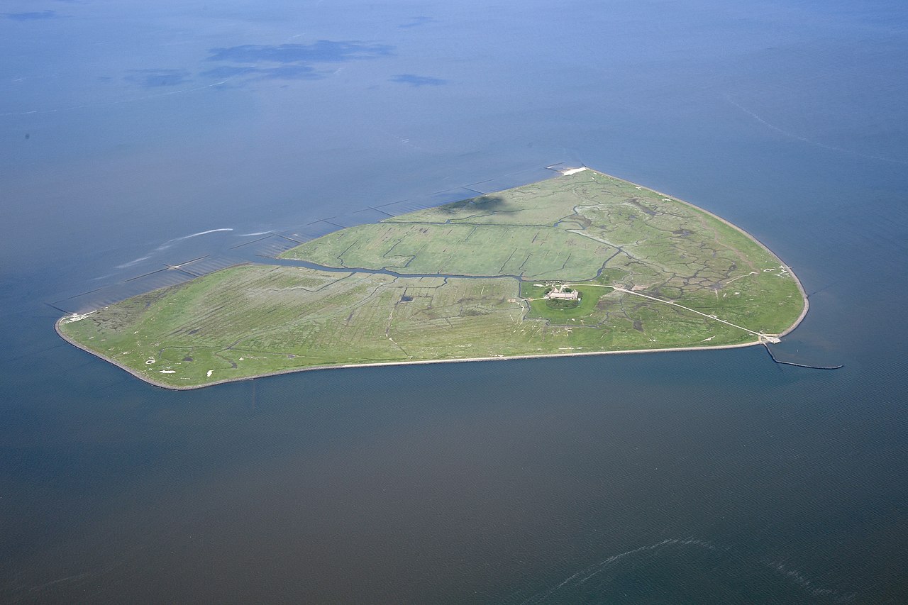
English: Aerial image of the Hallig Süderoog approximately 45 minutes before high tide
Deutsch: Luftbild der Hallig Süderoog etwa 45 Minuten vor Hochwasser |
| Date | |
| Source | Own work |
| Author | Carsten Steger |
| Camera location | | View this and other nearby images on: OpenStreetMap |
|
|---|
| Object location |
| View this and other nearby images on: OpenStreetMap |
|
|---|
Licensing
I, the copyright holder of this work, hereby publish it under the following license:
This file is licensed under the
Creative Commons
Attribution-Share Alike 4.0 International license.
- You are free:
- to share – to copy, distribute and transmit the work
- to remix – to adapt the work
- Under the following conditions:
- attribution – You must give appropriate credit, provide a link to the license, and indicate if changes were made. You may do so in any reasonable manner, but not in any way that suggests the licensor endorses you or your use.
- share alike – If you remix, transform, or build upon the material, you must distribute your contributions under the same or compatible license as the original.
This image has been assessed using the
Quality image guidelines and is considered a
Quality image.
|
File history
Click on a date/time to view the file as it appeared at that time.
| Date/Time | Thumbnail | Dimensions | User | Comment | |
|---|---|---|---|---|---|
| current | 12:59, 22 August 2022 |
| 5,568 × 3,712 (6.61 MB) | Carsten Steger | Reverted to version as of 15:16, 8 July 2021 (UTC) |
| 15:36, 21 August 2022 |
 | 5,300 × 3,300 (5.56 MB) | CactiStaccingCrane | crop to center | |
| 15:16, 8 July 2021 |
 | 5,568 × 3,712 (6.61 MB) | Carsten Steger | Uploaded own work with UploadWizard |
File usage
The following pages on the English Wikipedia use this file (pages on other projects are not listed):
Global file usage
The following other wikis use this file:
- Usage on de.wikipedia.org
- Usage on en.wiktionary.org
- Usage on pnb.wikipedia.org
- Usage on sg.wiktionary.org
- Usage on sr.wikipedia.org
- Usage on www.wikidata.org