
Size of this preview:
402 × 599 pixels. Other resolutions:
161 × 240 pixels |
322 × 480 pixels |
515 × 768 pixels |
687 × 1,024 pixels |
1,374 × 2,048 pixels |
3,013 × 4,489 pixels.
Original file (3,013 × 4,489 pixels, file size: 1.65 MB, MIME type: image/jpeg)
| This is a file from the
Wikimedia Commons. Information from its
description page there is shown below. Commons is a freely licensed media file repository. You can help. |
| Camera location |
| View this and other nearby images on: OpenStreetMap |
|
|---|
| Description |
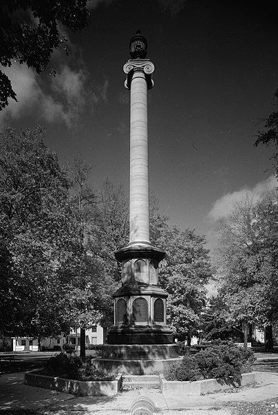
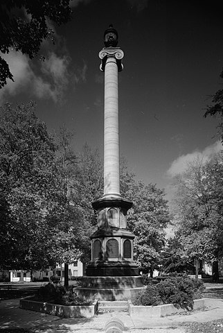
English: Southern side of the
Civil War Memorial in Monument Park in
Adrian,
Michigan,
United States. Once a part of the Bank of Pennsylvania building that was built in 1801 and demolished in 1868, it was erected as a Civil War monument in 1870. It is listed on the
National Register of Historic Places. |
|||||
| Date | ||||||
| Source | Library of Congress, Prints and Photograph Division HABS: MICH,46-ADRI,1A-1 | |||||
| Author | Gerda Peterich | |||||
| Permission ( Reusing this file) |
|


|
This image is available from the United States
Library of Congress's
Prints and Photographs division
under the digital ID hhh.mi0018. This tag does not indicate the copyright status of the attached work. A normal copyright tag is still required. See Commons:Licensing.
|
File history
Click on a date/time to view the file as it appeared at that time.
| Date/Time | Thumbnail | Dimensions | User | Comment | |
|---|---|---|---|---|---|
| current | 00:06, 6 February 2010 |
| 3,013 × 4,489 (1.65 MB) | Nyttend | {{Location|41|53|47|N|84|1|45|W}} {{Information |Description={{en|Southern side of the {{w|Civil War Memorial (Adrian, Michigan)|Civil War Memorial}} in Monument Park in {{w|Adrian, Michigan|Adrian}}, {{w|Michigan}}, {{w|United States}}. Once a part of t |
File usage
The following pages on the English Wikipedia use this file (pages on other projects are not listed):
Global file usage
The following other wikis use this file:
- Usage on ar.wikipedia.org
- Usage on arz.wikipedia.org
- Usage on es.wikipedia.org
- Usage on ro.wikipedia.org
- Usage on tr.wikipedia.org