
Size of this JPG preview of this TIF file:
734 × 599 pixels. Other resolutions:
294 × 240 pixels |
588 × 480 pixels |
941 × 768 pixels |
1,254 × 1,024 pixels |
2,509 × 2,048 pixels |
5,000 × 4,082 pixels.
Original file (5,000 × 4,082 pixels, file size: 19.47 MB, MIME type: image/tiff)
| This is a file from the
Wikimedia Commons. Information from its
description page there is shown below. Commons is a freely licensed media file repository. You can help. |
Summary
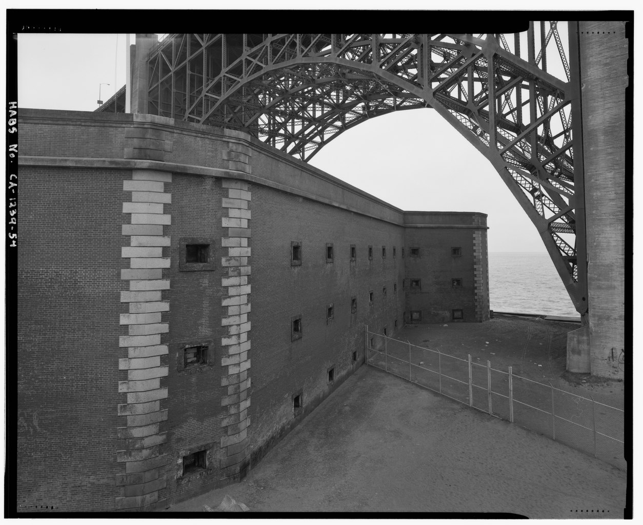
| A general view of the northwest wall, in relation to the Fort Point arch of the golden gate bridge. View to southwest. - Fort Point, U.S. Highway 101, San Francisco, San Francisco County, CA | ||||
|---|---|---|---|---|
| Photographer |
De Vries, David Related names:
|
|||
| Title |
A general view of the northwest wall, in relation to the Fort Point arch of the golden gate bridge. View to southwest. - Fort Point, U.S. Highway 101, San Francisco, San Francisco County, CA |
|||
| Depicted place | California; San Francisco County; San Francisco | |||
| Date | 2001 | |||
| Dimensions | 4 x 5 in. | |||
| Current location |
Library of Congress Prints and Photographs Division Washington, D.C. 20540 USA
http://hdl.loc.gov/loc.pnp/pp.print |
|||
| Accession number |
HABS CAL,38-SANFRA,4-54 |
|||
| Credit line |
|
|||
| Notes |
|
|||
| References |
|
|||
| Source | https://www.loc.gov/pictures/item/ca0649.photos.376935p | |||
| Permission ( Reusing this file) |
|
|||

| Object location |
| View this and other nearby images on: OpenStreetMap |
|
|---|
File history
Click on a date/time to view the file as it appeared at that time.
| Date/Time | Thumbnail | Dimensions | User | Comment | |
|---|---|---|---|---|---|
| current | 21:50, 3 July 2014 |
 | 5,000 × 4,082 (19.47 MB) | Fæ | GWToolset: Creating mediafile for Fæ. HABS 3 July 2014 (201:300) |
File usage
The following pages on the English Wikipedia use this file (pages on other projects are not listed):