Size of this preview:
438 × 599 pixels. Other resolutions:
175 × 240 pixels |
619 × 847 pixels.
Original file (619 × 847 pixels, file size: 715 KB, MIME type: image/jpeg)
| This is a file from the
Wikimedia Commons. Information from its
description page there is shown below. Commons is a freely licensed media file repository. You can help. |
Summary
| Description |
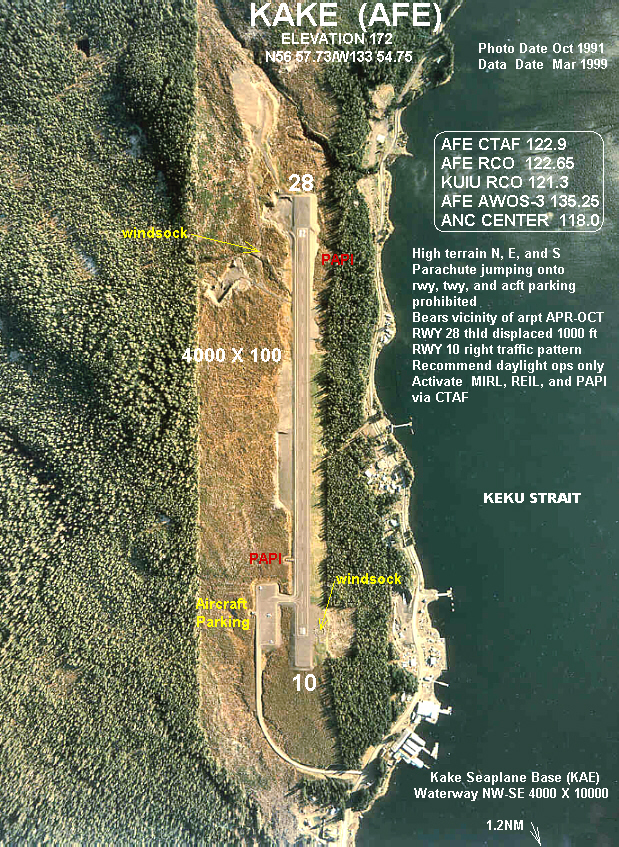
English: Kake (AFE) Airport Overhead |
| Date | Photo: Oct 1991; Data: Mar 1999 |
| Source | http://www.alaska.faa.gov/fai/images/SEAK/AFE-a.jpg |
| Author | Federal Aviation Administration, Alaska |
Kake, Alaska 99830
| Camera location |
| View this and other nearby images on: OpenStreetMap |
|
|---|
Licensing
This image or file is a work of a
Federal Aviation Administration employee, taken or made as part of that person's official duties. As a
work of the
U.S. federal government, the image is in the
public domain in the United States.
|
 |
File history
Click on a date/time to view the file as it appeared at that time.
| Date/Time | Thumbnail | Dimensions | User | Comment | |
|---|---|---|---|---|---|
| current | 10:51, 10 June 2008 |
| 619 × 847 (715 KB) | LeheckaG | {{Information |Description={{en|1=Kake (AFE) Airport Overhead}} |Source=http://www.alaska.faa.gov/fai/images/SEAK/AFE-a.jpg |Author=Federal Aviation Administration, Alaska |Date=Photo: Oct 1991; Data: Mar 1999 |Permission= |other_versions= }} Kake, Alaska |
File usage
The following pages on the English Wikipedia use this file (pages on other projects are not listed):
Global file usage
The following other wikis use this file:
- Usage on ceb.wikipedia.org
- Usage on fa.wikipedia.org
- Usage on ru.wikipedia.org
- Usage on tg.wikipedia.org
- Usage on www.wikidata.org