Size of this preview:
800 × 591 pixels. Other resolutions:
320 × 236 pixels |
640 × 473 pixels |
1,024 × 756 pixels |
1,280 × 945 pixels |
2,560 × 1,890 pixels |
4,052 × 2,992 pixels.
Original file (4,052 × 2,992 pixels, file size: 3.33 MB, MIME type: image/png)
| This is a file from the
Wikimedia Commons. Information from its
description page there is shown below. Commons is a freely licensed media file repository. You can help. |
Summary
| Description |
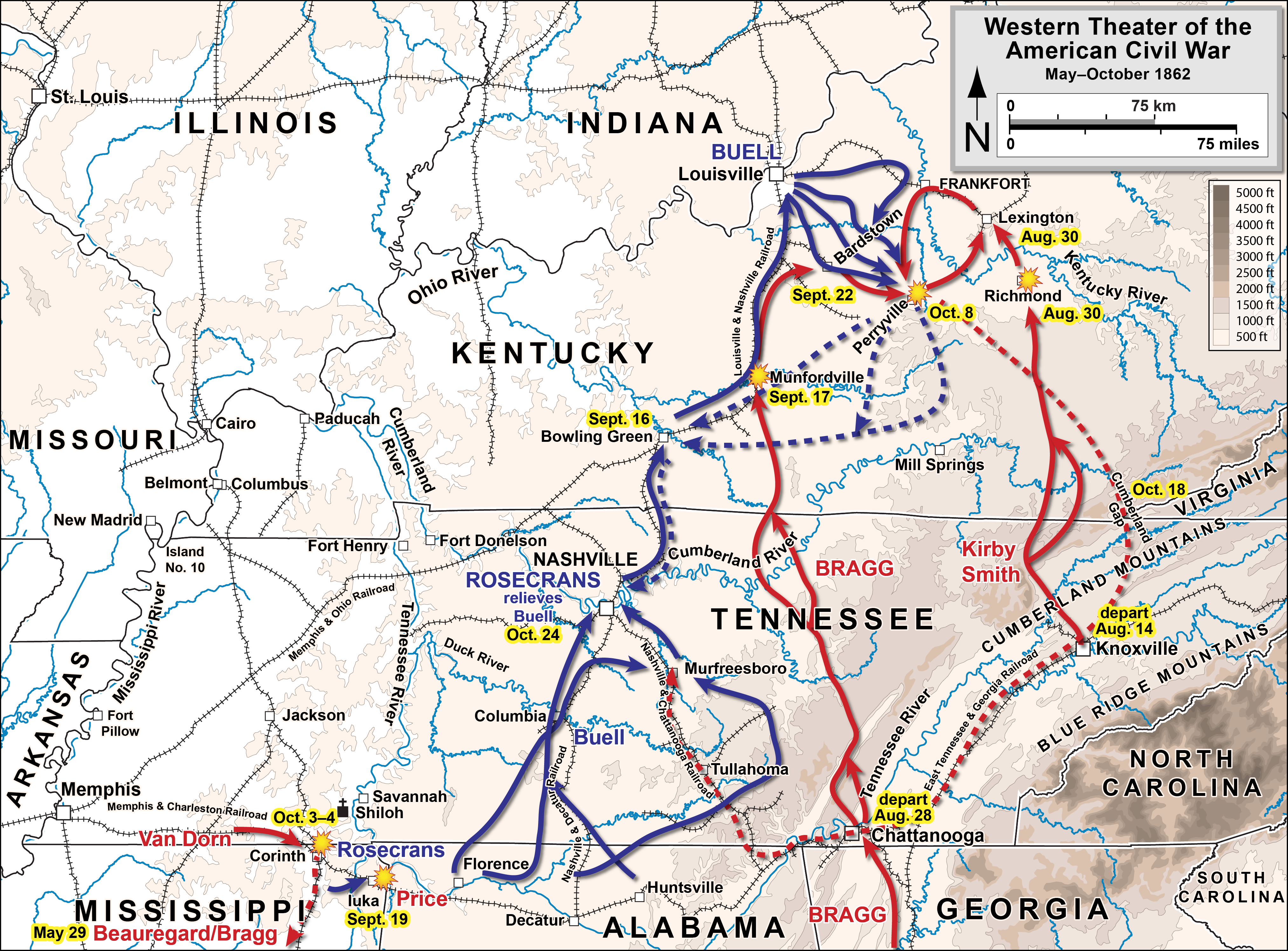
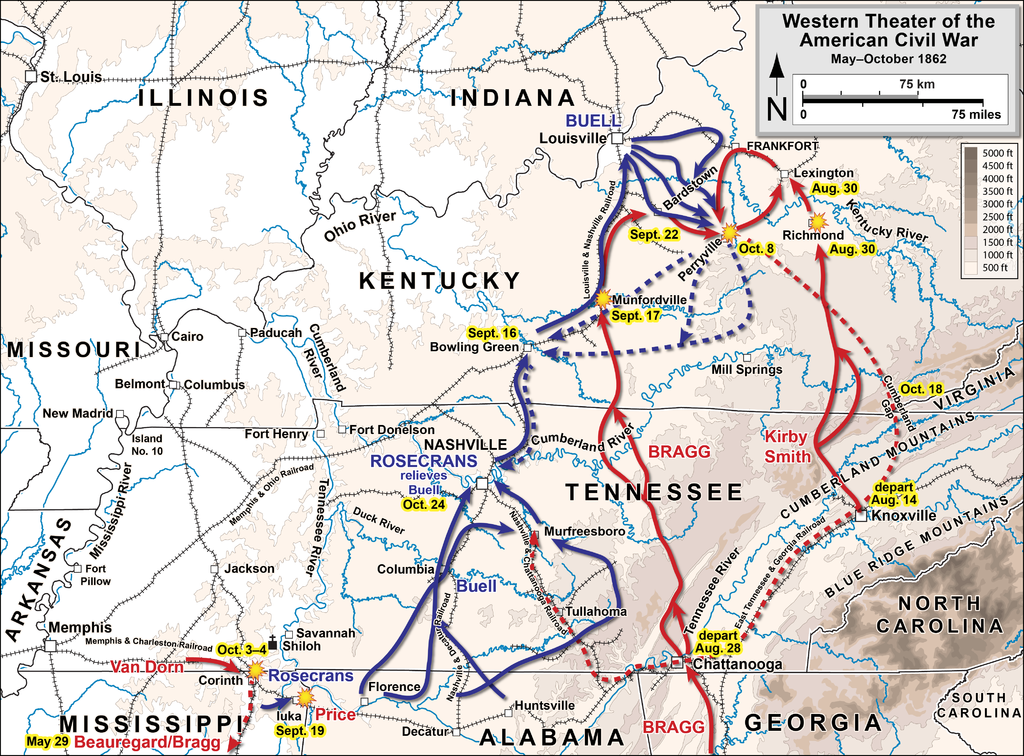
English: Map 3 of 5 of the
Western theater of the American Civil War. Drawn by Hal Jespersen in Adobe Illustrator CS5. Graphic source file is available at
http://cwmaps.com/ |
| Date | |
| Source | Own work |
| Author | Hal Jespersen |
| Permission ( Reusing this file) |
This file is licensed under the
Creative Commons
Attribution 3.0 Unported license. Attribution: Map by Hal Jespersen, www.cwmaps.com
|
File history
Click on a date/time to view the file as it appeared at that time.
| Date/Time | Thumbnail | Dimensions | User | Comment | |
|---|---|---|---|---|---|
| current | 22:08, 26 January 2015 |
| 4,052 × 2,992 (3.33 MB) | Hlj | Reverted back to the hypsometric topographic style used by most of my ACW maps. Improved the accuracy of locations, rivers, and railroads. Same license. |
| 21:56, 26 December 2011 |
 | 2,026 × 1,496 (4.75 MB) | Hlj |
File usage
The following pages on the English Wikipedia use this file (pages on other projects are not listed):
Global file usage
The following other wikis use this file:
- Usage on fr.wikipedia.org
- Usage on he.wikipedia.org
- Usage on hu.wikipedia.org
- Usage on it.wikipedia.org
- Usage on pt.wikipedia.org
- Usage on ru.wikipedia.org
- Usage on vi.wikipedia.org