
Size of this preview:
800 × 600 pixels. Other resolutions:
320 × 240 pixels |
640 × 480 pixels |
1,024 × 768 pixels |
1,280 × 960 pixels |
2,560 × 1,920 pixels |
4,608 × 3,456 pixels.
Original file (4,608 × 3,456 pixels, file size: 6.06 MB, MIME type: image/jpeg)
| This is a file from the
Wikimedia Commons. Information from its
description page there is shown below. Commons is a freely licensed media file repository. You can help. |
Summary
| Description |
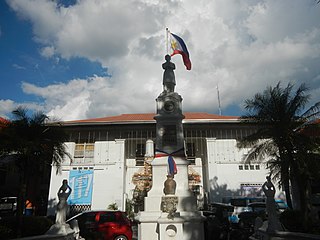
English: Santo Niño, Hagonoy, Bulacan Municipal Road Hagonoy East Central School, Bulacan Hagonoy, Bulacan Municipal Hall
Hagonoy, Bulacan Hagonoy, Bulacan Municipal Park and Fountain
Fire razes Hagonoy, Bulacan Market Aug 18, 2010
Burned Old Hagonoy Market Hagonoy Public Market, Commercial Complex & Punduhang Bayan (San Sebastian, Hagonoy, Bulacan) Hagonoy River (Bulacan) Upgrading-Concreting of F. L. Sebastian Street & M. H. del Pilar Street (San Sebastian-Santo Niño, Hagonoy, Bulacan) San Sebastian-San Jose, Hagonoy, Bulacan Bridge; Town Proper
Barangays
Santo Niño 14°50'26"N 120°44'33"E
San Sebastian 14°49'42"N 120°44'14"E
San Nicolas 14°48'58"N 120°43'50"E
Hagonoy, Bulacan (Note: Judge Florentino Floro, the owner, to repeat, Donor
Florentino Floro of all these photos hereby donate gratuitously, freely and unconditionally all these photos to and for Wikimedia Commons, exclusively, for public use of the public domain, and again without any condition whatsoever). |
| Date | |
| Source | Own work |
| Author | Judgefloro |
| Camera location | | View this and other nearby images on: OpenStreetMap |
|
|---|
Santo Niño 14°50'26"N 120°44'33"E
Licensing
I, the copyright holder of this work, hereby publish it under the following license:
| This file is made available under the Creative Commons CC0 1.0 Universal Public Domain Dedication. | |
| The person who associated a work with this deed has dedicated the work to the
public domain by waiving all of their rights to the work worldwide under copyright law, including all related and neighboring rights, to the extent allowed by law. You can copy, modify, distribute and perform the work, even for commercial purposes, all without asking permission.
|
File history
Click on a date/time to view the file as it appeared at that time.
| Date/Time | Thumbnail | Dimensions | User | Comment | |
|---|---|---|---|---|---|
| current | 16:19, 9 September 2017 |
| 4,608 × 3,456 (6.06 MB) | Judgefloro | User created page with UploadWizard |
File usage
No pages on the English Wikipedia use this file (pages on other projects are not listed).