
Size of this preview:
800 × 600 pixels. Other resolutions:
320 × 240 pixels |
640 × 480 pixels |
1,024 × 768 pixels |
1,280 × 960 pixels |
2,560 × 1,920 pixels |
4,608 × 3,456 pixels.
Original file (4,608 × 3,456 pixels, file size: 6.09 MB, MIME type: image/jpeg)
| This is a file from the
Wikimedia Commons. Information from its
description page there is shown below. Commons is a freely licensed media file repository. You can help. |
Summary
| Description |
English:
Legislative districts of Manila Barangays 637, 638, 639, 640, 641, 642, 643, 644, 645, 646, 647 & 648, Zones 66 & 67, Districts V and VI, Ermita-San Miguel, Manila,
San Miguel, Manila,
City of Manila,
Malacañang Palace
San Miguel San Rafael Street corner
Jose Laurel Street
Commission on the Filipino Language
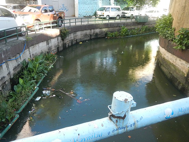
Estero de Sampaloc
List of rivers and estuaries in Metro Manila
Estero De Uli-Uli J. P. Laurel Bridges I, II & III - Estero de Sampaloc, Estero de San Miguel and Estero Uli-Uli (Jose P. Laurel Street, San Miguel, Manila) Legarda Bridge - Estero de Valencia
List of rivers and estuaries in Metro Manila
Sampaloc, Manila Legarda Bridge - Estero de Sampaloc (Barangay 410 and 420, Zones 42-43, District IV, Sampaloc, Manila)
Major roads in Manila
Magsaysay Boulevard Barangays 637, 638, 639 and 640, Zone 65, District VI, San Miguel, Manila, PhilHealth (Local Health Insurance Office, Manila) Bangko Nasyonal ng Pilipinas; Komisyon sa Wikang Filipino (Watson Building, Jose P. Laurel Street, San Miguel, Manila) R.A. 7104, 1991; First Residences (Jose P. Laurel Street, San Miguel, Manila); Exterior of the National Shrine of Saint Jude Thaddeus; St. Jude Catholic School; RCBC Savings Bank; San Beda University; Mendiola Peace Arch; Chino Roces Bridge; Department of Social Welfare and Development; (Note: Judge Florentino Floro, the owner, to repeat, Donor
Florentino Floro of all these photos hereby donate gratuitously, freely and unconditionally all these photos to and for Wikimedia Commons, exclusively, for public use of the public domain, and again without any condition whatsoever). |
| Date | |
| Source | Own work |
| Author | Judgefloro |
| Camera location | | View this and other nearby images on: OpenStreetMap |
|
|---|
San Miguel 14°35'42"N 120°59'28"E
Licensing
I, the copyright holder of this work, hereby publish it under the following license:
| This file is made available under the Creative Commons CC0 1.0 Universal Public Domain Dedication. | |
| The person who associated a work with this deed has dedicated the work to the
public domain by waiving all of their rights to the work worldwide under copyright law, including all related and neighboring rights, to the extent allowed by law. You can copy, modify, distribute and perform the work, even for commercial purposes, all without asking permission.
|
File history
Click on a date/time to view the file as it appeared at that time.
| Date/Time | Thumbnail | Dimensions | User | Comment | |
|---|---|---|---|---|---|
| current | 14:54, 28 June 2018 |
| 4,608 × 3,456 (6.09 MB) | Judgefloro | User created page with UploadWizard |
File usage
The following pages on the English Wikipedia use this file (pages on other projects are not listed):