Size of this preview:
800 × 533 pixels. Other resolutions:
320 × 213 pixels |
640 × 427 pixels |
1,024 × 682 pixels |
1,280 × 853 pixels |
1,802 × 1,201 pixels.
Original file (1,802 × 1,201 pixels, file size: 1.79 MB, MIME type: image/jpeg)
| This is a file from the
Wikimedia Commons. Information from its
description page there is shown below. Commons is a freely licensed media file repository. You can help. |
Summary
| Description |
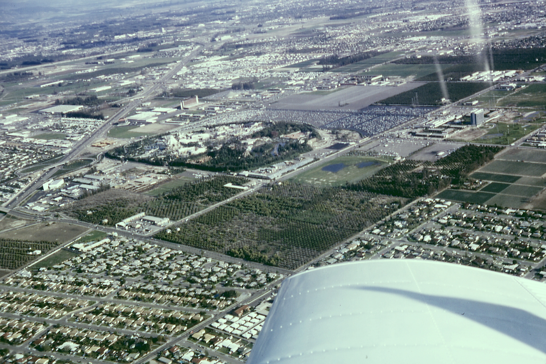
English: Archival aerial photo of Anaheim, California including Disneyland, the Disneyland Hotel, and the monorail system. The Disneyland Heliport, surrounding orange groves, Santa Ana Freeway (now I-5) and the Melodyland Theater "in the round," and much of the surrounding City of Anaheim, California are also visible. |
| Date | |
| Source | Own work |
| Author | Robert J. Boser EditorASC ( talk) |
|
|
Licensing
EditorASC at
en.wikipedia, the copyright holder of this work, hereby publishes it under the following license:
This file is licensed under the
Creative Commons
Attribution-Share Alike 3.0 Unported license.
Attribution:
EditorASC at
en.wikipedia
- You are free:
- to share – to copy, distribute and transmit the work
- to remix – to adapt the work
- Under the following conditions:
- attribution – You must give appropriate credit, provide a link to the license, and indicate if changes were made. You may do so in any reasonable manner, but not in any way that suggests the licensor endorses you or your use.
- share alike – If you remix, transform, or build upon the material, you must distribute your contributions under the same or compatible license as the original.
File history
Click on a date/time to view the file as it appeared at that time.
| Date/Time | Thumbnail | Dimensions | User | Comment | |
|---|---|---|---|---|---|
| current | 11:06, 25 July 2009 |
| 1,802 × 1,201 (1.79 MB) | File Upload Bot (Magnus Manske) | {{BotMoveToCommons|en.wikipedia|year={{subst:CURRENTYEAR}}|month={{subst:CURRENTMONTHNAME}}|day={{subst:CURRENTDAY}}}} {{Information |Description={{en|Aerial photo of Anaheim Disneyland, Disneyland Hotel with its Monorail Station. The Disneyland Helip |
File usage
The following pages on the English Wikipedia use this file (pages on other projects are not listed):
Global file usage
The following other wikis use this file:
- Usage on de.wikipedia.org
- Usage on he.wikipedia.org
- Usage on kn.wikipedia.org
- Usage on ms.wikipedia.org
- Usage on nv.wikipedia.org
- Usage on pt.wikipedia.org
- Usage on ro.wikipedia.org
- Usage on uk.wikipedia.org
- Usage on war.wikipedia.org