
Size of this preview:
788 × 600 pixels. Other resolutions:
315 × 240 pixels |
631 × 480 pixels |
1,009 × 768 pixels |
1,280 × 974 pixels |
2,560 × 1,949 pixels |
3,953 × 3,009 pixels.
Original file (3,953 × 3,009 pixels, file size: 2.18 MB, MIME type: image/jpeg)
| This is a file from the
Wikimedia Commons. Information from its
description page there is shown below. Commons is a freely licensed media file repository. You can help. |
Summary
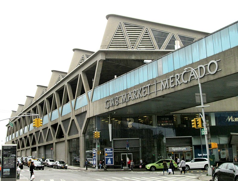
| Description | The George Washington Bridge Bus Station, located between Fort Washington and Wadsworth Avenues and 178th and 179th Streets in the Washington Heights neighborhood of Manhattan, New York City, straddles the Trans-Manhattan Expressway (Interstate 95). It was built in 1963 and was designed by the Port Authority of New York and New Jersey and Pier Luigi Nervi. (Source: AIA Guide to NYC (5th ed.) This image was taken from the southeast corner of Broadway and 178th Street. |
| Date | |
| Source | Own work |
| Author | Beyond My Ken |
| Camera location | | View this and other nearby images on: OpenStreetMap |
|
|---|
Licensing
I, the copyright holder of this work, hereby publish it under the following licenses:

|
Permission is granted to copy, distribute and/or modify this document under the terms of the GNU Free Documentation License, Version 1.2 or any later version published by the Free Software Foundation; with no Invariant Sections, no Front-Cover Texts, and no Back-Cover Texts. A copy of the license is included in the section entitled GNU Free Documentation License. |
This file is licensed under the
Creative Commons Attribution-Share Alike
4.0 International,
3.0 Unported,
2.5 Generic,
2.0 Generic and
1.0 Generic license.
- You are free:
- to share – to copy, distribute and transmit the work
- to remix – to adapt the work
- Under the following conditions:
- attribution – You must give appropriate credit, provide a link to the license, and indicate if changes were made. You may do so in any reasonable manner, but not in any way that suggests the licensor endorses you or your use.
- share alike – If you remix, transform, or build upon the material, you must distribute your contributions under the same or compatible license as the original.
You may select the license of your choice.
File history
Click on a date/time to view the file as it appeared at that time.
| Date/Time | Thumbnail | Dimensions | User | Comment | |
|---|---|---|---|---|---|
| current | 00:28, 24 June 2018 |
| 3,953 × 3,009 (2.18 MB) | Beyond My Ken | == {{int:filedesc}} == {{Information |Description= The George Washington Bridge Bus Station, located between Fort Washington and Wadsworth Avenues and 178th and 179th Streets in the Washington Heights neighborhood of Manhattan, New York City, straddles the Trans-Manhattan Expressway (Interstate 95). It was built in 1963 and was designed by the Port Authority of New York and New Jersey and Pier Luigi Nervi. (Source: ''AIA Guide to NYC'' (5th ed.) This image was taken from the southeast corne... |
File usage
The following pages on the English Wikipedia use this file (pages on other projects are not listed):
Global file usage
The following other wikis use this file:
- Usage on fr.wikipedia.org
- Usage on pt.wikipedia.org