
Size of this PNG preview of this SVG file:
800 × 401 pixels. Other resolutions:
320 × 160 pixels |
640 × 321 pixels |
1,024 × 514 pixels |
1,280 × 642 pixels |
2,560 × 1,284 pixels |
2,339 × 1,173 pixels.
Original file (SVG file, nominally 2,339 × 1,173 pixels, file size: 31 MB)
| This is a file from the
Wikimedia Commons. Information from its
description page there is shown below. Commons is a freely licensed media file repository. You can help. |
Summary
| Description |
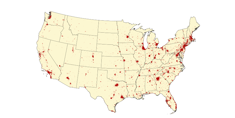
English: Replacement of Map image that for years has mistakenly been from the 2000 Census. When the 2020 Census Urban areas data is released, can update from a 2010 map to a 2020 map. |
| Date | |
| Source | Own work |
| Author | Chez Nation |
Licensing
I, the copyright holder of this work, hereby publish it under the following license:
This file is licensed under the
Creative Commons
Attribution-Share Alike 4.0 International license.
- You are free:
- to share – to copy, distribute and transmit the work
- to remix – to adapt the work
- Under the following conditions:
- attribution – You must give appropriate credit, provide a link to the license, and indicate if changes were made. You may do so in any reasonable manner, but not in any way that suggests the licensor endorses you or your use.
- share alike – If you remix, transform, or build upon the material, you must distribute your contributions under the same or compatible license as the original.
File history
Click on a date/time to view the file as it appeared at that time.
| Date/Time | Thumbnail | Dimensions | User | Comment | |
|---|---|---|---|---|---|
| current | 22:50, 26 November 2022 |
| 2,339 × 1,173 (31 MB) | Chez Nation | Uploaded own work with UploadWizard |
File usage
No pages on the English Wikipedia use this file (pages on other projects are not listed).