Size of this preview:
519 × 600 pixels. Other resolutions:
208 × 240 pixels |
598 × 691 pixels.
Original file (598 × 691 pixels, file size: 98 KB, MIME type: image/jpeg)
| This is a file from the
Wikimedia Commons. Information from its
description page there is shown below. Commons is a freely licensed media file repository. You can help. |
Summary
| Description |
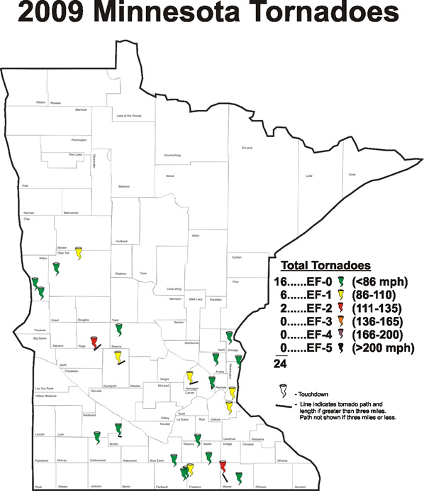
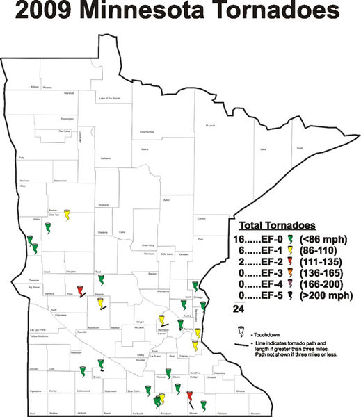
English: Map of the tornadoes that touched down in Minnesota during 2009. |
| Date | |
| Source | http://www.crh.noaa.gov/mpx/?n=minnesotatornadoes2009 |
| Author | NOAA |
Licensing
This image is in the
public domain because it contains materials that originally came from the U.S.
National Oceanic and Atmospheric Administration, taken or made as part of an employee's official duties.
|
File history
Click on a date/time to view the file as it appeared at that time.
| Date/Time | Thumbnail | Dimensions | User | Comment | |
|---|---|---|---|---|---|
| current | 04:20, 10 February 2010 |
| 598 × 691 (98 KB) | WxGopher | {{Information |Description={{en|1=Map of the tornadoes that touched down in Minnesota during 2009.}} |Source=http://www.crh.noaa.gov/mpx/?n=minnesotatornadoes2009 |Author=NOAA |Date=January 20, 2009 |Permission= |other_versions= }} |
File usage
The following pages on the English Wikipedia use this file (pages on other projects are not listed):