Size of this preview:
800 × 531 pixels. Other resolutions:
320 × 212 pixels |
640 × 425 pixels |
1,024 × 680 pixels |
1,280 × 850 pixels |
2,560 × 1,699 pixels |
4,284 × 2,844 pixels.
Original file (4,284 × 2,844 pixels, file size: 9.37 MB, MIME type: image/jpeg)
| This is a file from the
Wikimedia Commons. Information from its
description page there is shown below. Commons is a freely licensed media file repository. You can help. |
Summary
| Description |
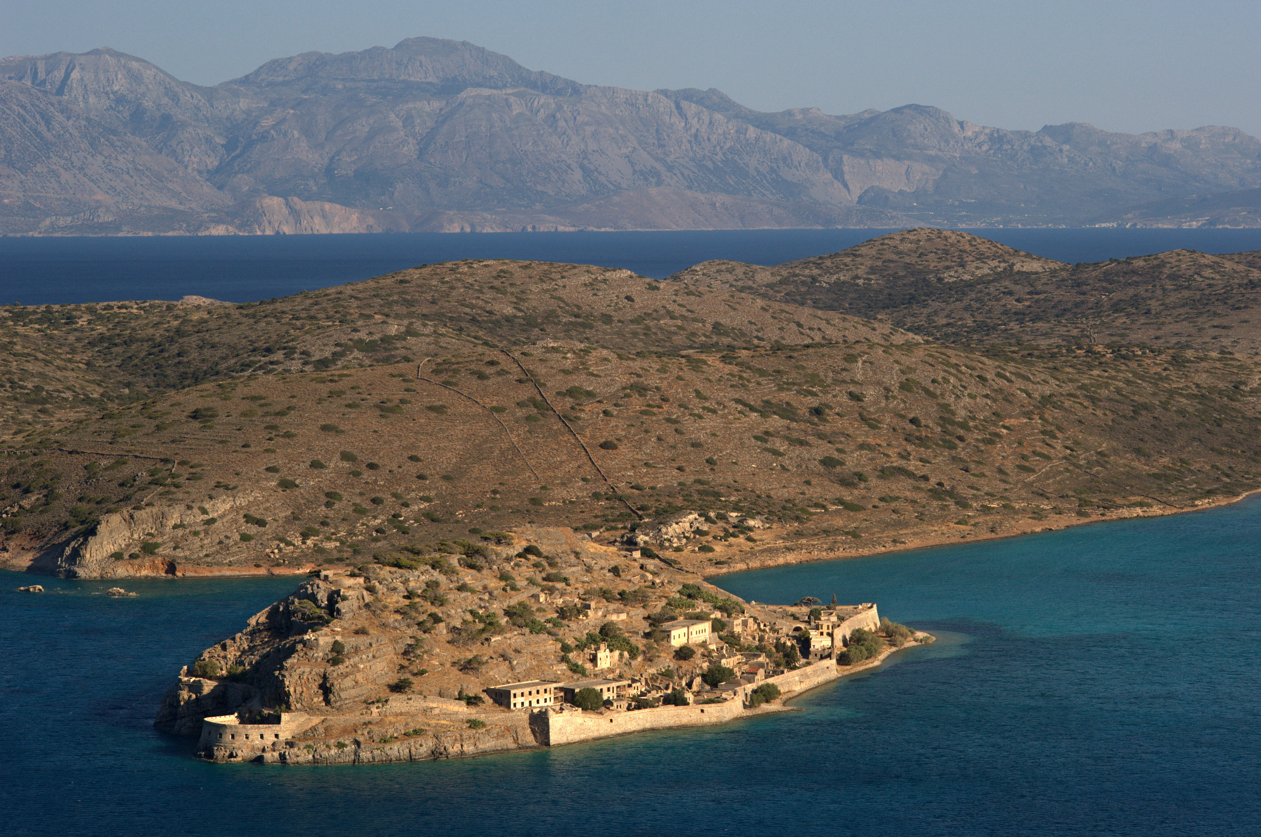
English: Island Spinalonga (Kalidon) – top view panorama, Crete, Greece.
Ελληνικά: Το νησί της Σπιναλόγκα - Καλυδών, Κρήτη. Πανοραμική εικόνα από το βουνό.
Français : L'île de Spinalonga (Kalydon) en Crète, Grèce - vue panoramique depuis la montagne.
|
| Date | |
| Source | Own work |
| Author | Ggia |
| Permission ( Reusing this file) |
Creative Common License 3.0 Share Alike |
| Camera location |
| View this and other nearby images on: OpenStreetMap |
|
|---|
|

This image was selected as
picture of the day on Wikimedia Commons for
21 October 2010. It was captioned as follows: English: Island Spinalonga (official name: Kalidon) top view panorama, Crete, Greece. Other languages:
Deutsch: Die Insel
Spinalonga (Offizieller Name: Kalidon) in einem Luftbildpanorama. Die Insel befindet sich vor
Kreta (
Griechenland). English: Island Spinalonga (official name: Kalidon) top view panorama, Crete, Greece. Español: Panorámica aérea de la isla Spinalonga (oficialmente Kalidon), Creta, Grecia. Íslenska: Loftmynd af eynni Spinalonga, á Krít. Nederlands: Het eiland
Spinalonga (officiële naam: Kalidon) vanuit de lucht. Het eiland ligt voor de kust van het veel grotere Griekse eiland
Kreta. Ελληνικά: Το νησί της Σπιναλόγκα - Καλυδών, Ελούντα - Κρήτη. Πανοραμική εικόνα από το γειτονικό βουνό. Македонски: Островот
Спиналонга (официјално: Калидон), Крит, Грција. 한국어: 그리스 크리타에 있는 스피나론가 섬(공식 이름은 칼리돈)의 파노라마 사진 |
Licensing
I, the copyright holder of this work, hereby publish it under the following license:
This file is licensed under the
Creative Commons
Attribution-Share Alike 3.0 Unported license.
- You are free:
- to share – to copy, distribute and transmit the work
- to remix – to adapt the work
- Under the following conditions:
- attribution – You must give appropriate credit, provide a link to the license, and indicate if changes were made. You may do so in any reasonable manner, but not in any way that suggests the licensor endorses you or your use.
- share alike – If you remix, transform, or build upon the material, you must distribute your contributions under the same or compatible license as the original.
| Annotations | This image is annotated: View the annotations at Commons |
File history
Click on a date/time to view the file as it appeared at that time.
| Date/Time | Thumbnail | Dimensions | User | Comment | |
|---|---|---|---|---|---|
| current | 00:21, 13 May 2010 |
| 4,284 × 2,844 (9.37 MB) | Ggia | more hi-quality |
| 14:39, 12 May 2010 |
 | 4,238 × 2,806 (4.45 MB) | Ggia | hi-resolution-quality of original image | |
| 12:56, 28 June 2009 |
 | 4,248 × 2,816 (2.59 MB) | Ggia | A little bit more bright colors. | |
| 12:52, 28 June 2009 |
 | 4,248 × 2,816 (2.57 MB) | Ggia | {{Information |Description={{en|1=Island Spinalonga (Kalidon)- top view panorama, Crete, Greece.}} {{el|1=Το νησί της Σπιναλόγκα - Καλυδών, Κρήτη. Πανοραμική εικόνα από το βουνό. }} |Source=Έργ� |
File usage
The following pages on the English Wikipedia use this file (pages on other projects are not listed):
Global file usage
The following other wikis use this file:
- Usage on ar.wikipedia.org
- Usage on arz.wikipedia.org
- Usage on az.wikipedia.org
- Usage on be-tarask.wikipedia.org
- Usage on bg.wikipedia.org
- Usage on bn.wikipedia.org
- Usage on ca.wikipedia.org
- Usage on ceb.wikipedia.org
- Usage on crh.wikipedia.org
- Usage on cs.wikipedia.org
- Usage on cv.wikipedia.org
- Usage on el.wikipedia.org
- Usage on en.wikivoyage.org
- Usage on eo.wikipedia.org
- Usage on es.wikipedia.org
- Usage on et.wikipedia.org
- Usage on fa.wikipedia.org
- Usage on fi.wikipedia.org
- Usage on fr.wikipedia.org
- Spinalonga
- Discussion:Spinalonga
- Utilisateur:GhosterBot/BacASable/Le saviez-vous ?/Archives
- Wikipédia:Le saviez-vous ?/Archives/2023
- Wikipédia:Statistiques des anecdotes de la page d'accueil/Visibilité des anecdotes (2023)
- Discussion:Spinalonga/LSV 22574
- Wikipédia:Statistiques des anecdotes de la page d'accueil/Visibilité des anecdotes (2023)/2023 10
- Wikipédia:Réseaux sociaux/X/Publications/archives/octobre 2023
- Usage on gl.wikipedia.org
- Usage on he.wikipedia.org
- Usage on hu.wikipedia.org
- Usage on hyw.wikipedia.org
- Usage on it.wikipedia.org
- Usage on ja.wikipedia.org
- Usage on ko.wikipedia.org
- Usage on krc.wikipedia.org
- Usage on lbe.wikipedia.org
- Usage on mk.wikipedia.org
- Usage on nl.wikipedia.org
- Usage on no.wikipedia.org
- Usage on os.wikipedia.org
- Usage on pl.wikipedia.org
- Usage on pt.wikipedia.org
View more global usage of this file.