
Size of this PNG preview of this SVG file:
800 × 407 pixels. Other resolutions:
320 × 163 pixels |
640 × 325 pixels |
1,024 × 520 pixels |
1,280 × 650 pixels |
2,560 × 1,301 pixels |
3,784 × 1,923 pixels.
Original file (SVG file, nominally 3,784 × 1,923 pixels, file size: 7.15 MB)
| This is a file from the
Wikimedia Commons. Information from its
description page there is shown below. Commons is a freely licensed media file repository. You can help. |
Summary
| Description |
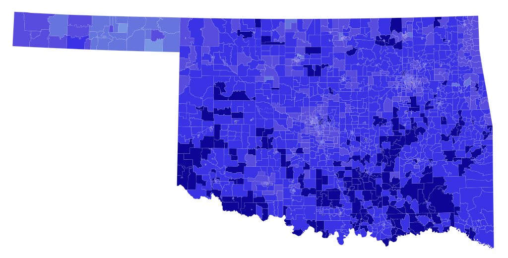
English: Results of the
1990 United States Senate election in Oklahoma.
Data from the Harvard Record of American Democracy Dataverse. Precinct shapefile is approximate -- 1990 Census Voting Tabulation Districts (VTDs) were used as approximate stand-ins for true precincts in most cases, since true precincts are difficult or impossible (records destroyed) to acquire in most cases. Using QGIS, real precincts were traced from paper maps and used in Canadian, Cleveland, and Garvin Counties. Early and absentee votes were formulaically allocated from the county level to the precinct level based on election day results. |
| Date | |
| Source | Own work |
| Author | Master of Time |
Licensing
I, the copyright holder of this work, hereby publish it under the following license:
This file is licensed under the
Creative Commons
Attribution-Share Alike 4.0 International license.
- You are free:
- to share – to copy, distribute and transmit the work
- to remix – to adapt the work
- Under the following conditions:
- attribution – You must give appropriate credit, provide a link to the license, and indicate if changes were made. You may do so in any reasonable manner, but not in any way that suggests the licensor endorses you or your use.
- share alike – If you remix, transform, or build upon the material, you must distribute your contributions under the same or compatible license as the original.
File history
Click on a date/time to view the file as it appeared at that time.
| Date/Time | Thumbnail | Dimensions | User | Comment | |
|---|---|---|---|---|---|
| current | 22:11, 16 October 2022 |
| 3,784 × 1,923 (7.15 MB) | Master of Time | =={{int:filedesc}}== {{Information |description={{en|1=Results of the 1990 United States Senate election in Oklahoma. [https://dataverse.harvard.edu/dataverse/road Data from the Harvard Record of American Democracy Dataverse]. Precinct shapefile is approximate -- 1990 Census Voting Tabulation Districts (VTDs) were used as approximate stand-ins for true precincts in most cases, since true precincts are difficult or impossible (records destr... |
File usage
The following pages on the English Wikipedia use this file (pages on other projects are not listed):