No higher resolution available.
1867_Map_of_Red_Hook.png (673 × 564 pixels, file size: 604 KB, MIME type: image/png)
| This is a file from the
Wikimedia Commons. Information from its
description page there is shown below. Commons is a freely licensed media file repository. You can help. |
Summary
| Description |
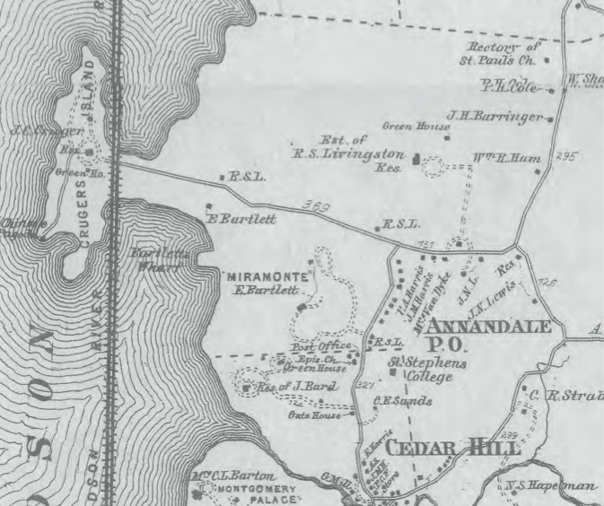
English: 1867 Map of Dutchess County Showing Red Hook estates |
| Date | |
| Source | Bard College Archives |
| Author | Bard College Master Preservation Plan |
Licensing
This media file is in the
public domain in the
United States. This applies to U.S. works where the copyright has expired, often because its first
publication occurred prior to January 1, 1929, and if not then due to lack of notice or renewal. See
this page for further explanation.
|
 | |
 |
This image might not be in the public domain outside of the United States; this especially applies in the countries and areas that do not apply the
rule of the shorter term for US works, such as Canada, Mainland China (not Hong Kong or Macao), Germany, Mexico, and Switzerland. The creator and year of publication are essential information and must be provided. See
Wikipedia:Public domain and
Wikipedia:Copyrights for more details.
|
File history
Click on a date/time to view the file as it appeared at that time.
| Date/Time | Thumbnail | Dimensions | User | Comment | |
|---|---|---|---|---|---|
| current | 06:53, 11 July 2012 |
| 673 × 564 (604 KB) | Jr991999 |
File usage
The following pages on the English Wikipedia use this file (pages on other projects are not listed):
Global file usage
The following other wikis use this file:
- Usage on azb.wikipedia.org
- Usage on es.wikipedia.org
- Usage on ro.wikipedia.org
- Usage on zh.wikipedia.org