Size of this preview:
738 × 600 pixels. Other resolutions:
295 × 240 pixels |
591 × 480 pixels |
945 × 768 pixels |
1,260 × 1,024 pixels |
2,520 × 2,048 pixels |
3,117 × 2,533 pixels.
Original file (3,117 × 2,533 pixels, file size: 2.37 MB, MIME type: image/jpeg)
| This is a file from the
Wikimedia Commons. Information from its
description page there is shown below. Commons is a freely licensed media file repository. You can help. |
|
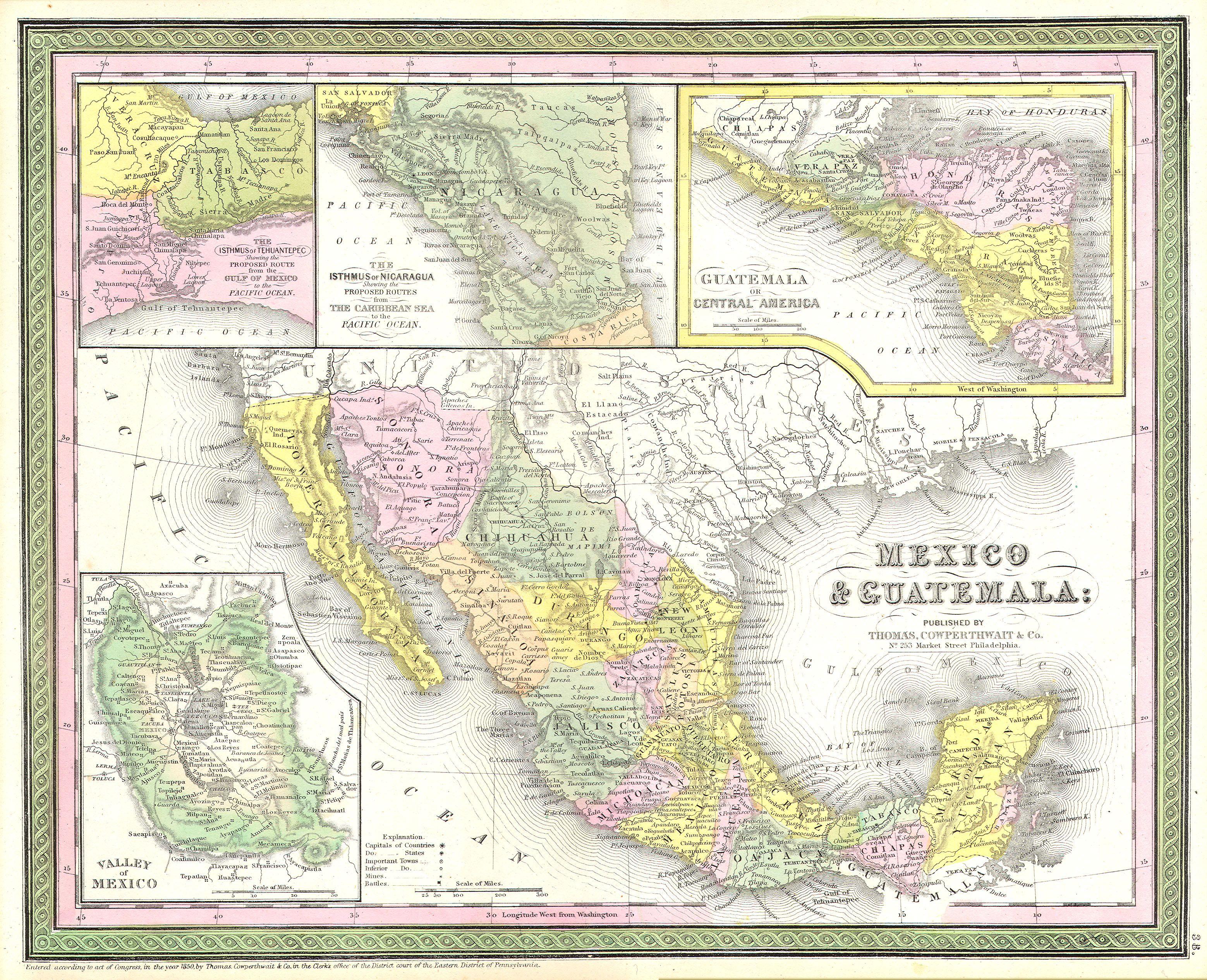
Samuel Augustus Mitchell: Mexico & Guatemala.
(
|
||||||||||||||||||||
|---|---|---|---|---|---|---|---|---|---|---|---|---|---|---|---|---|---|---|---|---|
| Artist |
|
|||||||||||||||||||
| Title |
Mexico & Guatemala. |
|||||||||||||||||||
| Description |
English: This scarce hand colored map is a lithographic engraving of Mexico. Roughly covers the territory of modern day Mexico and Texas. Inset maps depict the Valley of Mexico, today’s Mexico City and Estado de Mexico (Mexico State). Inset maps along the upper border depict the Isthmus of Tehuantepec, the Isthmus of Nicaragua, and Guatemala. The whole is shows both political and geological features and is rendered in the lovely pastels typical of 1850s Mitchell / Cowperthwait maps. Dated and copyrighted 1850. |
|||||||||||||||||||
| Date | 1850 | |||||||||||||||||||
| Dimensions | height: 12 in (30.4 cm); width: 15 in (38.1 cm) | |||||||||||||||||||
| Accession number |
Geographicus link:
MexicoTexas-m-50 |
|||||||||||||||||||
| Source/Photographer |
|
|||||||||||||||||||
| Permission ( Reusing this file) |
|
|||||||||||||||||||
File history
Click on a date/time to view the file as it appeared at that time.
| Date/Time | Thumbnail | Dimensions | User | Comment | |
|---|---|---|---|---|---|
| current | 07:13, 16 March 2011 |
| 3,117 × 2,533 (2.37 MB) | BotMultichill | {{subst:User:Multichill/Geographicus |link=http://www.geographicus.com/P/AntiqueMap/MexicoTexas-m-50 |product_name=1850 Mitchell Map of Mexico & Texas |map_title=Mexico & Guatemala. |description=This scarce hand colored map is a lithographic engraving of |
File usage
The following pages on the English Wikipedia use this file (pages on other projects are not listed):
Global file usage
The following other wikis use this file:
- Usage on es.wikipedia.org