Original file (6,678 × 2,700 pixels, file size: 2.12 MB, MIME type: image/jpeg)
| This is a file from the
Wikimedia Commons. Information from its
description page there is shown below. Commons is a freely licensed media file repository. You can help. |
Summary
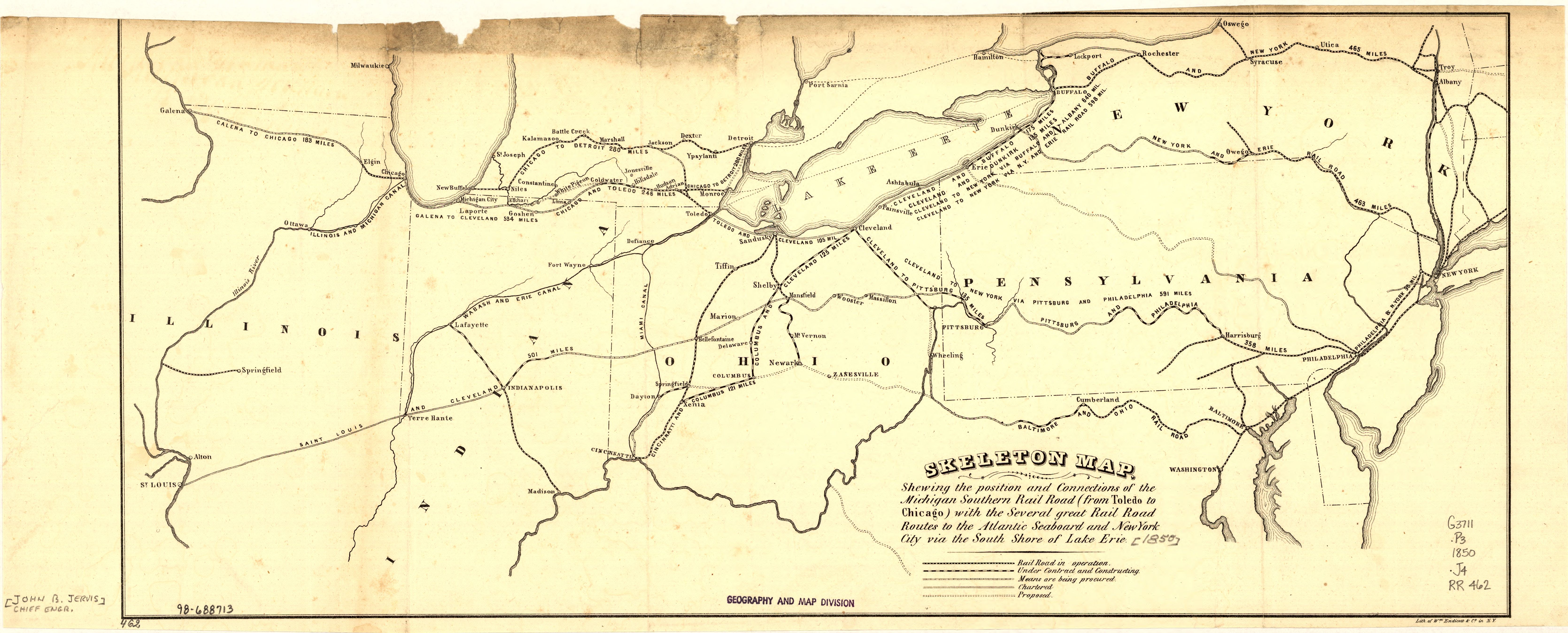
| Description | 1850 map of the Michigan Southern Rail Road. | ||
| Date | |||
| Source |
|
||
| Author | Michigan Southern Railroad | ||
| Other versions | 50% |

Licensing
|
This work is in the public domain in its country of origin and other countries and areas where the copyright term is the author's life plus 70 years or fewer.
| |
| This file has been identified as being free of known restrictions under copyright law, including all related and neighboring rights. | |
File history
Click on a date/time to view the file as it appeared at that time.
| Date/Time | Thumbnail | Dimensions | User | Comment | |
|---|---|---|---|---|---|
| current | 01:43, 12 August 2005 |
| 6,678 × 2,700 (2.12 MB) | SPUI~commonswiki | {{PD}} 1850 map of the Michigan Southern Rail Road from [http://memory.loc.gov/cgi-bin/query/r?ammem/gmd:@field(NUMBER+@band(g3711p+rr004620))]. category:New York Central Railroad category:railroad maps |
File usage
Global file usage
The following other wikis use this file:
- Usage on fr.wikipedia.org