
Original file (4,000 × 3,000 pixels, file size: 2.51 MB, MIME type: image/jpeg)
| This is a file from the
Wikimedia Commons. Information from its
description page there is shown below. Commons is a freely licensed media file repository. You can help. |
Summary
| Description |
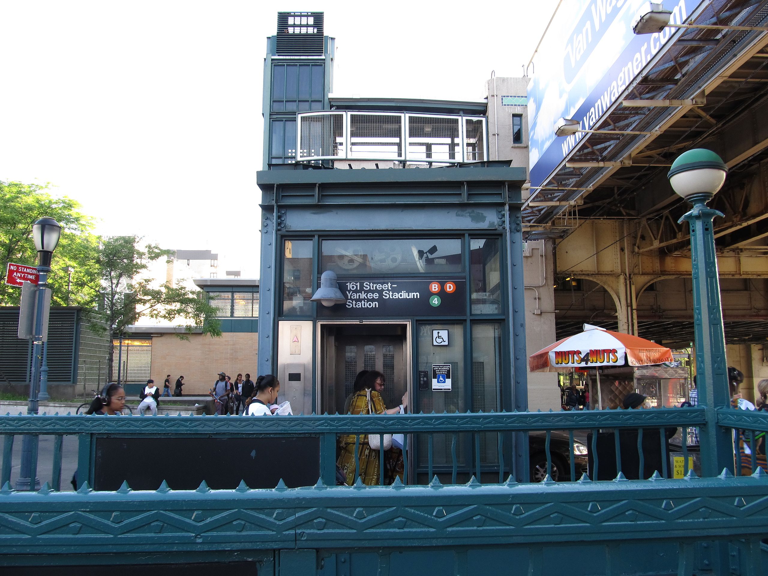
161st Street – Yankee Stadium is a New York City Subway station complex shared by the elevated IRT Jerome Avenue Line and the underground IND Concourse Line. Located at the intersection of 161st Street and River Avenue in the Bronx, it is served by the: 4 train at all times D train at all times except rush hours in the peak direction B train during rush hours Yankee Stadium is outside and many Bronx County courts, government facilities, and shopping districts are a short walk to the east. (Yankee Stadium is also accessible via the MTA's Metro-North via the Yankees – East 153rd Street station.) This is one of only two station complexes in The Bronx (the other being 149th Street – Grand Concourse). When the IND portion was built in 1933, paper tickets were used to transfer between the two lines; this method was used until the 1950s, when the indoor escalators were built. The complex has been fully renovated to include ADA-accessible elevators to all platforms. The combined passenger count for the complex in 2011 was 8,605,893, making it the busiest station in the Bronx and 36th overall. en.wikipedia.org/wiki/161st_Street_%E2%80%93_Yankee_Stadium_(New_York_City_Subway) en.wikipedia.org/wiki/Wikipedia:Text_of_Creative_Commons_... |
| Date | |
| Source | 161st Street – Yankee Stadium Station, The Bronx, New York |
| Author | Ken Lund from Las Vegas, Nevada, USA |
| Camera location |
| View this and other nearby images on: OpenStreetMap |
|
|---|
Licensing
- You are free:
- to share – to copy, distribute and transmit the work
- to remix – to adapt the work
- Under the following conditions:
- attribution – You must give appropriate credit, provide a link to the license, and indicate if changes were made. You may do so in any reasonable manner, but not in any way that suggests the licensor endorses you or your use.
- share alike – If you remix, transform, or build upon the material, you must distribute your contributions under the same or compatible license as the original.
| This image was originally posted to Flickr by Ken Lund at https://www.flickr.com/photos/75683070@N00/7237820616. It was reviewed on 3 October 2014 by FlickreviewR and was confirmed to be licensed under the terms of the cc-by-sa-2.0. |
File history
Click on a date/time to view the file as it appeared at that time.
| Date/Time | Thumbnail | Dimensions | User | Comment | |
|---|---|---|---|---|---|
| current | 17:36, 30 September 2014 |
| 4,000 × 3,000 (2.51 MB) | Vcohen | Transferred from Flickr via Flickr2commons |
File usage
Global file usage
The following other wikis use this file:
- Usage on it.wikipedia.org
- Usage on ja.wikipedia.org
- Usage on ru.wikipedia.org
- Usage on zh.wikipedia.org