Size of this preview:
800 × 511 pixels. Other resolutions:
320 × 204 pixels |
640 × 409 pixels |
1,024 × 654 pixels |
1,280 × 818 pixels |
1,687 × 1,078 pixels.
Original file (1,687 × 1,078 pixels, file size: 868 KB, MIME type: image/jpeg)
| This is a file from the
Wikimedia Commons. Information from its
description page there is shown below. Commons is a freely licensed media file repository. You can help. |
Summary
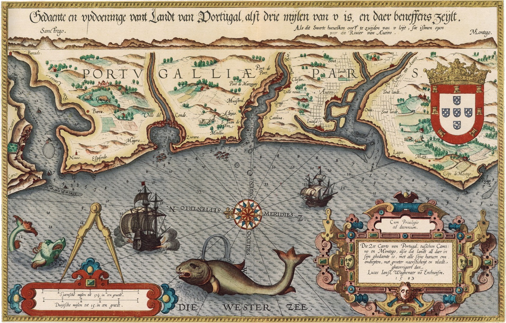
| Description | Sea map of Portugal; title: Gedaente en ... vant Landt van Portugal; from: Mariner’s Mirror (T'eerste deel vande Spieghel der zeevaerdt, van de navigatie der Westersche zee, innehoudende alle de custen van Vranckrijck, Spaingen ende 't principaelste deel van Engelandt, in diversche zee caerten begrepen", Leiden, Christoffel Plantijn, 1584) |
| Date | |
| Source | University of Texas at Arlington Libraries |
| Author | Waghenaer, Lucas Jansz |
Licensing
|
This work is in the public domain in its country of origin and other countries and areas where the copyright term is the author's life plus 100 years or fewer. | |
| This file has been identified as being free of known restrictions under copyright law, including all related and neighboring rights. | |
File history
Click on a date/time to view the file as it appeared at that time.
| Date/Time | Thumbnail | Dimensions | User | Comment | |
|---|---|---|---|---|---|
| current | 13:42, 22 November 2007 |
| 1,687 × 1,078 (868 KB) | Joopr | {{Information |Description=Sea map of Portugal; title: Gedaente en ... vant Landt van Portugal; from: Mariner’s Mirror |Source=http://libraries.uta.edu/speccoll/Exhibits/weuromaps/text_tms12-Waghenaer.htm |Date=1584 |Author=Waghenaer, Lucas Jansz |Permi |
File usage
The following pages on the English Wikipedia use this file (pages on other projects are not listed):
Global file usage
The following other wikis use this file:
- Usage on ca.wikipedia.org
- Usage on de.wikipedia.org
- Usage on de.wikisource.org
- Usage on nl.wikipedia.org
- Usage on ru.wikipedia.org
- Usage on zh.wikipedia.org