Size of this preview:
449 × 599 pixels. Other resolutions:
180 × 240 pixels |
359 × 480 pixels |
575 × 768 pixels |
767 × 1,024 pixels |
1,534 × 2,048 pixels |
2,692 × 3,594 pixels.
Original file (2,692 × 3,594 pixels, file size: 2.48 MB, MIME type: image/jpeg)
| This is a file from the
Wikimedia Commons. Information from its
description page there is shown below. Commons is a freely licensed media file repository. You can help. |
Summary
| Description |
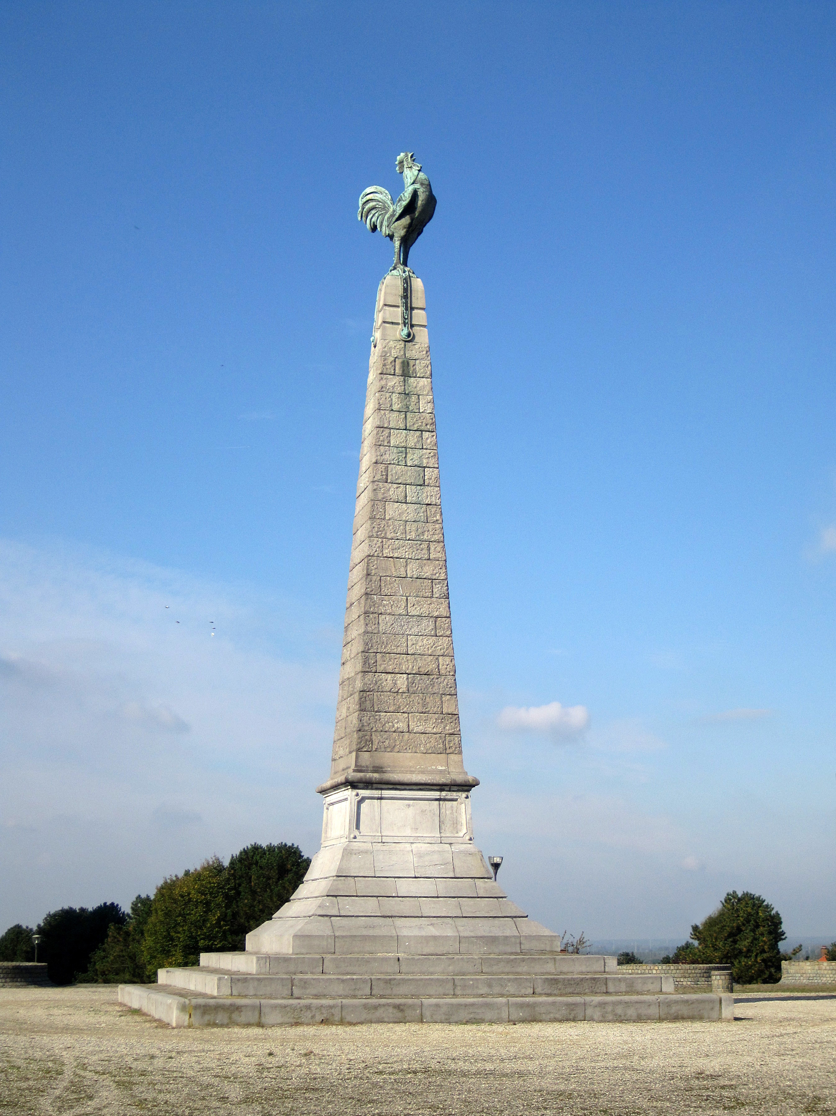
Français :
Jemappes (Belgique), le monument du Coq élevé en souvenir de la
bataille ayant opposé le 6 novembre 1792 l'
armée révolutionnaire française commandée par le Général
Dumouriez à l'armée autrichienne sous les ordres du
Duc Albert de Saxe-Teschen.
English:
Jemappes (Belgium), the monument du "Coq" (of the Rooster) erected in memory, the
battle having opposed the 6 november 1792 the
French Revolutionary Army ordered by General
Dumouriez to the Austrian army under orders of
Albert of Saxe-Teschen.
|
||||||
| Date | |||||||
| Source | Own work | ||||||
| Author | Jean-Pol GRANDMONT | ||||||
| Permission ( Reusing this file) |
|
||||||
| Other versions |
|

.JPG)
.JPG)
.JPG)
.JPG¶ms=050.442619_N_0003.882417_E_globe:Earth_type:camera_region:BE_heading:337.50&language=en)
Licensing
I, the copyright holder of this work, hereby publish it under the following licenses:
This file is licensed under the
Creative Commons
Attribution-Share Alike 3.0 Unported license.
- You are free:
- to share – to copy, distribute and transmit the work
- to remix – to adapt the work
- Under the following conditions:
- attribution – You must give appropriate credit, provide a link to the license, and indicate if changes were made. You may do so in any reasonable manner, but not in any way that suggests the licensor endorses you or your use.
- share alike – If you remix, transform, or build upon the material, you must distribute your contributions under the same or compatible license as the original.

|
Permission is granted to copy, distribute and/or modify this document under the terms of the GNU Free Documentation License, Version 1.2 or any later version published by the Free Software Foundation; with no Invariant Sections, no Front-Cover Texts, and no Back-Cover Texts. A copy of the license is included in the section entitled GNU Free Documentation License. |
You may select the license of your choice.
File history
Click on a date/time to view the file as it appeared at that time.
| Date/Time | Thumbnail | Dimensions | User | Comment | |
|---|---|---|---|---|---|
| current | 15:55, 4 February 2013 |
| 2,692 × 3,594 (2.48 MB) | Jean-Pol GRANDMONT | New file |
| 13:35, 9 October 2012 |
 | 2,692 × 3,594 (2.11 MB) | Jean-Pol GRANDMONT | {{Information |Description ={{fr|1= Jemappes (Belgique), le monument du Coq élevé en souvenir de la bataiile ayant opposé le 6 novembre 1792 l' armée revolutionnaire française commandée ... |
File usage
The following pages on the English Wikipedia use this file (pages on other projects are not listed):
Global file usage
The following other wikis use this file:
- Usage on cs.wikipedia.org
- Usage on de.wikipedia.org
- Usage on es.wikipedia.org
- Usage on fr.wikipedia.org
- Usage on ja.wikipedia.org
- Usage on nl.wikipedia.org
- Usage on pt.wikipedia.org
- Usage on tr.wikipedia.org
.JPG)