
Size of this preview:
800 × 532 pixels. Other resolutions:
320 × 213 pixels |
640 × 426 pixels |
1,024 × 682 pixels |
1,280 × 852 pixels |
2,048 × 1,363 pixels.
Original file (2,048 × 1,363 pixels, file size: 1.37 MB, MIME type: image/jpeg)
| This is a file from the
Wikimedia Commons. Information from its
description page there is shown below. Commons is a freely licensed media file repository. You can help. |
Summary
| Description |
English:
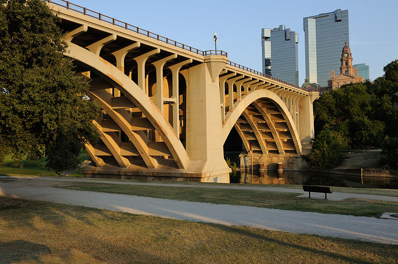
Paddock ViaductThe Paddock Viaduct connects crosses the Trinity River and connects downtown with North Fort Worth. NRHP Ref 76002068.
|
||
| Date | |||
| Source | Own work | ||
| Author | Mark Fisher | ||
| Permission ( Reusing this file) |
This version of the original photo is licensed under the Creative Commons Attribution-Share Alike 3.0 Unported license. All copies, distributions, derivatives, or adaptations of this image must include the original photographer's name "Mark Fisher" or "Mark W. Fisher" in a conspicuous location. Examples: "photo by Mark Fisher" or "based on photo by Mark Fisher". Provide a link back to this page when possible. |
| Camera location |
| View this and other nearby images on: OpenStreetMap |
|
|---|
Licensing
I, the copyright holder of this work, hereby publish it under the following license:
This file is licensed under the
Creative Commons
Attribution-Share Alike 3.0 Unported license.
- You are free:
- to share – to copy, distribute and transmit the work
- to remix – to adapt the work
- Under the following conditions:
- attribution – You must give appropriate credit, provide a link to the license, and indicate if changes were made. You may do so in any reasonable manner, but not in any way that suggests the licensor endorses you or your use.
- share alike – If you remix, transform, or build upon the material, you must distribute your contributions under the same or compatible license as the original.

|
This image was uploaded as part of
Wiki Loves Monuments 2012.
|
 |
File history
Click on a date/time to view the file as it appeared at that time.
| Date/Time | Thumbnail | Dimensions | User | Comment | |
|---|---|---|---|---|---|
| current | 04:45, 1 October 2012 |
| 2,048 × 1,363 (1.37 MB) | MWFisher1 | User created page with UploadWizard |
File usage
The following pages on the English Wikipedia use this file (pages on other projects are not listed):
Global file usage
The following other wikis use this file:
- Usage on fy.wikipedia.org
- Usage on simple.wikipedia.org