
Size of this PNG preview of this SVG file:
800 × 471 pixels. Other resolutions:
320 × 188 pixels |
640 × 377 pixels |
1,024 × 603 pixels |
1,280 × 754 pixels |
2,560 × 1,507 pixels.
Original file (SVG file, nominally 800 × 471 pixels, file size: 1.05 MB)
| This is a file from the
Wikimedia Commons. Information from its
description page there is shown below. Commons is a freely licensed media file repository. You can help. |
Summary
| Description |
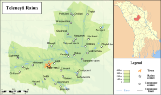
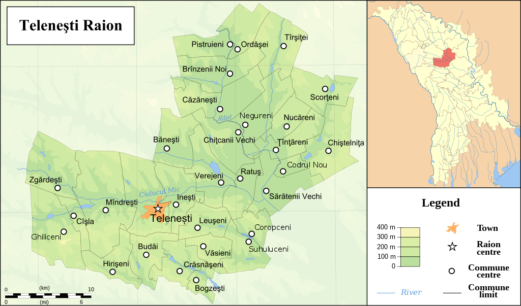
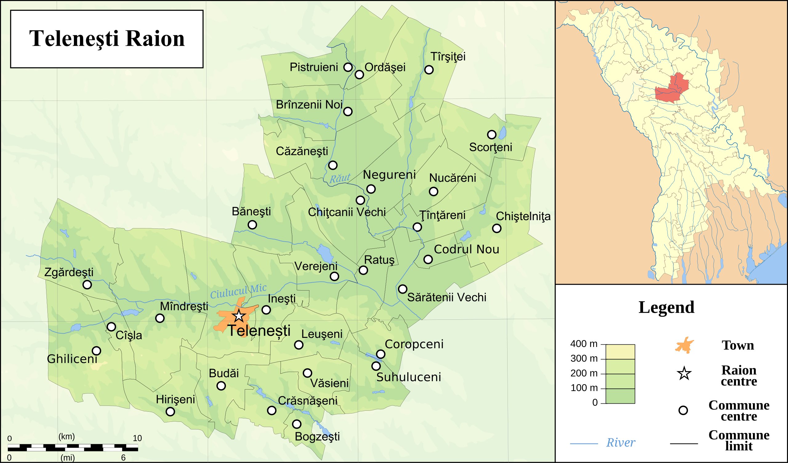
English: Map of the
Telenesti raion |
| Date | |
| Source | Own work by uploader and colleagues, who agreed to release this under the license below. Relief from NASA Shuttle Radar Topography Mission (SRTM3 v.2) (public domain) |
| Author | Xasha |
Licensing
I, the copyright holder of this work, hereby publish it under the following licenses:
This file is licensed under the
Creative Commons
Attribution-Share Alike 3.0 Unported license.
- You are free:
- to share – to copy, distribute and transmit the work
- to remix – to adapt the work
- Under the following conditions:
- attribution – You must give appropriate credit, provide a link to the license, and indicate if changes were made. You may do so in any reasonable manner, but not in any way that suggests the licensor endorses you or your use.
- share alike – If you remix, transform, or build upon the material, you must distribute your contributions under the same or compatible license as the original.

|
Permission is granted to copy, distribute and/or modify this document under the terms of the GNU Free Documentation License, Version 1.2 or any later version published by the Free Software Foundation; with no Invariant Sections, no Front-Cover Texts, and no Back-Cover Texts. A copy of the license is included in the section entitled GNU Free Documentation License. |
You may select the license of your choice.
File history
Click on a date/time to view the file as it appeared at that time.
| Date/Time | Thumbnail | Dimensions | User | Comment | |
|---|---|---|---|---|---|
| current | 14:14, 20 June 2008 |
| 800 × 471 (1.05 MB) | Xasha | {{Information |Description= |Source= |Date= |Author= |Permission= |other_versions= }} |
| 13:54, 20 June 2008 |
 | 800 × 471 (824 KB) | Xasha | {{Information |Description= |Source= |Date= |Author= |Permission= |other_versions= }} | |
| 13:24, 20 June 2008 |
 | 800 × 471 (830 KB) | Xasha | {{Information |Description={{en|1=Map of the Telenesti raion }} |Source=Own work by uploader and colleagues, who agreed to release this under the license below. Relief from [http://www2.jpl.nasa.gov/srtm NASA Shuttle Radar Topo |
File usage
The following pages on the English Wikipedia use this file (pages on other projects are not listed):
Global file usage
The following other wikis use this file:
- Usage on de.wikipedia.org
- Usage on es.wikipedia.org
- Usage on no.wikipedia.org
- Usage on ro.wikipedia.org
- Usage on ur.wikipedia.org