
Size of this preview:
480 × 600 pixels. Other resolutions:
192 × 240 pixels |
384 × 480 pixels |
614 × 768 pixels |
819 × 1,024 pixels |
1,600 × 2,000 pixels.
Original file (1,600 × 2,000 pixels, file size: 451 KB, MIME type: image/jpeg)
| This is a file from the
Wikimedia Commons. Information from its
description page there is shown below. Commons is a freely licensed media file repository. You can help. |
Summary
| Description |
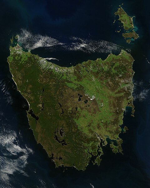
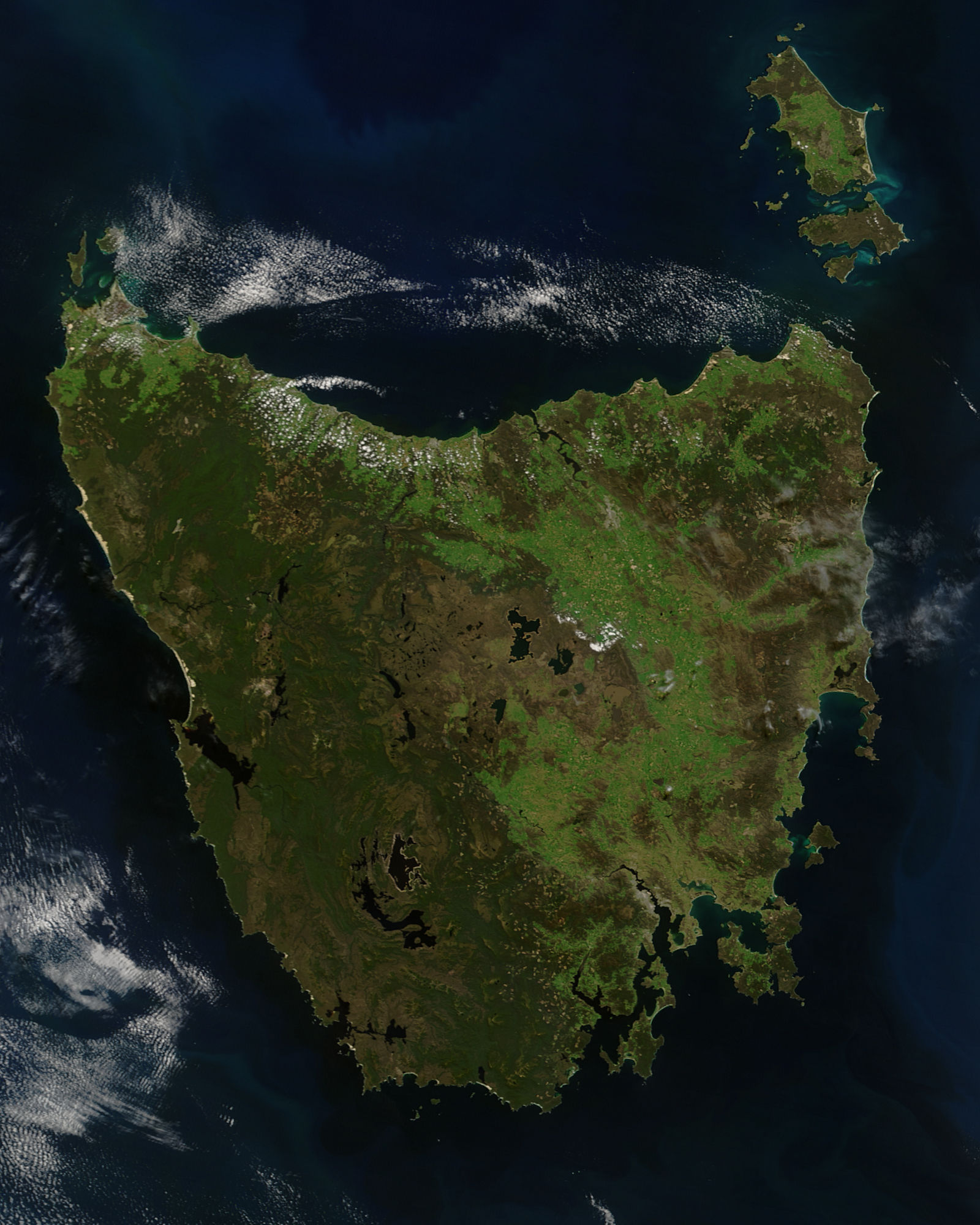
English: A true-colour satellite view of Tasmania, including Flinder's Island, taken in the spring of 2005.
Description from NASA's Visible Earth website: http://visibleearth.nasa.gov/view.php?id=74906 Tasmania was emerald green with the flush of late spring when the Moderate Resolution Imaging Spectroradiometer (MODIS) on NASA’s Terra satellite captured this image on November 16, 2005. The western half of the island is covered with dense forest, which is darker green than grasslands in the east. Sitting below 40 degrees South, the island is the only part of Australia able to support a temperate rainforest. Above the northeast corner of Tasmania are Flinders Island (top), Cape Barren Island (center), and Clarke Island (closest to Tasmania). Tasmania is thought to have been a part of mainland Australia until the end of the last ice age 10,000 years ago when sea levels rose and made Tasmania into an island. |
| Date | |
| Source | http://eoimages.gsfc.nasa.gov/images/imagerecords/74000/74906/Tasmania.A2005320.2355.250m.jpg |
| Author | Jeff Schmaltz, MODIS Rapid Response Team, NASA/GSFC |
Licensing
| This file is in the public domain in the United States because it was solely created by NASA. NASA copyright policy states that "NASA material is not protected by copyright unless noted". (See Template:PD-USGov, NASA copyright policy page or JPL Image Use Policy.) | ||
 |
Warnings:
|
File history
Click on a date/time to view the file as it appeared at that time.
| Date/Time | Thumbnail | Dimensions | User | Comment | |
|---|---|---|---|---|---|
| current | 04:55, 5 March 2012 |
| 1,600 × 2,000 (451 KB) | NotTarts |
File usage
The following pages on the English Wikipedia use this file (pages on other projects are not listed):
Global file usage
The following other wikis use this file:
- Usage on ace.wikipedia.org
- Usage on af.wikipedia.org
- Usage on bn.wikipedia.org
- Usage on ckb.wikipedia.org
- Usage on es.wikipedia.org
- Usage on hu.wikipedia.org
- Usage on it.wikipedia.org
- Usage on kk.wikipedia.org
- Usage on lmo.wikipedia.org
- Usage on ml.wikipedia.org
- Usage on pa.wikipedia.org
- Usage on pl.wikipedia.org
- Usage on pt.wikipedia.org
- Usage on sd.wikipedia.org
- Usage on sr.wikipedia.org
- Usage on zh-yue.wikipedia.org