
Size of this preview:
800 × 443 pixels. Other resolutions:
320 × 177 pixels |
640 × 355 pixels |
913 × 506 pixels.
Original file (913 × 506 pixels, file size: 491 KB, MIME type: image/png)
| This is a file from the
Wikimedia Commons. Information from its
description page there is shown below. Commons is a freely licensed media file repository. You can help. |
Summary
| Description |
English:
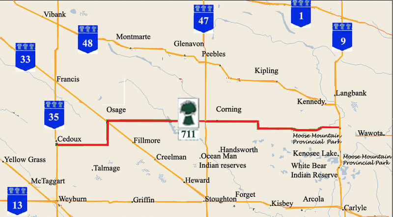
Saskatchewan Highway 711 map
Vibank, Montmarte, Glenavon, Peebles, Francis, Osage, corning, Kennedy, Langbank, Wawota, Moose Mountain provincial park, Kenosee Lake, White Bear Indian Reserve, Ocean Man Indian Reserves, Creelman, Langbank, Kennegy, Carlyle, Arcola, Kisbey, forget, Stoughton, Heward, Fillmore, Creelman, Fillmore, Griffin, Talmage, Weyburn, McTaggart, Yellow Grass. No township range roads are located in the map. |
| Source | Own work |
| Author | SriMesh |
Licensing
I, the copyright holder of this work, hereby publish it under the following licenses:
This file is licensed under the
Creative Commons
Attribution-Share Alike 3.0 Unported license.
- You are free:
- to share – to copy, distribute and transmit the work
- to remix – to adapt the work
- Under the following conditions:
- attribution – You must give appropriate credit, provide a link to the license, and indicate if changes were made. You may do so in any reasonable manner, but not in any way that suggests the licensor endorses you or your use.
- share alike – If you remix, transform, or build upon the material, you must distribute your contributions under the same or compatible license as the original.

|
Permission is granted to copy, distribute and/or modify this document under the terms of the GNU Free Documentation License, Version 1.2 or any later version published by the Free Software Foundation; with no Invariant Sections, no Front-Cover Texts, and no Back-Cover Texts. A copy of the license is included in the section entitled GNU Free Documentation License. |
You may select the license of your choice.
File history
Click on a date/time to view the file as it appeared at that time.
| Date/Time | Thumbnail | Dimensions | User | Comment | |
|---|---|---|---|---|---|
| current | 20:55, 1 February 2009 |
| 913 × 506 (491 KB) | SriMesh | {{Information |Description={{en|1= Saskatchewan Highway 711 map Vibank, Montmarte, Glenavon, Peebles, Francis, Osage, corning, Kennedy, Langbank, Wawota, Moose Mountain provincial park, Kenosee Lake, White Bear Indian Rese |
File usage
The following pages on the English Wikipedia use this file (pages on other projects are not listed):
Global file usage
The following other wikis use this file:
- Usage on www.wikidata.org