
Size of this preview:
800 × 598 pixels. Other resolutions:
320 × 239 pixels |
640 × 479 pixels |
1,024 × 766 pixels |
1,280 × 957 pixels |
2,560 × 1,915 pixels |
11,210 × 8,384 pixels.
Original file (11,210 × 8,384 pixels, file size: 37.19 MB, MIME type: image/jpeg)
| This is a file from the
Wikimedia Commons. Information from its
description page there is shown below. Commons is a freely licensed media file repository. You can help. |
| Warning | The original file is very high-resolution. It might not load properly or could cause your browser to freeze when opened at full size. |
|---|
Summary
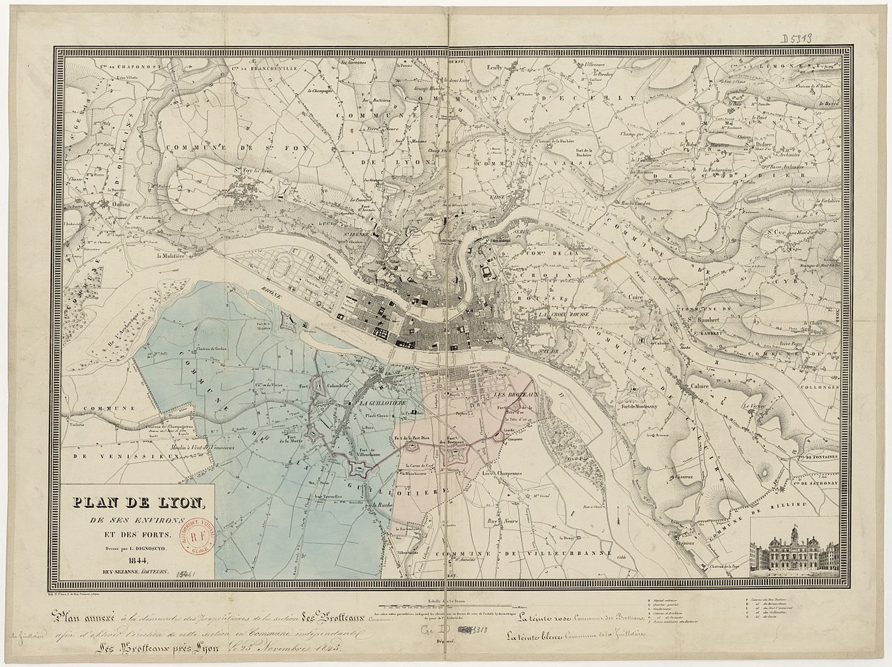
| Plan de Lyon et forts en 1844
(
|
|||||||||||||||||||||||||||
|---|---|---|---|---|---|---|---|---|---|---|---|---|---|---|---|---|---|---|---|---|---|---|---|---|---|---|---|
| Artist |
Laurent de Dignoscyo (1795-1876) |
||||||||||||||||||||||||||
| Title |
Plan de Lyon et forts en 1844 |
||||||||||||||||||||||||||
| Description |
English: Map of Lyons and its forts in 1844. Français : Plan de Lyon, de ses environs et des forts en 1844. |
||||||||||||||||||||||||||
| Date | 1844 | ||||||||||||||||||||||||||
| Dimensions | 64 x 48 cm | ||||||||||||||||||||||||||
| Collection |
|
||||||||||||||||||||||||||
| Source/Photographer |
Bibliothèque nationale de France |
||||||||||||||||||||||||||

Licensing
| Previous public domain rationale, no longer applicable | ||
|---|---|---|
|
File history
Click on a date/time to view the file as it appeared at that time.
| Date/Time | Thumbnail | Dimensions | User | Comment | |
|---|---|---|---|---|---|
| current | 23:48, 9 March 2012 |
| 11,210 × 8,384 (37.19 MB) | Rexcornot | =={{int:filedesc}}== {{Artwork | artist = Laurent de Dignoscyo (1795-1876) | title = Plan de Lyon et forts en 1844 | description = {{en|Map of Lyons and its forts in 1844.}}{{fr|Plan de Lyon, de ses environs et des forts en... |
File usage
The following pages on the English Wikipedia use this file (pages on other projects are not listed):
Global file usage
The following other wikis use this file: