Size of this preview:
779 × 599 pixels. Other resolutions:
312 × 240 pixels |
624 × 480 pixels |
998 × 768 pixels |
1,280 × 985 pixels |
2,417 × 1,860 pixels.
Original file (2,417 × 1,860 pixels, file size: 2.23 MB, MIME type: image/jpeg)
| This is a file from the
Wikimedia Commons. Information from its
description page there is shown below. Commons is a freely licensed media file repository. You can help. |
Summary
| Description |
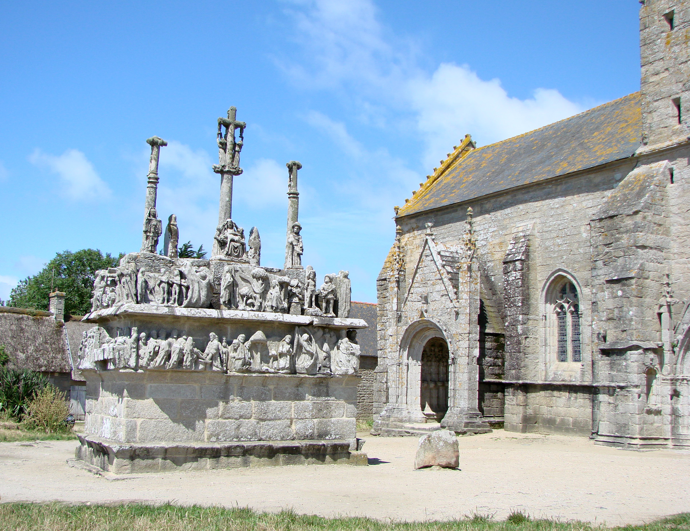
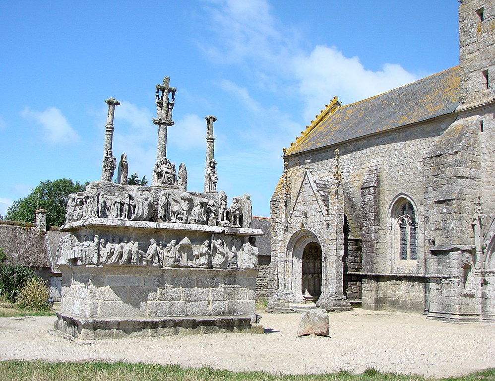
Français : Le calvaire de Notre-Dame de Tronoën. XVe siècle.
English: The calvaire of Notre-Dame de Tronoën. 15th century.
Deutsch: Notre Dame de Tronoën ist eine kleine gotische Kapelle mit dem ältesten Kalvarienberg der Bretagne. Sie liegt einsam in einer weiten Dünen- und Heidelandschaft zwischen dem Pointe de la Torche und Saint-Jean-Trolimon, 9 Kilometer westlich von Pont-l’Abbé. Die Entstehungszeit von Kapelle und Kalvarienberg wird auf den Zeitraum 1450 bis 1470 datiert. Im romanisch geprägten Portal ist eine Männerfigur verborgen, die aus einem Spalt herauszuschauen scheint - der Späher. |
| Date | 10/08/07 |
| Source | Own work |
| Author | Vassil |
| Camera location | | View this and other nearby images on: OpenStreetMap |
|
|---|
Licensing
| I, the copyright holder of this work, release this work into the
public domain. This applies worldwide. In some countries this may not be legally possible; if so: I grant anyone the right to use this work for any purpose, without any conditions, unless such conditions are required by law. |
File history
Click on a date/time to view the file as it appeared at that time.
| Date/Time | Thumbnail | Dimensions | User | Comment | |
|---|---|---|---|---|---|
| current | 22:00, 11 August 2007 |
| 2,417 × 1,860 (2.23 MB) | Vassil | {{Information |Description= |Source= |Date= |Author= |Permission= |other_versions= }} |
File usage
The following pages on the English Wikipedia use this file (pages on other projects are not listed):
Global file usage
The following other wikis use this file:
- Usage on de.wikipedia.org
- Usage on hu.wikipedia.org
- Usage on id.wikipedia.org
- Usage on it.wikipedia.org
- Usage on ja.wikipedia.org
- Usage on lv.wikipedia.org
- Usage on mk.wikipedia.org
- Usage on uz.wikipedia.org