
Size of this preview:
800 × 600 pixels. Other resolutions:
320 × 240 pixels |
640 × 480 pixels |
1,024 × 768 pixels |
1,280 × 960 pixels |
2,272 × 1,704 pixels.
Original file (2,272 × 1,704 pixels, file size: 911 KB, MIME type: image/jpeg)
| This is a file from the
Wikimedia Commons. Information from its
description page there is shown below. Commons is a freely licensed media file repository. You can help. |
Summary
| Description |
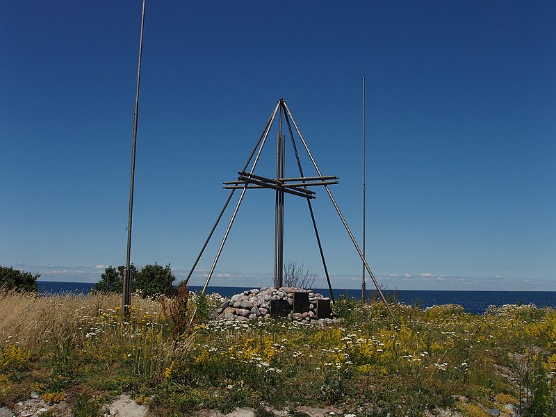
Eesti: 14. juunil 1940 tulistati Keri saarest põhjas alla Soome reisilennuk
Kaleva. 14. juunil 1993 püstitati Finnairi rahalisel toel Kaleva huku mälestuseks Kerile mälestusmärk.
English: Memorial site in Keri, Estonia, for
Kaleva aircraft that was shot down on 14th of June 1940.
Suomi: Aero O/Y:n matkustajalentokone Kalevan (OH-ALL)
alasampumisen muistomerkki Kerin majakkasaaressa Virossa |
| Date | (8 October 2006, according to Exif data) |
| Source | Own work |
| Author | Ivo Kruusamägi |
| Permission ( Reusing this file) |
When using this picture outside of Wikipedia the name of the author and the name Wikipedia (or Vikipeedia) must be mentioned. |
| Camera location |
| View this and other nearby images on: OpenStreetMap |
|
|---|
Licensing
I, the copyright holder of this work, hereby publish it under the following licenses:

|
Permission is granted to copy, distribute and/or modify this document under the terms of the GNU Free Documentation License, Version 1.2 or any later version published by the Free Software Foundation; with no Invariant Sections, no Front-Cover Texts, and no Back-Cover Texts. A copy of the license is included in the section entitled GNU Free Documentation License. |
This file is licensed under the
Creative Commons
Attribution 3.0 Unported license.
- You are free:
- to share – to copy, distribute and transmit the work
- to remix – to adapt the work
- Under the following conditions:
- attribution – You must give appropriate credit, provide a link to the license, and indicate if changes were made. You may do so in any reasonable manner, but not in any way that suggests the licensor endorses you or your use.
You may select the license of your choice.
File history
Click on a date/time to view the file as it appeared at that time.
| Date/Time | Thumbnail | Dimensions | User | Comment | |
|---|---|---|---|---|---|
| current | 17:34, 6 January 2010 |
| 2,272 × 1,704 (911 KB) | Kruusamägi | {{Information |Description={{en|1=Memorial site for Kaleva that was shot down in 14th of June 1940.}} {{et|1=14. juunil 1940 tulistati Keri saarest põhjas alla Soome reisilennuk Kaleva. 14. juunil 1993 p� |
File usage
No pages on the English Wikipedia use this file (pages on other projects are not listed).
Global file usage
The following other wikis use this file:
- Usage on ar.wikipedia.org
- Usage on de.wikipedia.org
- Usage on et.wikipedia.org
- Usage on fi.wikipedia.org
- Usage on it.wikipedia.org
- Usage on ru.wikipedia.org
- Usage on smn.wikipedia.org
- Usage on www.wikidata.org