
Size of this PNG preview of this SVG file:
800 × 423 pixels. Other resolutions:
320 × 169 pixels |
640 × 338 pixels |
1,024 × 541 pixels |
1,280 × 677 pixels |
2,560 × 1,353 pixels |
1,470 × 777 pixels.
Original file (SVG file, nominally 1,470 × 777 pixels, file size: 338 KB)
| This is a file from the
Wikimedia Commons. Information from its
description page there is shown below. Commons is a freely licensed media file repository. You can help. |
Summary
| Description |
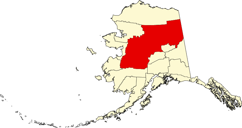
English: This is a locator map showing
Yukon-Koyukuk Census Area in Alaska |
| Date | |
| Source |
Own work: English: The maps use data from
nationalatlas.gov, specifically
countyp020.tar.gz on the
Raw Data Download page. The maps also use state outline data from
statesp020.tar.gz. The Florida maps use
hydrogm020.tar.gz to display Lake Okeechobee. |
| Author | David Benbennick |
| SVG development |
Licensing
| I, the copyright holder of this work, release this work into the
public domain. This applies worldwide. In some countries this may not be legally possible; if so: I grant anyone the right to use this work for any purpose, without any conditions, unless such conditions are required by law. |
File history
Click on a date/time to view the file as it appeared at that time.
| Date/Time | Thumbnail | Dimensions | User | Comment | |
|---|---|---|---|---|---|
| current | 19:30, 5 March 2006 |
| 1,470 × 777 (338 KB) | David Benbennick | {{subst:User:Dbenbenn/clm|county=Yukon-Koyukuk Census Area|state=Alaska|type=borough and census area}} |
File usage
More than 100 pages use this file. The following list shows the first 100 pages that use this file only. A full list is available.
- Alatna, Alaska
- Alatna River
- Allakaket, Alaska
- Allakaket Airport
- Anvik, Alaska
- Anvik Airport
- Anvik River
- Arctic Village, Alaska
- Arctic Village (book)
- Arctic Village Airport
- Arrigetch Peaks
- Beaver, Alaska
- Bettles, Alaska
- Birch Creek, Alaska
- Central, Alaska
- Chalkyitsik, Alaska
- Chandalar Lake
- Chandalar Lake Airport
- Christ Church Mission
- Circle, Alaska
- Circle Hot Springs, Alaska
- Coldfoot, Alaska
- Coleen River
- Cosna River (Alaska)
- Crow Lake (Alaska)
- Deloy Ges
- Draanjik River
- Evansville, Alaska
- Finger Mountain
- Five Mile Airport
- Flat, Alaska
- Fort Yukon, Alaska
- Four Mile Road, Alaska
- Galena, Alaska
- Grayling, Alaska
- Grayling Airport
- Hogatza River
- Holikachuk, Alaska
- Holy Cross, Alaska
- Holy Cross Airport
- Hughes, Alaska
- Huslia, Alaska
- Huslia River
- Iditarod, Alaska
- Iditarod River
- Iniakuk Lake
- Innoko River
- KZPA
- Kaltag, Alaska
- Koyukuk, Alaska
- Kuskokwim Mountains
- Lake Minchumina, Alaska
- List of boroughs and census areas in Alaska
- Livengood, Alaska
- Manley Hot Springs, Alaska
- McGrath, Alaska
- Medfra, Alaska
- Melozitna River
- Minto, Alaska
- Mollie Beattie Wilderness
- Mount Prindle
- National Register of Historic Places listings in Yukon–Koyukuk Census Area, Alaska
- Nenana, Alaska
- Nenana Municipal Airport
- Nikolai, Alaska
- North Fork Koyukuk River
- Nulato, Alaska
- Ophir, Alaska
- Poorman, Alaska
- Presentation of Our Lord Chapel
- Prindle Volcano
- Prospect Creek, Alaska
- Prospect Creek Airport
- Rampart, Alaska
- Rampart Canyon (Alaska)
- Ray Mountains
- Ruby, Alaska
- Selawik River
- Shageluk, Alaska
- Steese National Conservation Area
- Stevens Village, Alaska
- Takotna, Alaska
- Tanana, Alaska
- Tanana Mission
- Telida, Alaska
- Tofty, Alaska
- Unorganized Borough, Alaska
- Venetie, Alaska
- White Mountains (Alaska)
- Wind River (Yukon–Koyukuk Census Area, Alaska)
- Wiseman, Alaska
- Yankee Creek Airport
- Yukon Flats
- Yukon Flats National Wildlife Refuge
- Yukon–Koyukuk Census Area, Alaska
- User:Nyttend/County templates/AK
- Wikipedia:WikiProject Alaska
- Template:Unorganized Borough, Alaska
- Template:YukonKoyukukAK-geo-stub
- Template:Yukon–Koyukuk Census Area, Alaska
View more links to this file.
Global file usage
The following other wikis use this file:
- Usage on av.wikipedia.org
- Usage on bpy.wikipedia.org
- Usage on ca.wikipedia.org
- Tanana (Alaska)
- Huslia
- Central (Alaska)
- Alatna
- Allakaket
- Anvik
- Arctic Village
- Beaver (Alaska)
- Bettles
- Birch Creek
- Chalkyitsik
- Circle (Alaska)
- Coldfoot
- Evansville (Alaska)
- Fort Yukon
- Four Mile Road
- Galena (Alaska)
- Grayling (Alaska)
- Holy Cross (Alaska)
- Hughes (Alaska)
- Kaltag
- Koyukuk
- Lake Minchumina
- Livengood
- Manley Hot Springs
- Minto (Alaska)
- Nenana
- New Allakaket
- Nikolai (Alaska)
- Nulato
- Rampart
- Ruby (Alaska)
- Shageluk
- Stevens Village
- Takotna
- Venetie (Alaska)
- Wiseman
- Plantilla:Àrea censal de Yukon-Koyukuk
- Categoria:Àrea censal de Yukon-Koyukuk
- Llista de boroughs i àrees censals d'Alaska
- Usage on ce.wikipedia.org
- Usage on de.wikipedia.org
- Usage on es.wikipedia.org
- Usage on fa.wikipedia.org
View more global usage of this file.