
Size of this PNG preview of this SVG file:
800 × 423 pixels. Other resolutions:
320 × 169 pixels |
640 × 338 pixels |
1,024 × 541 pixels |
1,280 × 677 pixels |
2,560 × 1,353 pixels |
1,470 × 777 pixels.
Original file (SVG file, nominally 1,470 × 777 pixels, file size: 644 KB)
| This is a file from the
Wikimedia Commons. Information from its
description page there is shown below. Commons is a freely licensed media file repository. You can help. |
Summary
| Description |
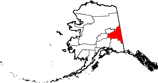
English: This is a locator map showing
Southeast Fairbanks Census Area in Alaska |
| Date | |
| Source |
Own work: English: The maps use data from
nationalatlas.gov, specifically
countyp020.tar.gz on the
Raw Data Download page. The maps also use state outline data from
statesp020.tar.gz. The Florida maps use
hydrogm020.tar.gz to display Lake Okeechobee. |
| Author | David Benbennick |
| SVG development |
Licensing
| I, the copyright holder of this work, release this work into the
public domain. This applies worldwide. In some countries this may not be legally possible; if so: I grant anyone the right to use this work for any purpose, without any conditions, unless such conditions are required by law. |
File history
Click on a date/time to view the file as it appeared at that time.
| Date/Time | Thumbnail | Dimensions | User | Comment | |
|---|---|---|---|---|---|
| current | 20:12, 25 June 2024 |
| 1,470 × 777 (644 KB) | Nux | uniform colors with good contrast |
| 22:59, 17 June 2024 |
 | 1,470 × 777 (338 KB) | Nux | fix rendering (remove clipping) | |
| 19:28, 5 March 2006 |
 | 1,470 × 777 (338 KB) | David Benbennick | {{subst:User:Dbenbenn/clm|county=Southeast Fairbanks Census Area|state=Alaska|type=borough and census area}} |
File usage
The following pages on the English Wikipedia use this file (pages on other projects are not listed):
- Alcan Border, Alaska
- Alcan–Beaver Creek Border Crossing
- Big Delta, Alaska
- Charlieskin Village, Alaska
- Chicken, Alaska
- Chicken Historic District
- Coarse Money Creek
- Delta/Greely School District
- Delta Junction, Alaska
- Delta Mountains
- Deltana, Alaska
- Dick Dale Creek
- Donnelly, Alaska
- Donnelly Dome
- Dot Lake, Alaska
- Dot Lake Village, Alaska
- Dry Creek, Alaska
- Eagle, Alaska
- Eagle Village, Alaska
- Fort Greely, Alaska
- Granite Mountains (Alaska)
- Hayes Range
- Healy Lake, Alaska
- Jack Wade, Alaska
- Kathakne, Alaska
- List of boroughs and census areas in Alaska
- Mentasta Mountains
- Mount Kimball
- National Register of Historic Places listings in Southeast Fairbanks Census Area, Alaska
- Northway, Alaska
- Northway Army Airfield
- Northway Junction, Alaska
- Northway Village, Alaska
- Nutzotin Mountains
- Poker Creek–Little Gold Creek Border Crossing
- Quartz Lake (Alaska)
- Southeast Fairbanks Census Area, Alaska
- Sullivan Roadhouse
- Susitna Glacier
- Tanacross, Alaska
- Tetlin, Alaska
- Tok, Alaska
- Trout Creek (Alaska)
- Unorganized Borough, Alaska
- Whitestone, Alaska
- Wiki Peak
- Yupiit Piciryarait Cultural Center
- User:AridCeption/sandbox
- User:Nyttend/County templates/AK
- User talk:ASHMAN3334
- Wikipedia:WikiProject Alaska
- File talk:Map of Alaska highlighting Southeast Fairbanks Census Area.svg
- Template:SoutheastFairbanksAK-geo-stub
- Template:Southeast Fairbanks Census Area, Alaska
- Template:Unorganized Borough, Alaska
- Category:Populated places in Southeast Fairbanks Census Area, Alaska
- Category:Populated places in Unorganized Borough, Alaska
Global file usage
The following other wikis use this file:
- Usage on bpy.wikipedia.org
- Usage on ca.wikipedia.org
- Alcan Border
- Big Delta
- Chicken
- Delta Junction
- Deltana
- Dot Lake
- Dot Lake Village
- Dry Creek (Alaska)
- Eagle (Alaska)
- Eagle Village
- Fort Greely
- Healy Lake
- Northway
- Northway Junction
- Northway Village
- Tanacross
- Tetlin
- Llista de boroughs i àrees censals d'Alaska
- Plantilla:Àrea censal de Southeast Fairbanks
- Categoria:Àrea censal de Southeast Fairbanks
- Usage on ce.wikipedia.org
- Usage on cy.wikipedia.org
- Usage on de.wikipedia.org
- Usage on es.wikipedia.org
- Usage on fi.wikipedia.org
- Usage on fr.wikipedia.org
- Région de recensement de Southeast Fairbanks
- Chicken (Alaska)
- Eagle (Alaska)
- Eagle Village (Alaska)
- Utilisateur:Tifoultoute
- Tok
- Tetlin (Alaska)
- Big Delta (Alaska)
- Alcan Border
- Northway
- Northway Junction
- Northway Village
- Delta Junction
- Deltana (Alaska)
- Dot Lake
- Dot Lake Village
- Tanacross (Alaska)
- Dry Creek
- Fort Greely
- Healy Lake
View more global usage of this file.