
Size of this preview:
193 × 600 pixels. Other resolutions:
77 × 240 pixels |
154 × 480 pixels |
698 × 2,169 pixels.
Original file (698 × 2,169 pixels, file size: 254 KB, MIME type: image/jpeg)
| This is a file from the
Wikimedia Commons. Information from its
description page there is shown below. Commons is a freely licensed media file repository. You can help. |
| Description |
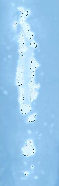
Deutsch: Physische Positionskarte der
Malediven
Quadratische Plattkarte. Geographische Begrenzung der Karte:
English: Physical location map of the
Maledives
Equirectangular projection. Geographic limits of the map:
|
| Date | |
| Source |
Own work, using
|
| Author | Carport |
| Permission ( Reusing this file) |
This file is licensed under the
Creative Commons
Attribution-Share Alike 3.0 Unported license.
|
| Other versions |
|
File history
Click on a date/time to view the file as it appeared at that time.
| Date/Time | Thumbnail | Dimensions | User | Comment | |
|---|---|---|---|---|---|
| current | 20:39, 14 December 2012 |
| 698 × 2,169 (254 KB) | Carport | {{Information |Description= {{de|Physische Positionskarte der Malediven}} Quadratische Plattkarte. Geographische Begrenzung der Karte: * N: 7.5° N * S: 1.2° S * W: 71.9° O * O: 74.7° O {{en|Physical location map of the [[:en:Maled... |
File usage
More than 100 pages use this file. The following list shows the first 100 pages that use this file only. A full list is available.
- Addu City
- Bandidhoo
- Bileddhoo (Faafu Atoll)
- Burunee (Thaa Atoll)
- Dhaandhoo
- Dhanbidhoo
- Dhangethi (Alif Dhaal Atoll)
- Dharanboodhoo (Faafu Atoll)
- Dhevvadhoo
- Dhiffushi (Kaafu Atoll)
- Dhiggaru (Meemu Atoll)
- Dhigurah (Alif Dhaal Atoll)
- Dhiyadhoo
- Dhiyamingili (Thaa Atoll)
- Didhdhoo (Alif Dhaal Atoll)
- Fares-Maathodaa
- Feeali (Faafu Atoll)
- Fenfushi (Alif Dhaal Atoll)
- Feridhoo (Alif Alif Atoll)
- Feydhoo (Addu Atoll)
- Fiyoaree
- Fonadhoo (Laamu Atoll)
- Fulidhoo (Vaavu Atoll)
- Fuvahmulah
- Gaadhiffushi (Thaa Atoll)
- Gaadhoo (Laamu Atoll)
- Gaafaru (Kaafu Atoll)
- Gadhdhoo
- Gan (Addu Atoll)
- Gan (Laamu Atoll)
- Gemanafushi
- Gemendhoo (Dhaalu Atoll)
- Gulhi (Kaafu Atoll)
- Guraidhoo (Kaafu Atoll)
- Guraidhoo (Thaa Atoll)
- Himandhoo (Alif Alif Atoll)
- Himmafushi (Kaafu Atoll)
- Hirilandhoo (Thaa Atoll)
- Hithadhoo (Laamu Atoll)
- Hoandeddhoo
- Hulhudheli
- Hulhulé Island
- Huraa (Kaafu Atoll)
- Isdhoo (Laamu Atoll)
- Kaashidhoo (Kaafu Atoll)
- Kadhdhoo
- Kandoodhoo (Thaa Atoll)
- Kanduhulhudhoo
- Keyodhoo (Vaavu Atoll)
- Kinbidhoo (Thaa Atoll)
- Kolamaafushi
- Kolhufushi (Meemu Atoll)
- Kondey
- Kudahuvadhoo
- Kunahandhoo (Laamu Atoll)
- Kunburudhoo (Alif Dhaal Atoll)
- List of airports in the Maldives
- Maabaidhoo (Laamu Atoll)
- Maaenboodhoo
- Maafushi (Kaafu Atoll)
- Maalhos (Alif Alif Atoll)
- Maamendhoo (Gaafu Alif Atoll)
- Maamendhoo (Laamu Atoll)
- Maamigili (Alif Dhaal Atoll)
- Maavah (Laamu Atoll)
- Madaveli
- Madifushi (Meemu Atoll)
- Madifushi (Thaa Atoll)
- Maduvvaree (Meemu Atoll)
- Magoodhoo (Faafu Atoll)
- Mahibadhoo
- Mandhoo (Alif Dhaal Atoll)
- Maradhoo
- Maradhoo-Feydhoo
- Mathiveri (Alif Alif Atoll)
- Meedhoo (Dhaalu Atoll)
- Mulah
- Muli, Meemu Atoll
- Mundoo (Laamu Atoll)
- Naalaafushi (Meemu Atoll)
- Nadellaa
- Nilandhoo (Gaafu Alif Atoll)
- Omadhoo (Alif Dhaal Atoll)
- Omadhoo (Thaa Atoll)
- Raimmandhoo
- Rakeedhoo (Vaavu Atoll)
- Rathafandhoo
- Rinbudhoo
- Ross Atoll
- Thimarafushi (Thaa Atoll)
- Thinadhoo (Huvadhu Atoll)
- Thinadhoo (Vaavu Atoll)
- Thoddoo (Alif Alif Atoll)
- Thulusdhoo (Kaafu Atoll)
- Ukulhas
- Vaadhoo (Gaafu Dhaalu Atoll)
- Vaanee
- Vandhoo
- Veymandoo
- Veyvah (Meemu Atoll)
View more links to this file.
Global file usage
The following other wikis use this file:
- Usage on ar.wikipedia.org
- Usage on ast.wikipedia.org
- Usage on az.wikipedia.org
- Usage on be-tarask.wikipedia.org
- Usage on bn.wikipedia.org
- মডিউল:অবস্থান মানচিত্র/উপাত্ত/মালদ্বীপ
- ভেলানা আন্তর্জাতিক বিমানবন্দর
- মডিউল:অবস্থান মানচিত্র/উপাত্ত/মালদ্বীপ/নথি
- হানিমাধূ আন্তর্জাতিক বিমানবন্দর
- কাদেদ্ধো বিমানবন্দর
- ধারাভন্ধো বিমানবন্দর
- কাদ্ধো বিমানবন্দর
- টেমপ্লেট:মালদ্বীপের বিমানবন্দরের মানচিত্র
- মালদ্বীপের বিমানবন্দরের তালিকা
- ফুনাধু বিমানবন্দর
- হিম্মাফুশি
- ইহাভান্ধু
- কান্দুডু
- বুরুনি
- হাথিফুশি
- মাভাহ
- ওলহুভেলিফুশি
- বিলেদ্ধু
- কুনাহান্ধু
- রাঙ্গালি
- আলিফুশি
- Usage on bs.wikipedia.org
- Usage on ceb.wikipedia.org
- Usage on ce.wikipedia.org
- Usage on da.wikipedia.org
- Usage on de.wikipedia.org
View more global usage of this file.