
Size of this PNG preview of this SVG file:
611 × 600 pixels. Other resolutions:
245 × 240 pixels |
489 × 480 pixels |
782 × 768 pixels |
1,043 × 1,024 pixels |
2,086 × 2,048 pixels |
1,085 × 1,065 pixels.
Original file (SVG file, nominally 1,085 × 1,065 pixels, file size: 30 KB)
| This is a file from the
Wikimedia Commons. Information from its
description page there is shown below. Commons is a freely licensed media file repository. You can help. |
Summary
| Description |
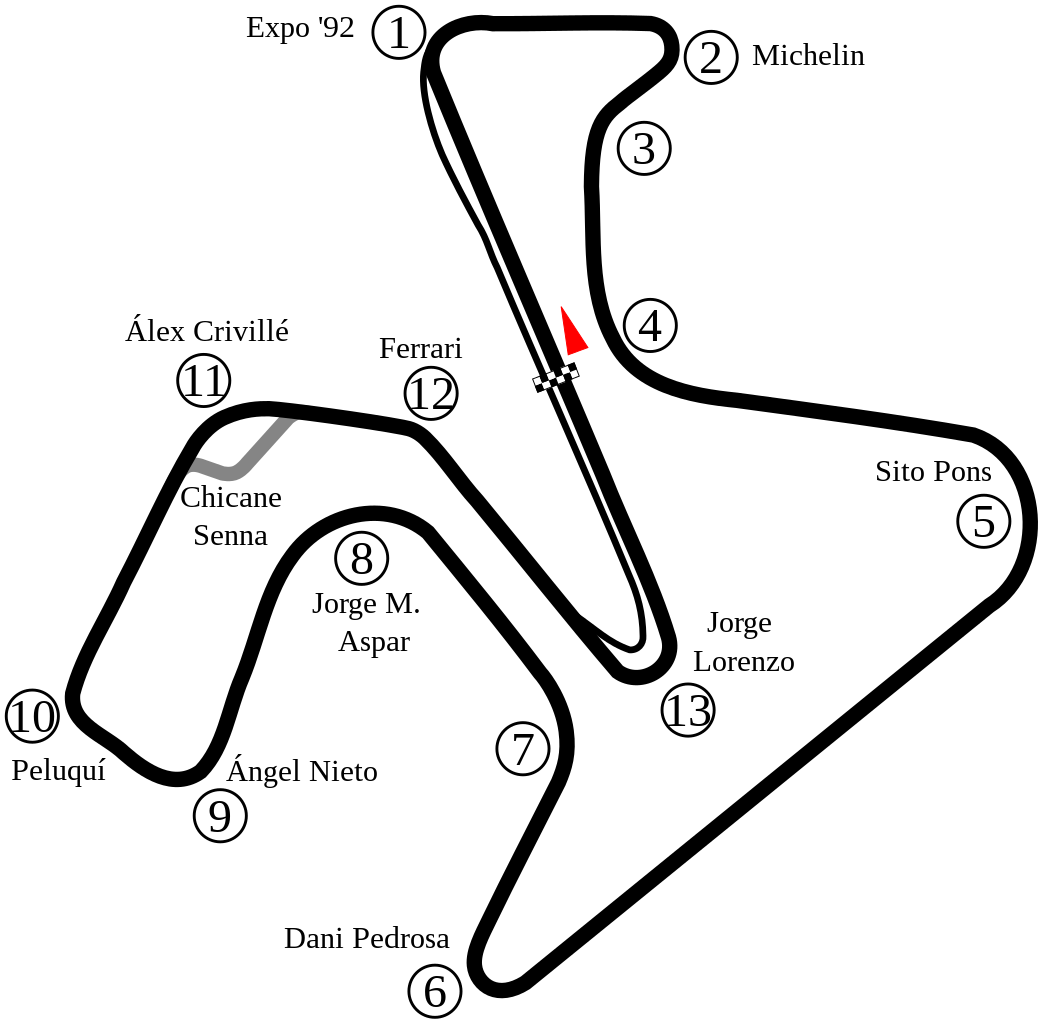
English: Track map of
Circuito Permanente de Jerez. |
| Date | |
| Source | Own work |
| Author | Will Pittenger |
| Other versions |
|

| Camera location |
| View this and other nearby images on: OpenStreetMap |
|
|---|
Licensing
| I, the copyright holder of this work, release this work into the
public domain. This applies worldwide. In some countries this may not be legally possible; if so: I grant anyone the right to use this work for any purpose, without any conditions, unless such conditions are required by law. |
File history
Click on a date/time to view the file as it appeared at that time.
| Date/Time | Thumbnail | Dimensions | User | Comment | |
|---|---|---|---|---|---|
| current | 08:35, 29 May 2022 |
| 1,085 × 1,065 (30 KB) | Sentoan | Cambios menores curvas 7 y 11 |
| 08:22, 29 May 2022 |
 | 1,085 × 1,065 (30 KB) | Sentoan | Corrigiendo nombre de Curva 6, Anchura del trazado real, perfilando algunas curvas | |
| 04:03, 4 May 2015 |
 | 1,225 × 1,134 (34 KB) | Uppsalo | Created a more accurate map from satellite image. | |
| 16:14, 2 May 2015 |
 | 1,164 × 933 (27 KB) | Uppsalo | Removed text over path, since it creates problem during PNG rendering | |
| 13:31, 2 May 2015 |
 | 1,164 × 933 (27 KB) | Uppsalo | Updated names of corners (Lorenzo, Aspar and Ferrari corners) | |
| 09:39, 18 July 2008 |
 | 1,164 × 933 (80 KB) | Will Pittenger | New version gets around the Mediawiki/RSVG bug where text on path objects are omitted by converting those objects to paths. If you need to edit the file, please use the previous version. | |
| 09:35, 18 July 2008 |
 | 1,164 × 933 (34 KB) | Will Pittenger | Moved Turn 11's marker closer to the turn. | |
| 09:16, 18 July 2008 |
 | 1,164 × 933 (34 KB) | Will Pittenger | {{Information |Description={{en|1=Track map of w:Circuito Permanente de Jerez.}} |Source=Own work by uploader |Author= Will Pittenger |Date=7-18-2008 |Permission= |other_versions=<gallery>Image:Circuit Jerez.png|Old version &md |
File usage
The following pages on the English Wikipedia use this file (pages on other projects are not listed):
- 1992 Spanish motorcycle Grand Prix
- 1993 Spanish motorcycle Grand Prix
- 1994 Spanish motorcycle Grand Prix
- 1995 Spanish motorcycle Grand Prix
- 1996 Spanish motorcycle Grand Prix
- 1997 Spanish motorcycle Grand Prix
- 1998 Spanish motorcycle Grand Prix
- 1999 Spanish motorcycle Grand Prix
- 2000 Spanish motorcycle Grand Prix
- 2001 Spanish motorcycle Grand Prix
- 2003 Spanish motorcycle Grand Prix
- 2004 Spanish motorcycle Grand Prix
- 2005 Spanish motorcycle Grand Prix
- 2006 Spanish motorcycle Grand Prix
- 2007 Spanish motorcycle Grand Prix
- 2008 Spanish motorcycle Grand Prix
- 2009 Spanish motorcycle Grand Prix
- 2010 Spanish motorcycle Grand Prix
- 2011 Spanish motorcycle Grand Prix
- 2012 Spanish motorcycle Grand Prix
- 2013 Spanish motorcycle Grand Prix
- 2014 Spanish motorcycle Grand Prix
- 2015 Spanish motorcycle Grand Prix
- 2016 Jerez Superbike World Championship round
- 2016 Spanish motorcycle Grand Prix
- 2017 Spanish motorcycle Grand Prix
- 2018 Spanish motorcycle Grand Prix
- 2020 Andalusian motorcycle Grand Prix
- List of Grand Prix motorcycle circuits
- List of Superbike World Championship circuits
- Spanish motorcycle Grand Prix
- User talk:4u1e/archive5
- User talk:Bam123456789/Archive 1
- User talk:Barkjon/Archive 2
- User talk:Cdhaptomos/Archive 1
- User talk:Chubbennaitor/Archive7
- User talk:Chubbennaitor/archive2
- User talk:Clyde1998/Archive/2008
- User talk:Cs-wolves/Archive 3
- User talk:Donnie Park/Archive 1
- User talk:Hellboy2hell/archive2
- User talk:Midgrid/Archive 6
- User talk:NapHit/Archive 1
- User talk:Readro/Archive 3
- User talk:Sage Callahan/Archive 1
- User talk:Spenalzo/Archive/2008
- User talk:The359/Archive 4
- User talk:Thelb4/Archive 5
- User talk:Typ932/Archive 3
- Wikipedia:WikiProject Formula One/Newsletter/200808
- Template:Infobox Grand Prix motorcycle race report
- Template:Infobox Grand Prix motorcycle race report/doc
Global file usage
The following other wikis use this file:
- Usage on af.wikipedia.org
- Usage on ar.wikipedia.org
- جائزة إسبانيا الكبرى للدراجات النارية 2006
- جائزة إسبانيا الكبرى للدراجات النارية 2007
- جائزة إسبانيا الكبرى للدراجات النارية 2008
- جائزة إسبانيا الكبرى للدراجات النارية 2009
- جائزة إسبانيا الكبرى للدراجات النارية 2010
- جائزة إسبانيا الكبرى للدراجات النارية 2011
- جائزة إسبانيا الكبرى للدراجات النارية 2000
- جائزة إسبانيا الكبرى للدراجات النارية 1989
- جائزة إسبانيا الكبرى للدراجات النارية 1990
- جائزة إسبانيا الكبرى للدراجات النارية 1992
- جائزة إسبانيا الكبرى للدراجات النارية 1993
- جائزة إسبانيا الكبرى للدراجات النارية 1994
- جائزة إسبانيا الكبرى للدراجات النارية 1995
- جائزة إسبانيا الكبرى للدراجات النارية 1996
- جائزة إسبانيا الكبرى للدراجات النارية 1998
- جائزة إسبانيا الكبرى للدراجات النارية 1999
- جائزة إسبانيا الكبرى للدراجات النارية 2018
- جائزة إسبانيا الكبرى للدراجات النارية 2019
- Usage on ast.wikipedia.org
- Usage on bg.wikipedia.org
- Usage on bn.wikipedia.org
- Usage on ca.wikipedia.org
- Circuit de Jerez
- Gran Premi d'Espanya de motociclisme de 2009
- Temporada 2011 de Fórmula 1
- Gran Premi Expo 92 de motociclisme
- Gran Premi d'Espanya de motociclisme
- Gran Premi d'Espanya de motociclisme de 2010
- Gran Premi d'Espanya de motociclisme de 2020
- Gran Premi d'Andalusia de motociclisme de 2020
- Gran Premi d'Espanya de motociclisme de 2021
- Gran Premi d'Espanya de motociclisme de 2018
- Usage on de.wikipedia.org
- Usage on es.wikipedia.org
View more global usage of this file.