Size of this preview:
276 × 598 pixels. Other resolutions:
110 × 240 pixels |
329 × 713 pixels.
Original file (329 × 713 pixels, file size: 27 KB, MIME type: image/png)
| This is a file from the
Wikimedia Commons. Information from its
description page there is shown below. Commons is a freely licensed media file repository. You can help. |
| Description |
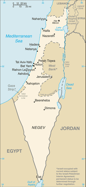
Русский: Карта Израиля |
| Date | (2004) |
| Source | CIA-WF |
| Author | CIA |
| Other versions |
.png)
This image is in the
public domain because it contains materials that originally came from the United States
Central Intelligence Agency's
World Factbook.
|
 |
File history
Click on a date/time to view the file as it appeared at that time.
| Date/Time | Thumbnail | Dimensions | User | Comment | |
|---|---|---|---|---|---|
| current | 07:25, 21 June 2007 |
| 329 × 713 (27 KB) | Hoshie | Updated map of Israel from the CIA World Factbook, 14 June 07 rev. Src: https://www.cia.gov/library/publications/the-world-factbook/maps/is-map.gif |
| 14:27, 16 June 2005 |
 | 330 × 715 (24 KB) | Csörföly D | Category:Maps of Israel {{PD-USGov-CIA-PD}} |
File usage
The following pages on the English Wikipedia use this file (pages on other projects are not listed):
- Chronology of Aliyah in modern times
- Demographic history of Palestine (region)
- Hamas war crimes
- History of Israel
- History of Palestine
- Israel
- Israeli Declaration of Independence
- Israeli settlement
- Israeli war crimes
- Israeli–Palestinian conflict
- Land of Israel
- Law of Return
- List of journalists killed during the Israeli–Palestinian conflict
- Timeline of the name Palestine
- Zionism
- User:প্রলয়স্রোত/sandbox
- User talk:Theblackbay
- Wikipedia:In the news/Posted/February 2005
- Template:Zionism and the Land of Israel
- Module:Location map/data/Israel
- Module:Location map/data/Israel/doc
Global file usage
The following other wikis use this file:
- Usage on ar.wikipedia.org
- Usage on bg.wikipedia.org
- Usage on bn.wikipedia.org
- Usage on bs.wikipedia.org
- Usage on ca.wikipedia.org
- Usage on de.wikipedia.org
- Usage on en.wikinews.org
- Usage on es.wikipedia.org
- Usage on eu.wikipedia.org
- Usage on fi.wikipedia.org
- Usage on fi.wikivoyage.org
- Usage on fr.wikipedia.org
- Usage on fr.wikinews.org
- Usage on hif.wikipedia.org
- Usage on hi.wikipedia.org
- Usage on hr.wikipedia.org
- Usage on hy.wikipedia.org
- Usage on ilo.wikipedia.org
- Usage on it.wikinews.org
- Israele: tregua finita, piovono razzi
- Israele scarcererà 250 detenuti arabo-palestinesi
- Giordania: re Abd Allah II incontra Olmert e Barak. A Gaza autoesplode un miliziano
- Abu Mazen proclamato presidente dello «Stato di Palestina». Israele riapre i valichi
- Israele richiude i valichi, Napolitano ammonisce Ahmadinejad
- Israele: il governo approva scarcerazione detenuti, da Gaza ancora razzi
- Israele ferma una nave di aiuti diretta a Gaza
- Israele riapre temporaneamente i valichi per Gaza. Primarie per il Likud
- Israele: liberati 227 detenuti
- Israele: richiusi i valichi, la Siria propone sul Golan, l'Iran rifiuta il riconoscimento
- Israele: continuano i lanci di razzi. La Siria vuole negoziati diretti
- Israele riapre i valichi. Razzi uccidono due bambine
- Israele e ANP: l'opinione pubblica si radicalizza
- Striscia di Gaza: cresce la popolazione. Israele vuole la liberazione di Shalit
- Gerusalemme: palestinese guida ruspa contro polizia e bus
- Usage on ja.wikipedia.org
- Usage on ml.wikipedia.org
View more global usage of this file.