Size of this preview:
411 × 600 pixels. Other resolutions:
164 × 240 pixels |
329 × 480 pixels |
847 × 1,236 pixels.
Original file (847 × 1,236 pixels, file size: 191 KB, MIME type: image/png)
| This is a file from the
Wikimedia Commons. Information from its
description page there is shown below. Commons is a freely licensed media file repository. You can help. |
Summary
| Description |
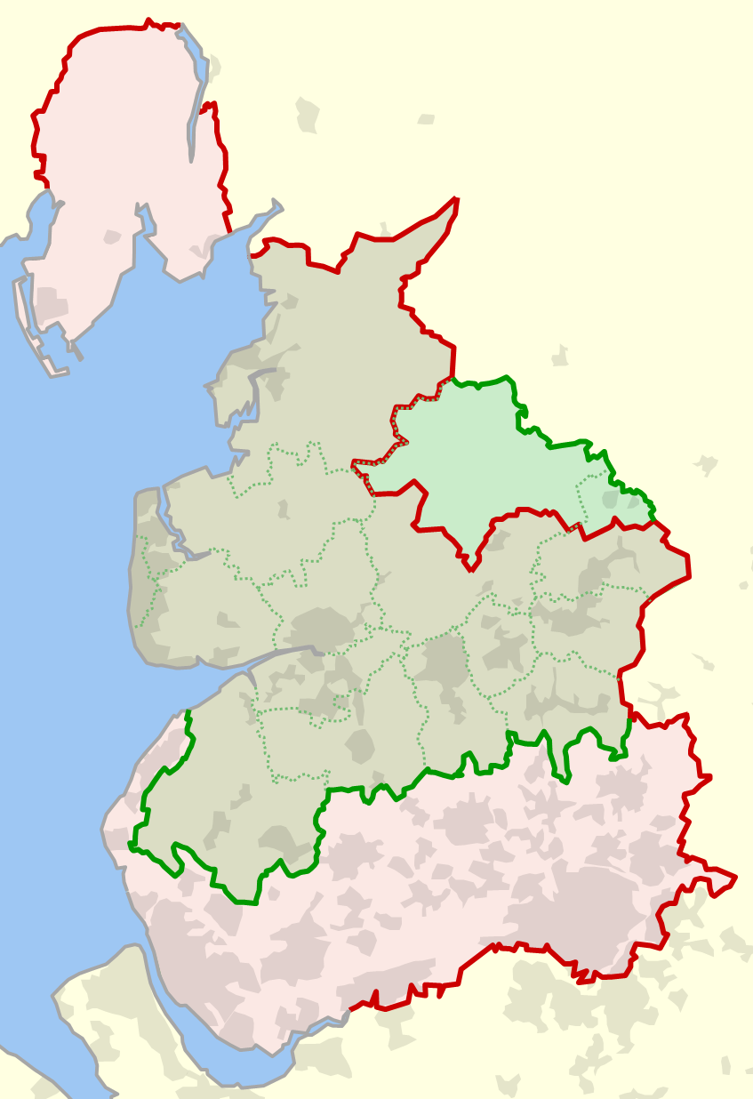
English: The historical boundary of the county of
Lancashire, England, shown in red, and the modern-day boundary (since 1974), shown in green. Also shown in dotted green are the modern-day local government districts and unitary authorities of ceremonial Lancashire. |
| Date | |
| Source | Own work |
| Author | Dr Greg |
References
- (1929) Combined index shewing civil parishes and the Ordnance Survey of Lancashire archive copy at the Wayback Machine, Ordnance Survey, accessed 2010-06-12
- MARIO: Maps & Related Information Online, Lancashire County Council website, accessed 2010-06-12
- OS OpenData, Ordnance Survey website, accessed 2010-06-12
Licensing
| I, the copyright holder of this work, release this work into the
public domain. This applies worldwide. In some countries this may not be legally possible; if so: I grant anyone the right to use this work for any purpose, without any conditions, unless such conditions are required by law. |
File history
Click on a date/time to view the file as it appeared at that time.
| Date/Time | Thumbnail | Dimensions | User | Comment | |
|---|---|---|---|---|---|
| current | 22:14, 12 June 2010 |
| 847 × 1,236 (191 KB) | Dr Greg | {{Information |Description={{en|1=The historical boundary of the county of en:Lancashire, England, shown in red, and the modern-day boundary (since 1974), shown in green. Also shown in dotted green are the modern-day local government districts and u |
File usage
The following pages on the English Wikipedia use this file (pages on other projects are not listed):
Global file usage
The following other wikis use this file:
- Usage on ca.wikipedia.org
- Usage on fr.wikipedia.org
- Usage on hu.wikipedia.org
- Usage on lt.wikipedia.org
- Usage on pt.wikipedia.org