Size of this preview:
487 × 599 pixels. Other resolutions:
195 × 240 pixels |
390 × 480 pixels |
624 × 768 pixels |
833 × 1,024 pixels |
1,566 × 1,926 pixels.
Original file (1,566 × 1,926 pixels, file size: 1.39 MB, MIME type: image/png)
| This is a file from the
Wikimedia Commons. Information from its
description page there is shown below. Commons is a freely licensed media file repository. You can help. |
Summary
| Description |
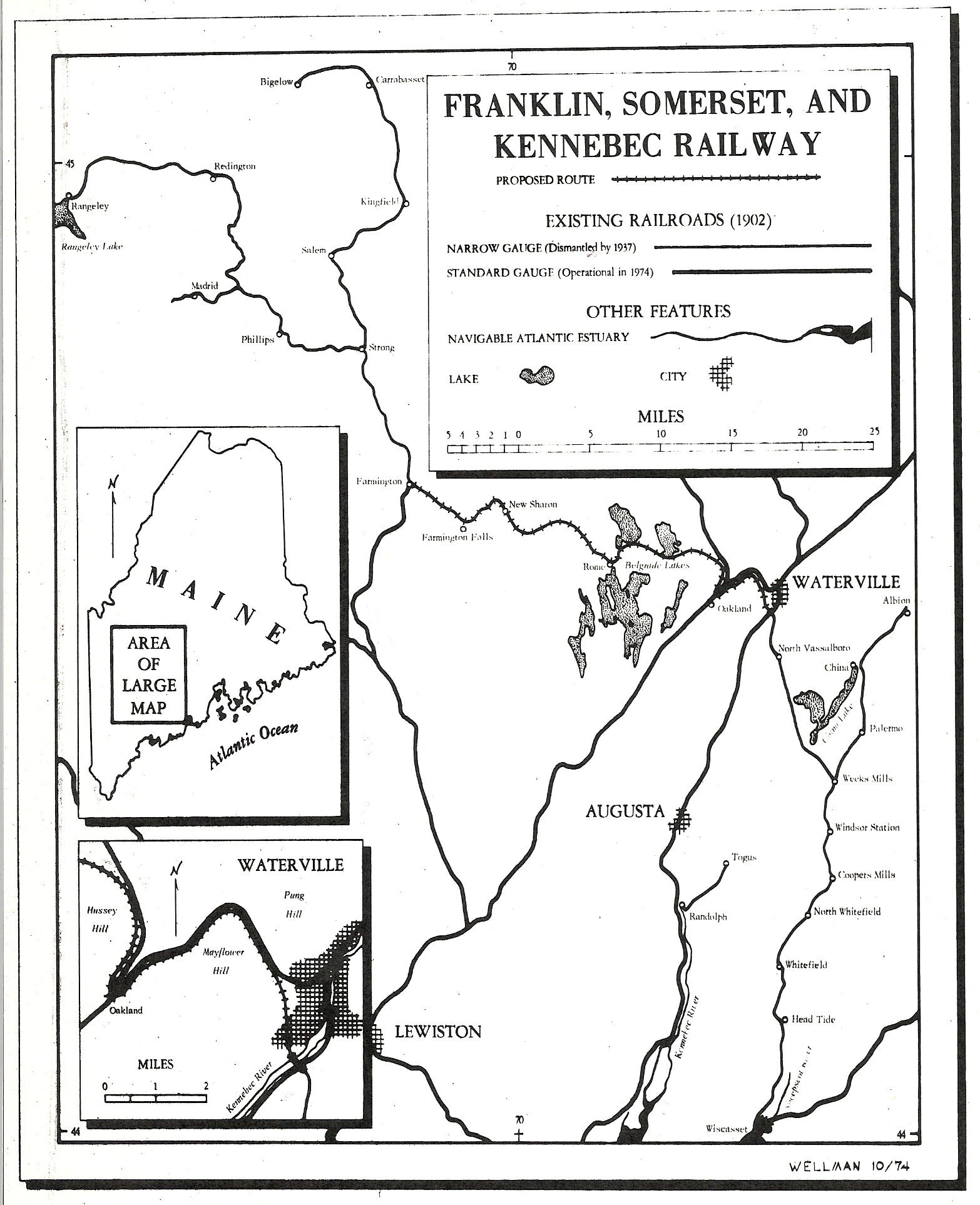
English: Map of the proposed 2-foot gauge Franklin, Somerset and Kennebec Railway which would have connected the Wiscasset, Waterville and Farmington Railway with the Sandy River Railroad. |
| Date | |
| Source | Own work |
| Author | Thewellman |
Licensing
| I, the copyright holder of this work, release this work into the
public domain. This applies worldwide. In some countries this may not be legally possible; if so: I grant anyone the right to use this work for any purpose, without any conditions, unless such conditions are required by law. |
File history
Click on a date/time to view the file as it appeared at that time.
| Date/Time | Thumbnail | Dimensions | User | Comment | |
|---|---|---|---|---|---|
| current | 17:53, 2 August 2009 |
| 1,566 × 1,926 (1.39 MB) | Thewellman | {{Information |Description={{en|1=Map of the proposed 2-foot gauge Franklin, Somerset and Kennebec Railway which would have connected the Wiscasset, Waterville and Farmington Railway with the Sandy River Railroad.}} |Source=Own work by uploader |Author=[[ |
File usage
The following pages on the English Wikipedia use this file (pages on other projects are not listed):