
Size of this preview:
800 × 533 pixels. Other resolutions:
320 × 213 pixels |
640 × 427 pixels |
1,024 × 682 pixels |
1,280 × 853 pixels |
2,560 × 1,706 pixels.
Original file (2,560 × 1,706 pixels, file size: 1.62 MB, MIME type: image/jpeg)
| This is a file from the
Wikimedia Commons. Information from its
description page there is shown below. Commons is a freely licensed media file repository. You can help. |
Source
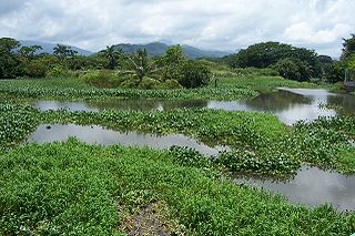
Español: Cercanías cenagosas de la desembocadura del río de
Tela,
Honduras, en el mar Caribe. Tomada por
José Manuel Ibáñez Fernández el 11 de agosto de 2005 a las 12:24 (hora local).
English: Marshy area of the river in
Tela,
Honduras, near its mouth flowing into the Caribbean Sea. Taken by
José Manuel Ibáñez Fernández on 11 August, 2005 at 12:24 (local time).

|
Permission is granted to copy, distribute and/or modify this document under the terms of the GNU Free Documentation License, Version 1.2 or any later version published by the Free Software Foundation; with no Invariant Sections, no Front-Cover Texts, and no Back-Cover Texts. A copy of the license is included in the section entitled GNU Free Documentation License. |
| This file is licensed under the Creative Commons Attribution-Share Alike 3.0 Unported license. | ||
| ||
| This licensing tag was added to this file as part of the GFDL licensing update. |
File history
Click on a date/time to view the file as it appeared at that time.
| Date/Time | Thumbnail | Dimensions | User | Comment | |
|---|---|---|---|---|---|
| current | 11:55, 27 December 2005 |
| 2,560 × 1,706 (1.62 MB) | Piolinfax | ==Source== {{es|Cercanías cenagosas de la desembocadura del río de Tela, Honduras, en el mar Caribe. Tomada por José Manuel Ibáñez Fernández el 11 de agosto de 2005 a las 12:24 (hora local).}} {{es|Marshy area of the river i |
File usage
The following pages on the English Wikipedia use this file (pages on other projects are not listed):
Global file usage
The following other wikis use this file:
- Usage on ar.wikipedia.org
- Usage on bg.wikipedia.org
- Usage on ceb.wikipedia.org
- Usage on de.wikipedia.org
- Usage on es.wikipedia.org
- Usage on mr.wikipedia.org
- Usage on nds.wikipedia.org
- Usage on nl.wikipedia.org
- Usage on nn.wikipedia.org
- Usage on pt.wikipedia.org
- Usage on sr.wikipedia.org
- Usage on tr.wikipedia.org
- Usage on ur.wikipedia.org
- Usage on www.wikidata.org