Size of this preview:
434 × 599 pixels. Other resolutions:
174 × 240 pixels |
348 × 480 pixels |
557 × 768 pixels |
1,093 × 1,508 pixels.
Original file (1,093 × 1,508 pixels, file size: 301 KB, MIME type: image/jpeg)
| This is a file from the
Wikimedia Commons. Information from its
description page there is shown below. Commons is a freely licensed media file repository. You can help. |
Summary
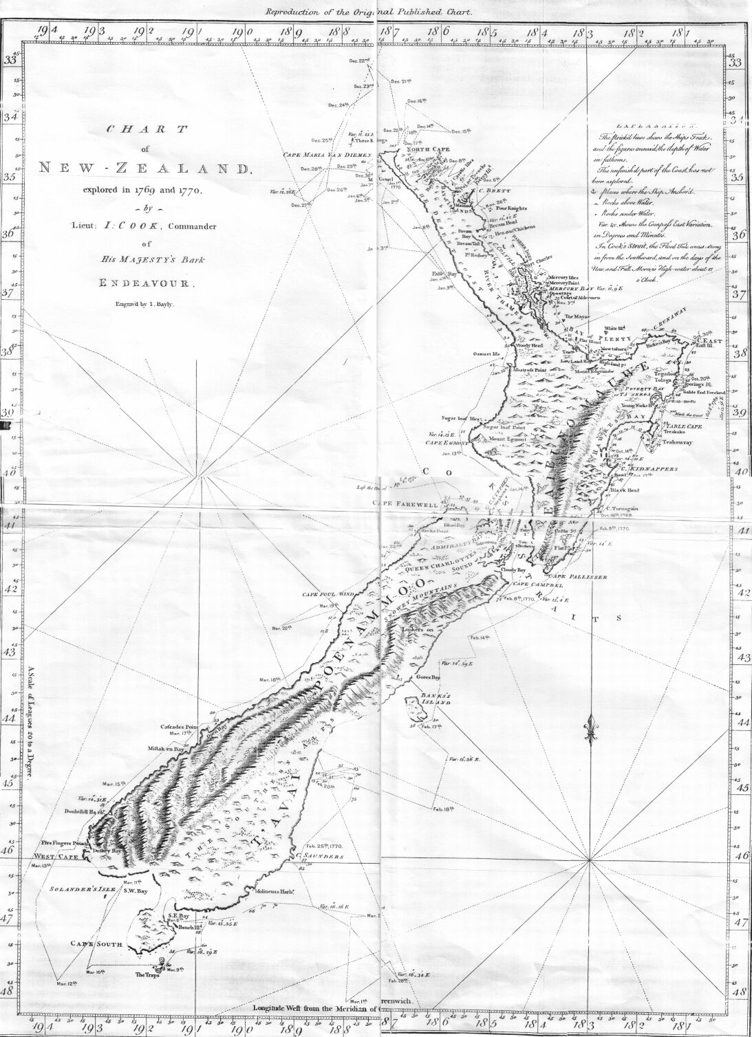
| Description | This is an image of a chart of New Zealand made by Lieutenant (later Captain Sir) James Cook during his 1770 voyage of exploration in the Pacific in command of HM Bark Endeavour. |
| Date | |
| Source | Taken from the Project Gutenberg edition of Captain Cook's Journal, First Voyage, which is based on an 1893 publication of Cook's original manuscript |
| Author | James Cook |
| Permission ( Reusing this file) |
It is in the public domain worldwide |
Licensing
|
This work is in the public domain in its country of origin and other countries and areas where the copyright term is the author's life plus 100 years or fewer. | |
| This file has been identified as being free of known restrictions under copyright law, including all related and neighboring rights. | |
File history
Click on a date/time to view the file as it appeared at that time.
| Date/Time | Thumbnail | Dimensions | User | Comment | |
|---|---|---|---|---|---|
| current | 02:59, 27 September 2006 |
| 1,093 × 1,508 (301 KB) | Hesperian | == Summary == {{Information |Description=This is an image of a chart of New Zealand made by Lieutenant (later Captain Sir) James Cook during his 1770 voyage of exploration in the Pacific in command of HM Bark '' Endeavour''. |Source=Taken from the |
File usage
The following pages on the English Wikipedia use this file (pages on other projects are not listed):
Global file usage
The following other wikis use this file:
- Usage on cbk-zam.wikipedia.org
- Usage on cs.wikipedia.org
- Usage on cy.wikipedia.org
- Usage on de.wikipedia.org
- Usage on es.wikipedia.org
- Usage on fi.wikipedia.org
- Usage on hu.wikipedia.org
- Usage on ko.wikipedia.org
- Usage on pa.wikipedia.org
- Usage on pl.wikipedia.org
- Usage on pnb.wikipedia.org
- Usage on sk.wikipedia.org
- Usage on sl.wikipedia.org
- Usage on th.wikipedia.org
- Usage on ur.wikipedia.org