
Size of this preview:
740 × 599 pixels. Other resolutions:
296 × 240 pixels |
593 × 480 pixels |
948 × 768 pixels |
1,264 × 1,024 pixels |
2,127 × 1,723 pixels.
Original file (2,127 × 1,723 pixels, file size: 2.04 MB, MIME type: image/jpeg)
| This is a file from the
Wikimedia Commons. Information from its
description page there is shown below. Commons is a freely licensed media file repository. You can help. |
| Description |
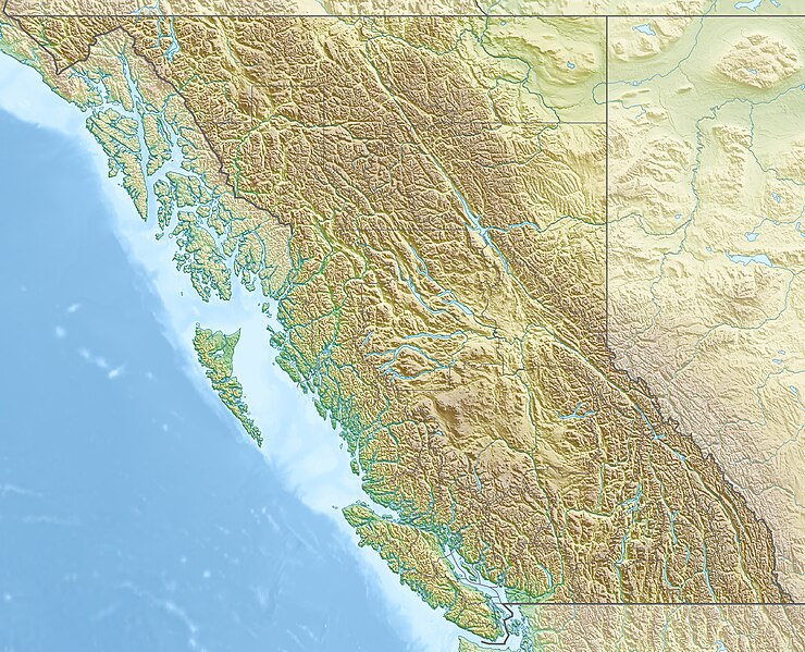
Quadratische Plattkarte, N-S-Streckung 170 %. Geographische Begrenzung der Karte:
Equirectangular projection, N/S stretching 170 %. Geographic limits of the map:
|
| Date | |
| Source |
Own work, using
|
| Author | Carport |
| Permission ( Reusing this file) |
This file is licensed under the
Creative Commons
Attribution-Share Alike 3.0 Unported license.
|
| Other versions |
|

File history
Click on a date/time to view the file as it appeared at that time.
| Date/Time | Thumbnail | Dimensions | User | Comment | |
|---|---|---|---|---|---|
| current | 16:38, 30 November 2012 |
| 2,127 × 1,723 (2.04 MB) | Carport | {{Information |Description= {{de|Physische Positionskarte von British Columbia, Kanada}} Quadratische Plattkarte, N-S-Streckung 170 %. Geographische Begrenzung der Karte: * N: 60.3° N * S: 48.1° N * W: 139.3° ... |
File usage
More than 100 pages use this file. The following list shows the first 100 pages that use this file only. A full list is available.
- Adams Lake
- Arrow Lakes
- Atlin Lake
- Ball Range
- Beaverfoot Range
- Berg Lake
- Boundary Bay
- Bowron Lake Provincial Park
- Bulkley River
- Burrard Inlet
- CFB Esquimalt
- Canadian Women's Open
- Capilano River
- Clayoquot Sound
- Columbia Icefield
- Comox Valley
- Connaught Tunnel
- Coquitlam Lake
- Crowsnest Pass
- Deltaform Mountain
- Discovery Islands
- Emerald Lake (British Columbia)
- False Creek
- Fernie Alpine Resort
- Fraser Canyon
- Fraser River
- Fraser Valley
- Glacier National Park (Canada)
- Gulf Islands National Park Reserve
- Gwaii Haanas National Park Reserve and Haida Heritage Site
- Haiduk Peak
- Hecate Strait
- Howe Sound
- Inga Lake
- Isabelle Peak
- Kalamalka Lake
- Kamloops Lake
- Keenleyside Dam
- Kicking Horse River
- Kinbasket Lake
- King Edward Peak
- Kitsilano Beach
- Kokanee Lake
- Kootenay Lake
- Kootenay National Park
- Lake Revelstoke
- Mica Dam
- Mount Assiniboine
- Mount Ball
- Mount Bryce
- Mount Burke (British Columbia)
- Mount Clemenceau
- Mount Collie
- Mount Columbia (Canada)
- Mount Fairweather
- Mount Field (British Columbia)
- Mount Garibaldi
- Mount Hungabee
- Mount Joffre
- Mount Kain
- Mount King Edward
- Mount Macdonald
- Mount Macdonald Tunnel
- Mount Revelstoke National Park
- Mount Robson
- Mount Robson Provincial Park
- Mount Stephen
- Mount Waddington
- Moyie Lake
- Nat Bailey Stadium
- Nootka Sound
- Okanagan Lake
- Pacific Rim National Park Reserve
- Panorama Mountain Resort
- Petroglyph Provincial Park
- Portland Canal
- President Range
- Prospera Place
- Queen Charlotte Sound (Canada)
- Queen Charlotte Strait
- Revelstoke Dam
- Rivers Inlet
- Rogers Pass (British Columbia)
- Ross Lake (Washington)
- Sandman Centre
- Save-On-Foods Memorial Centre
- Saysutshun (Newcastle Island Marine) Park
- Shuswap Lake
- Silver Star Mountain Resort
- Skaha Lake
- Stawamus Chief
- Stikine River
- Strait of Georgia
- Stuart Lake
- Sun Peaks Resort
- W. A. C. Bennett Dam
- Wasa Lake
- Williston Lake
- Windermere Lake (British Columbia)
- Winston Churchill Range
View more links to this file.
Global file usage
The following other wikis use this file:
- Usage on als.wikipedia.org
- Usage on ar.wikipedia.org
- Usage on ast.wikipedia.org
- Usage on ban.wikipedia.org
- Usage on ba.wikipedia.org
- Usage on be-tarask.wikipedia.org
- Usage on be.wikipedia.org
- Usage on bg.wikipedia.org
- Ванкувър
- Лейдисмит (Канада)
- Виктория (Британска Колумбия)
- Чейс (Британска Колумбия)
- Университет на Британска Колумбия
- Съри (Канада)
- Ричмънд (Британска Колумбия)
- Уислър
- Сайпръс (планина)
- Западен Ванкувър
- Бърнаби
- Роджърс Пас (Британска Колумбия)
- Шаблон:ПК Канада Британска Колумбия
- Китсолт
- Колумбийски планини
- Карибу (планина)
- Селкирк (планина)
- Фрейзър (плато)
- Хайда Гуаи
- Usage on bn.wikipedia.org
- Usage on cs.wikipedia.org
View more global usage of this file.